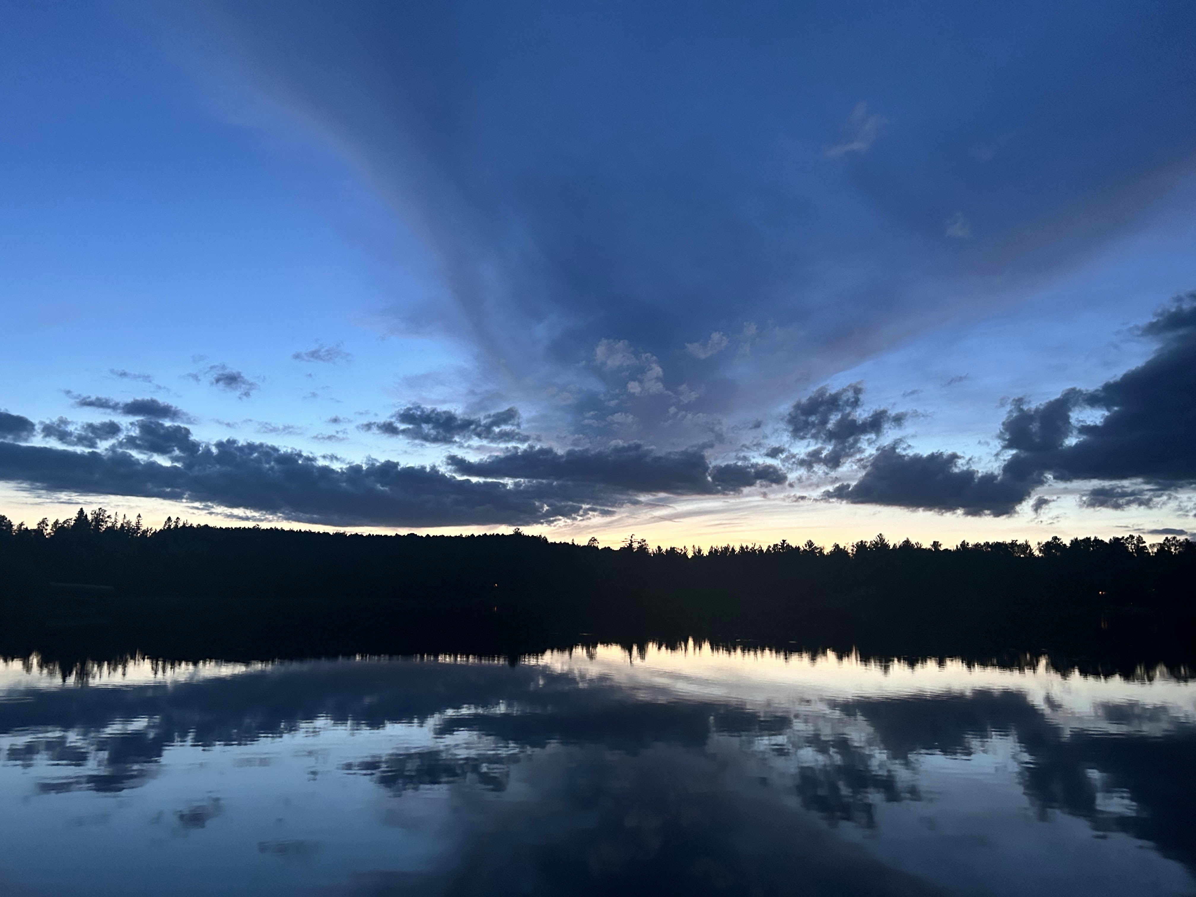
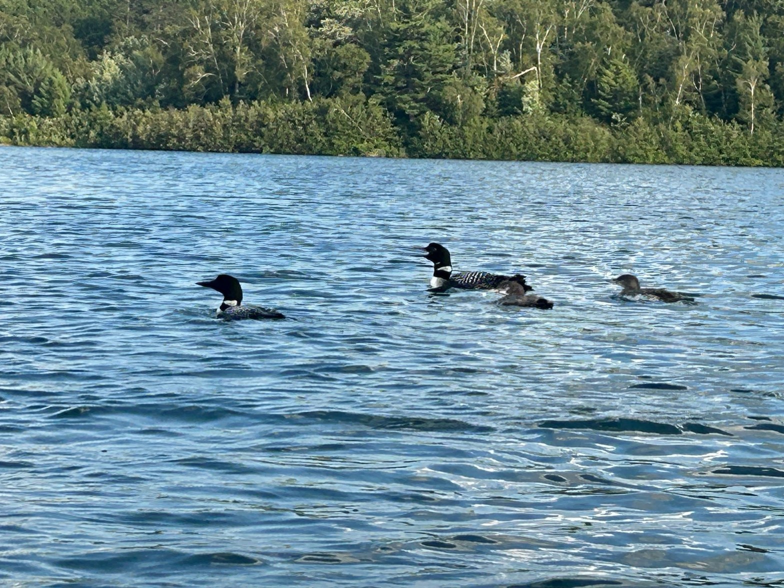
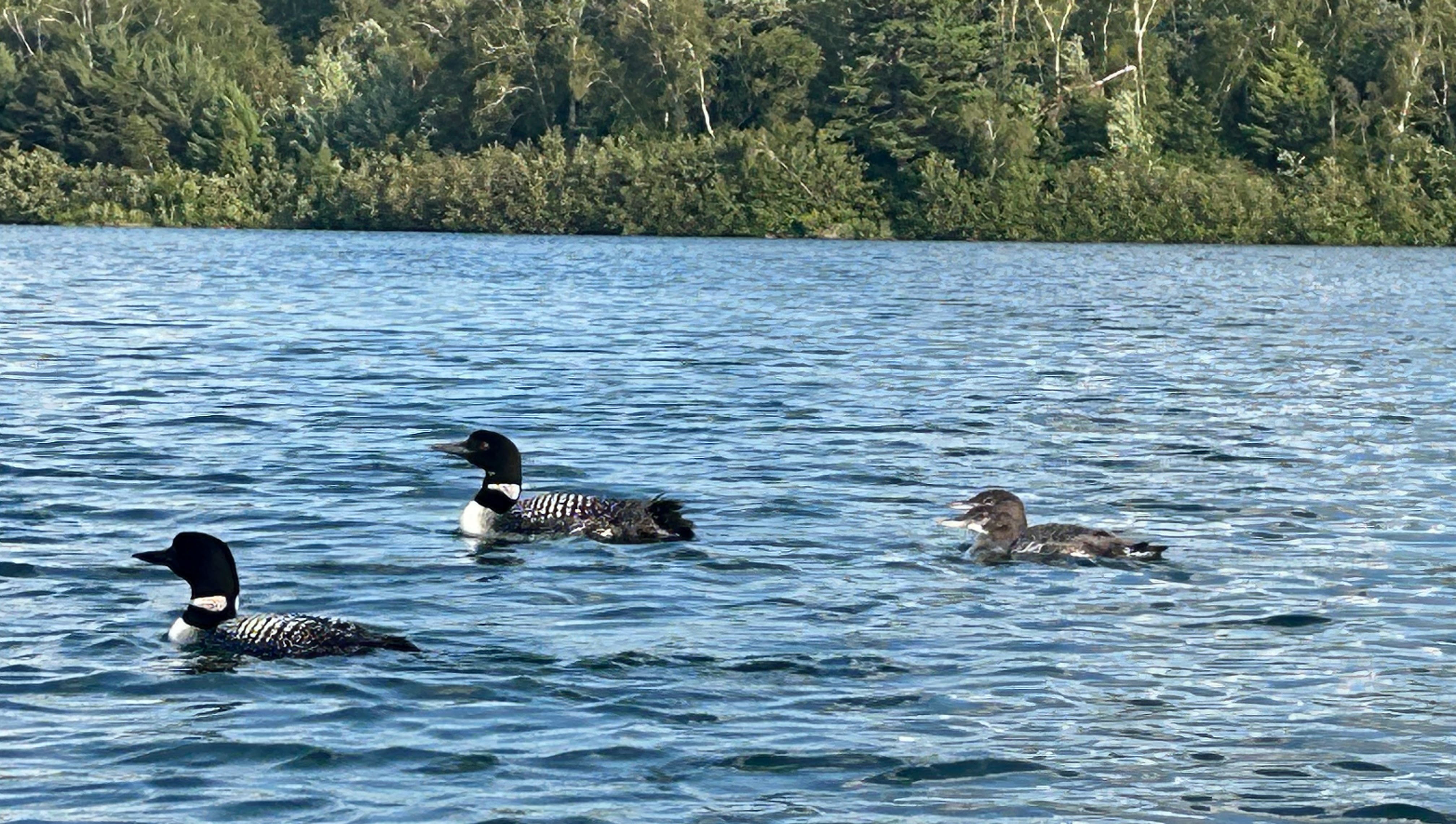
This year the nesting pair of loons on our lake raised two chicks. Below, these pictures of them were taken July 16.
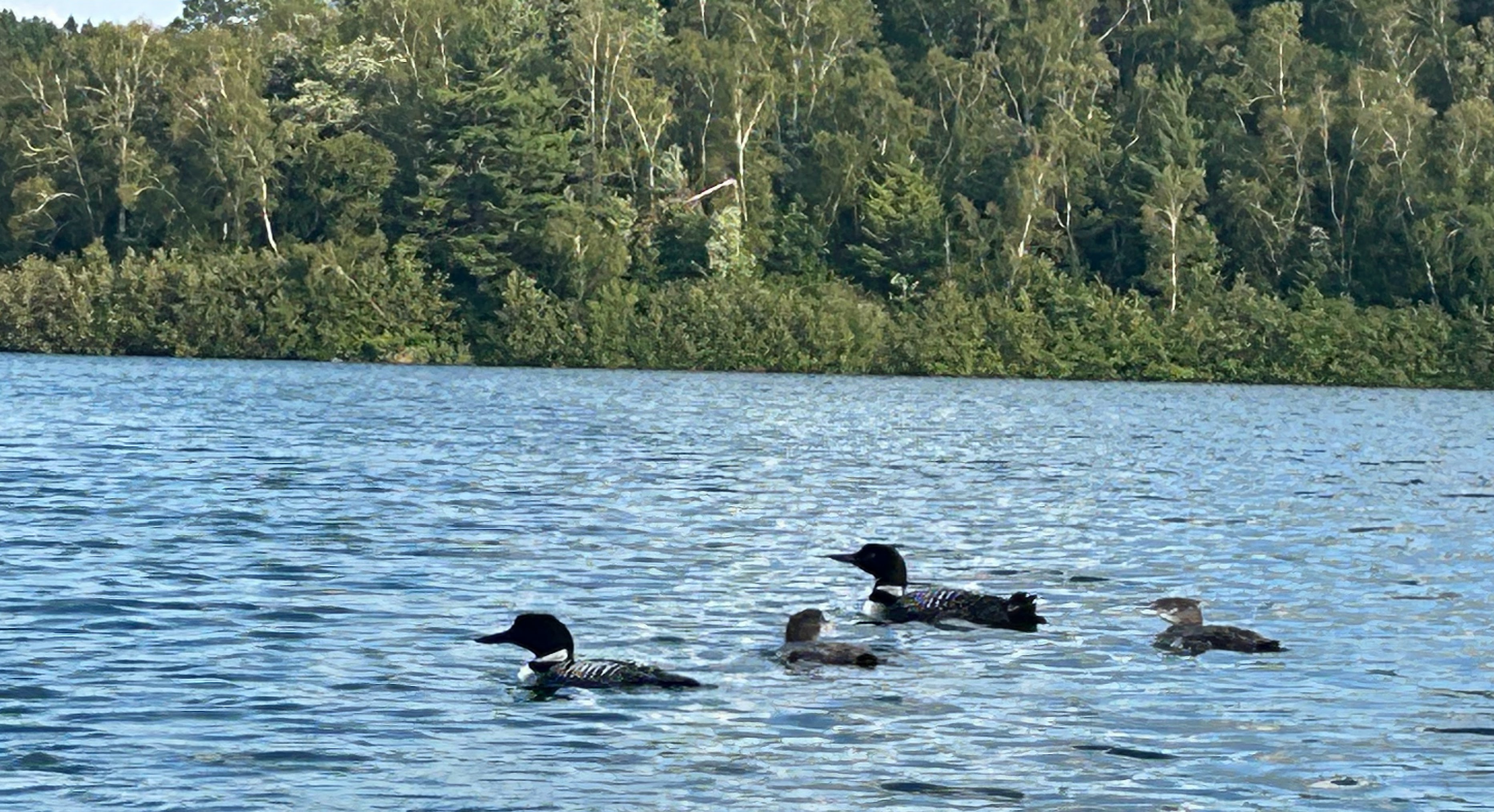
July 25
This next group of pictures was taken nine days later, on July 25. The chicks are growing fast.
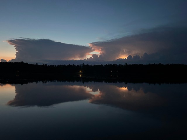
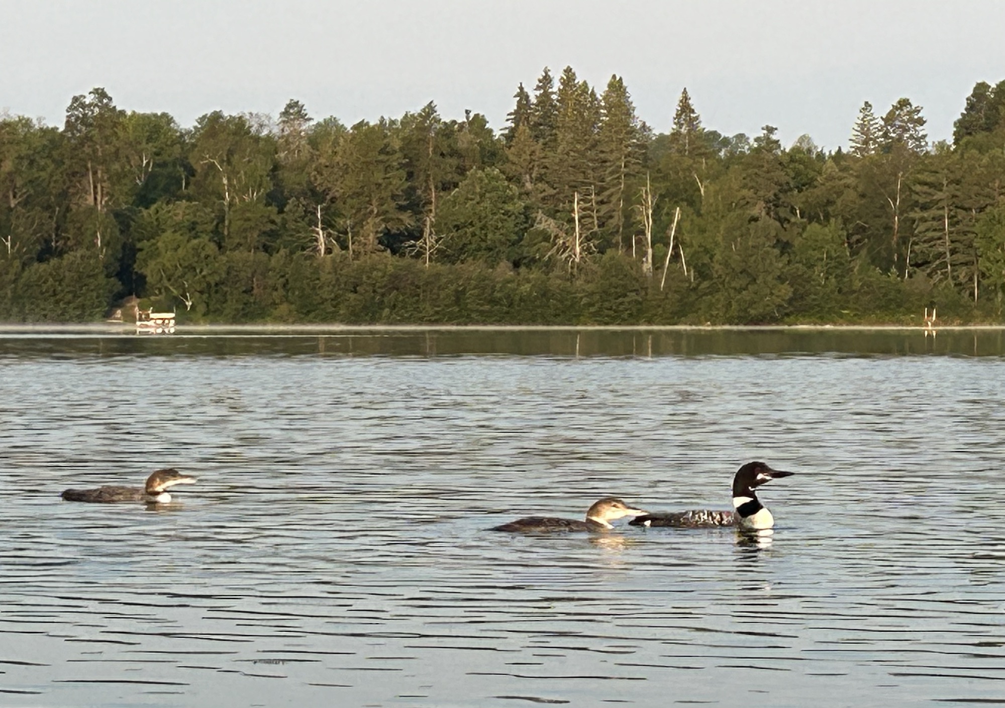
August 14
These pictures were taken August 14, the final day I saw the chicks this summer. On this occasion they were accompanied by only one parent loon. The chicks have grown at an amazing rate, which must be necessary for them to survive their upcoming migration south.
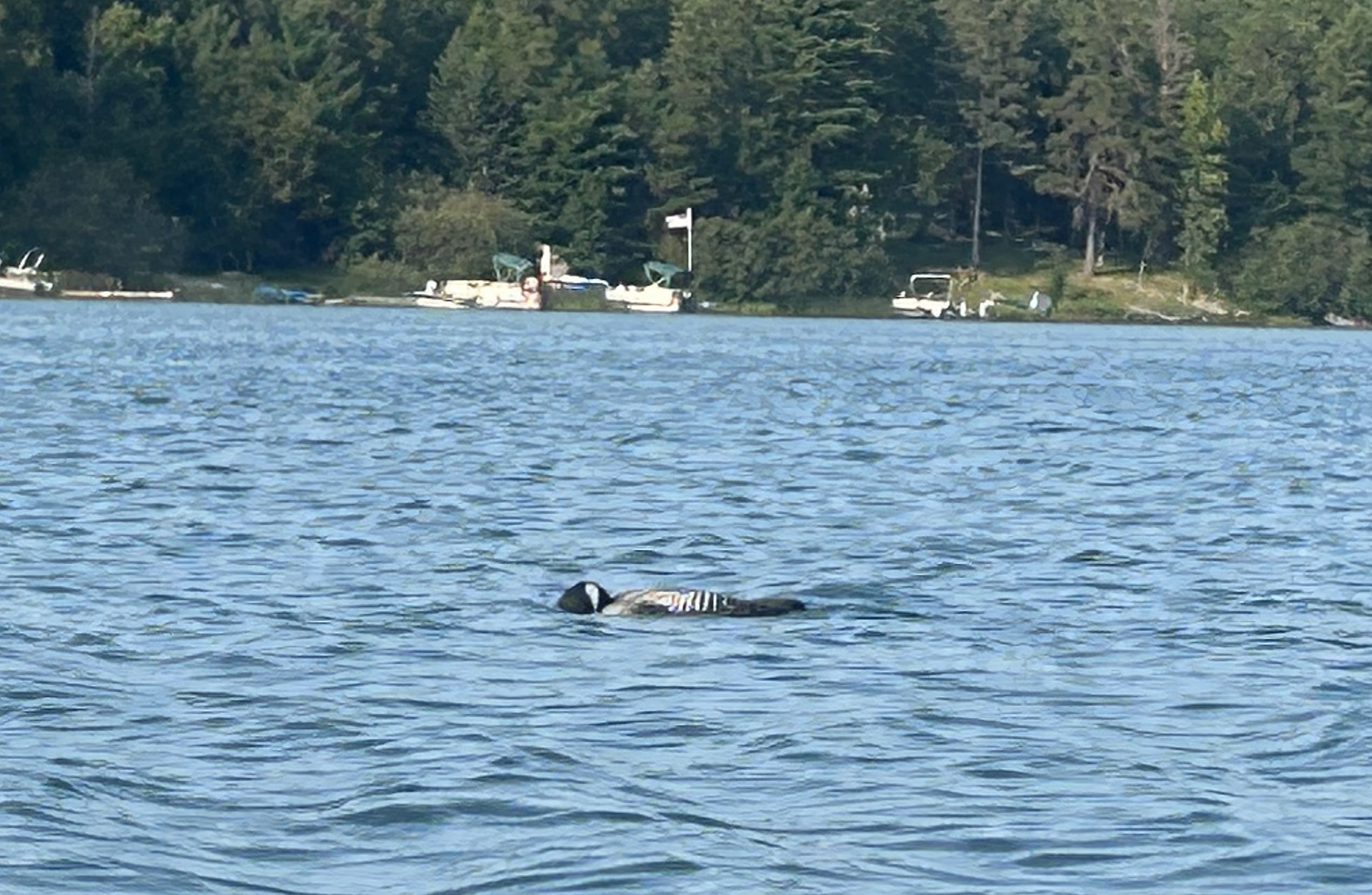
August 15
On the next day, August 15, I did not see the chicks. However, I did video a lone loon struggling to swallow a fish that appears to be a bit too big.
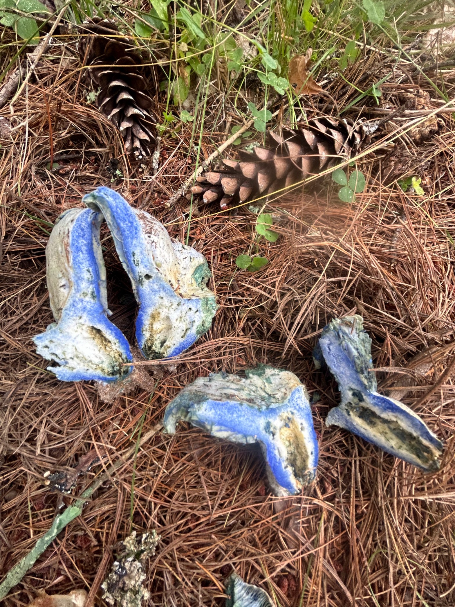
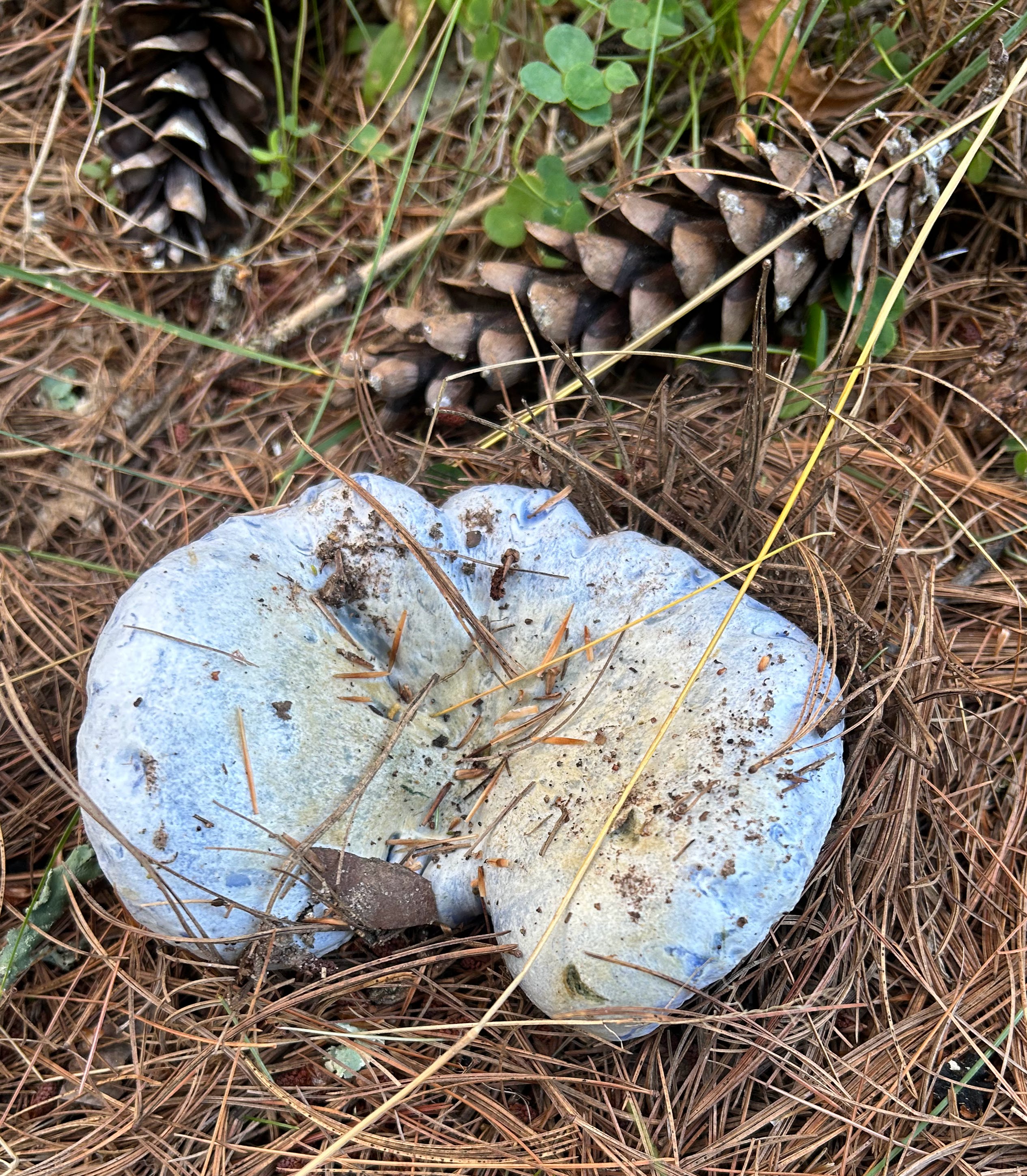
Recently we were surprised to find blue mushrooms beneath white pines on our daily walk near our lake home in North-Central Minnesota. Research on-line allowed identification of it with reasonable confidence as the indigo milk cap (Lactarius indigo).
We first noticed this indigo milk cap September 5, 2024. You can see that it is right next to pinecones dropped from nearby Eastern White Pine trees.
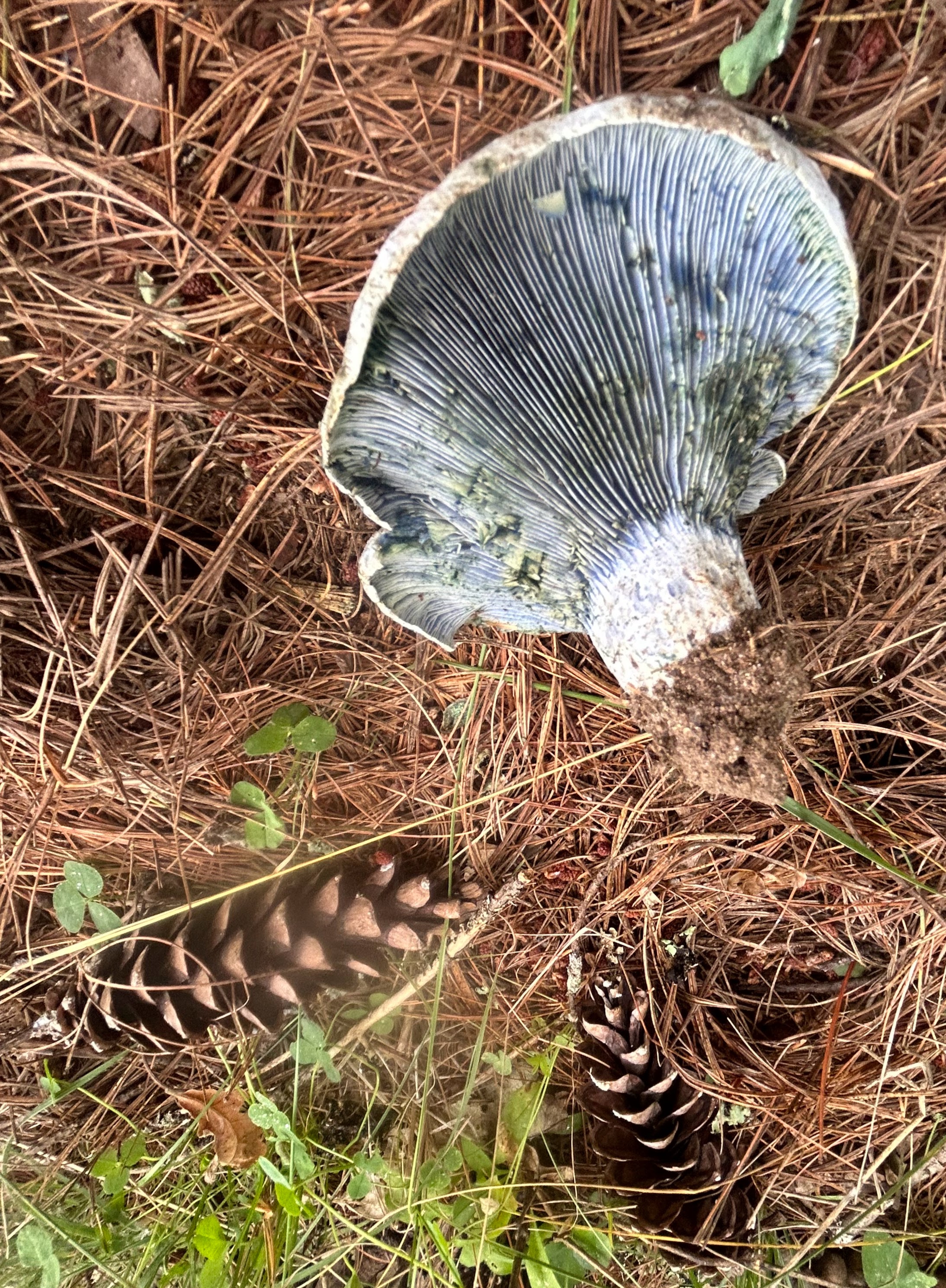
The next day we took a closer look at it, the picture above shows light-blue gills on the under-side of the indigo milk cap.
Using a knife to split the mushroom in halves revealed more intense blue coloring.
According to Wikipedia, the indigo milk cap typically has a mutually beneficial relationship with nearby trees. It breaks down minerals from the soil to make them more readily available to trees. In this case, I believe that white pines are the beneficiary.
The mushroom is reportedly edible, and there are even on-line sites that provide recipes for them. Personally, blue mushrooms are a little too strange for me to trust.
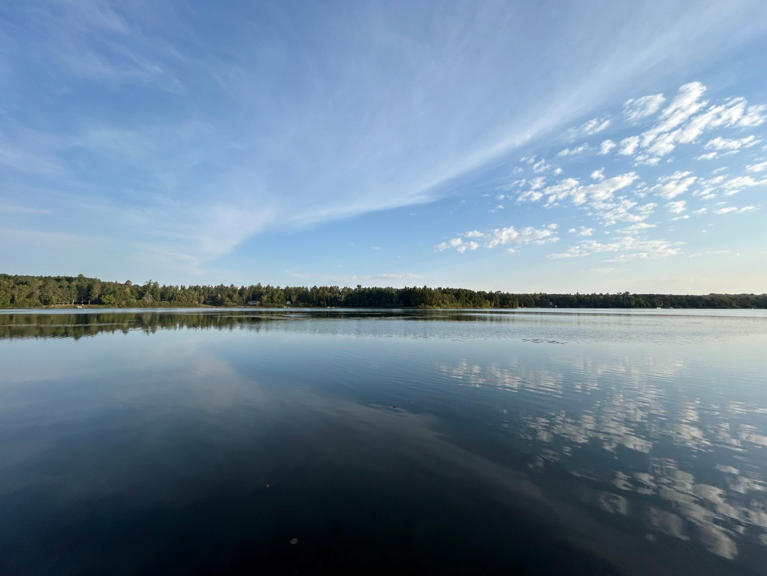
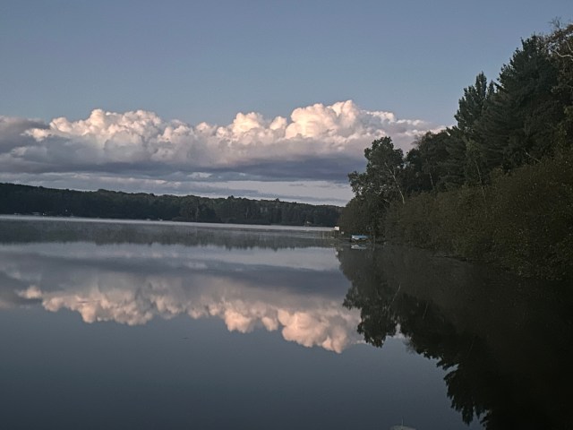
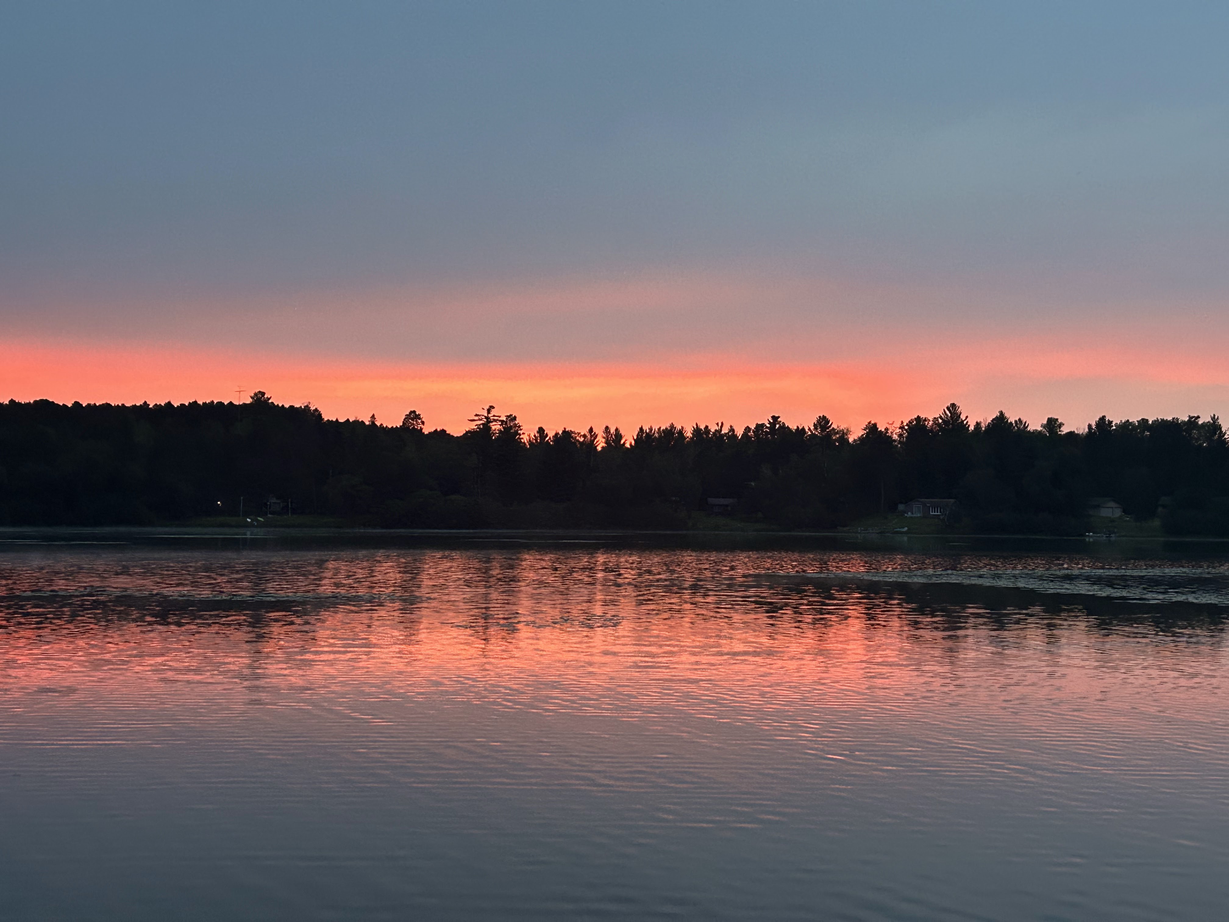
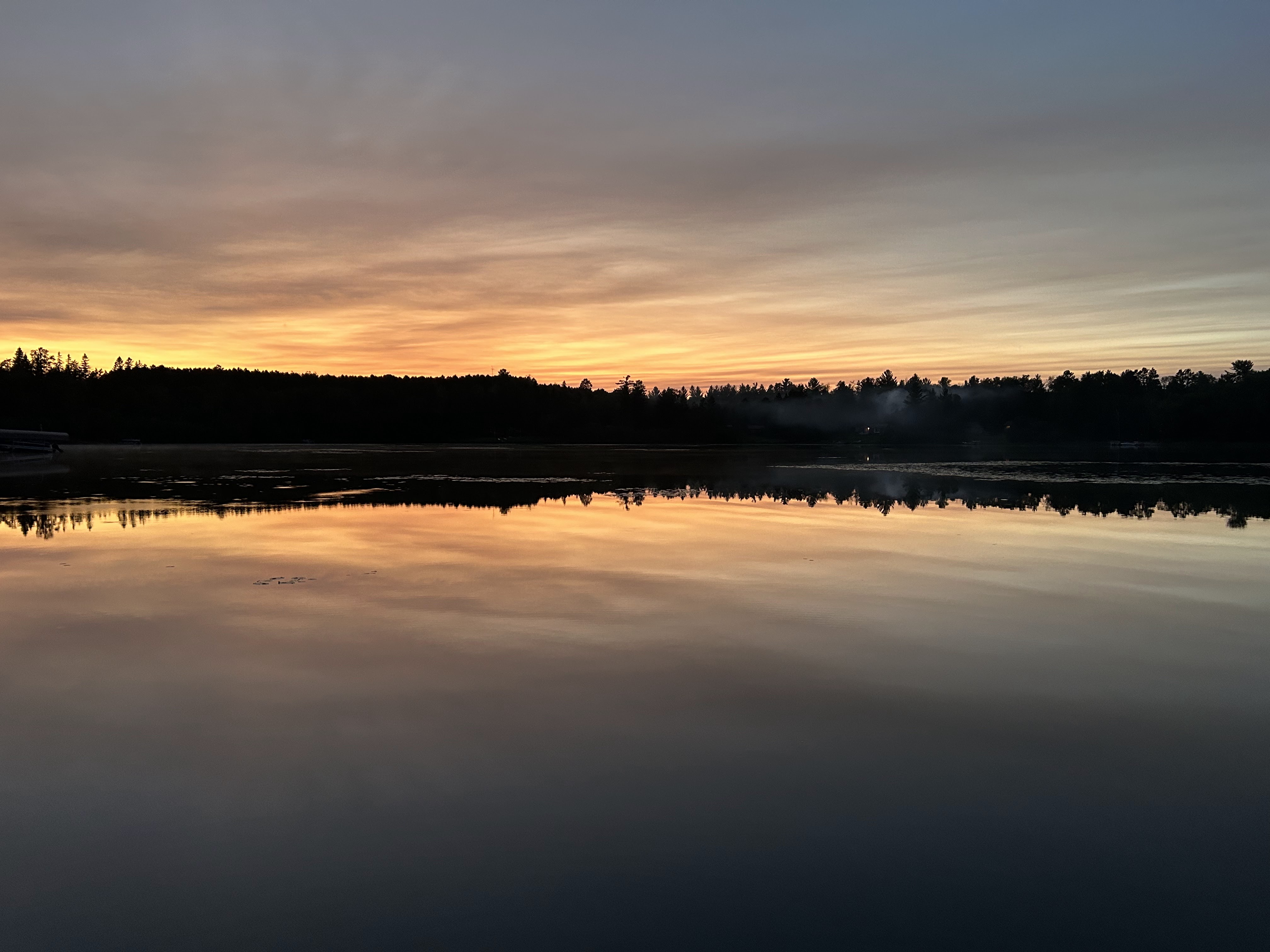
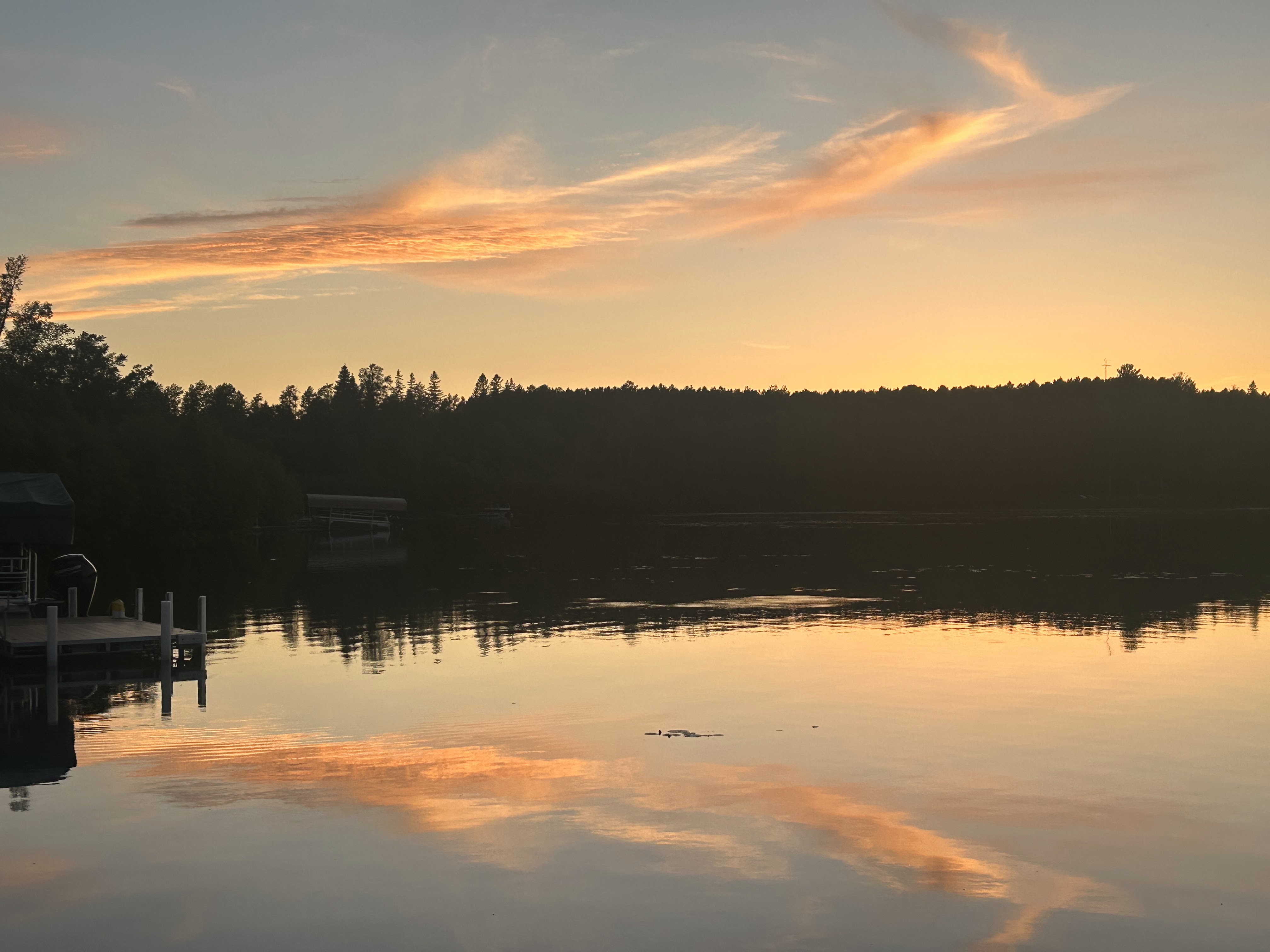
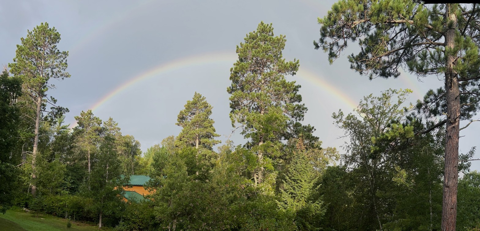
These pictures were taken looking west across our lake around 8AM on September 6, 2024. There was a slight rain shower to the west with sunlight from the east hitting the raindrops. Sunlight is reflected back towards the observer by the raindrops.
Because of the refractive index of water, the wavelength of light, and the spherical shape of the drops, sunlight that hits the top surface of raindrops at an angle of 42 degrees is reflected back most intensely.
The rainbow is reflected light from the cone of raindrops that sunlight hits at angle of about 42 degrees. The exact angle of maximum reflectance is influenced by the wavelength of the incident light. The slightly different wavelengths corresponding to different colors of light are what cause the reflected light of the rainbow to appear with separated colors.
Primary and secondary rainbows
A smaller amount of sunlight hitting raindrops is reflected twice within the drops. This light reaches maximum intensity at 51 degrees and produces a secondary rainbow, fainter and with a wider diameter than the primary rainbow.
Violet, with the shortest wavelength, is along the inside arc of a primary rainbow and red, with the longest wavelength is on the outside arc. The geometry of double reflection causes the order of these colors to be reversed in the secondary rainbow, as can be seen in the picture above.
Explaining the physics behind rainbows has been a focus of many of the most famous philosophers/scientists in history, from Aristotle to Descartes to Newton.
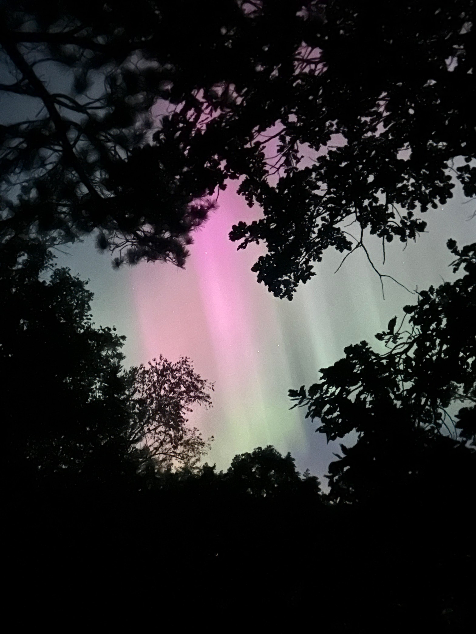
I had thought Northern Lights predominantly occur in winter. This really does not make sense though. They are caused by interactions between solar activity and the Earth’s magnetic field and neither of these things change because of the Earth’s seasons.
Northern Lights are undoubtedly more noticeable during the long dark nights of winter. This must be why we typically associate them with wintertime.
There are forecasts that solar activity will be high during the upcoming winter of 2025, which will likely lead to spectacular Northern Light shows.
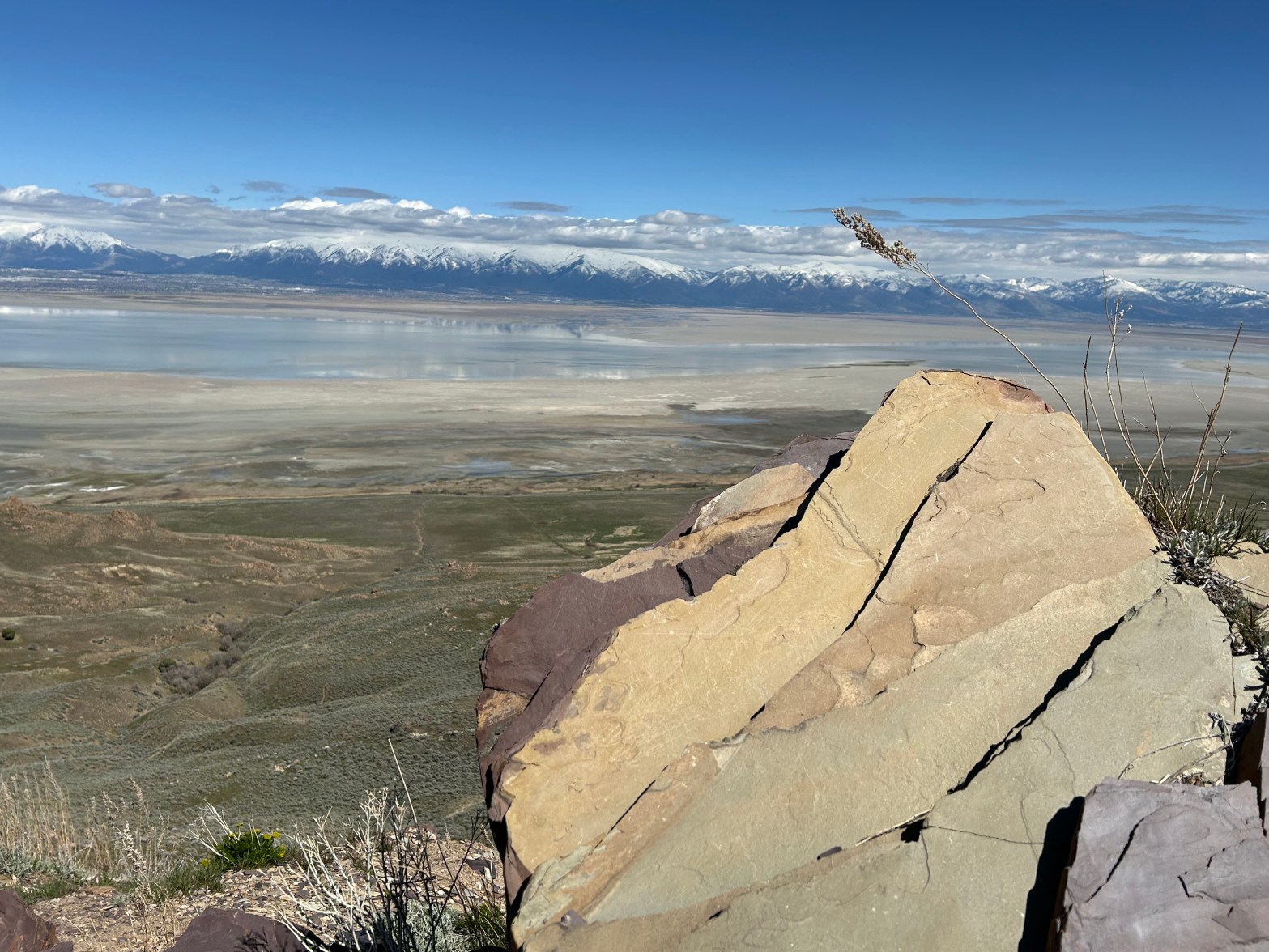
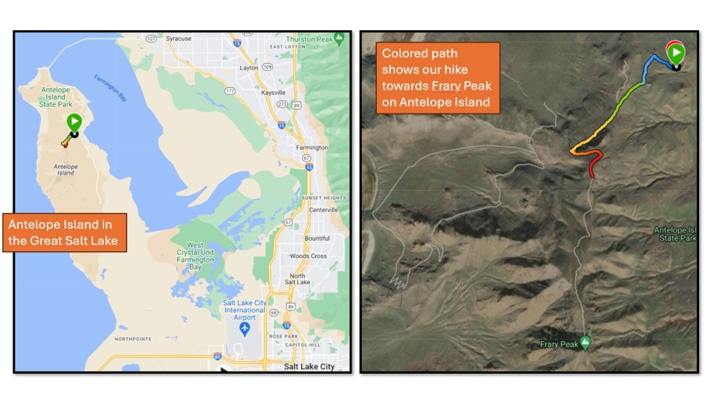
Antelope Island is a peninsula that juts out into the east side of the Great Salt Lake in Utah. The Utah State Park on Antelope Island is a short drive from Salt Lake City. Access to the park across a causeway is seen in the picture above.
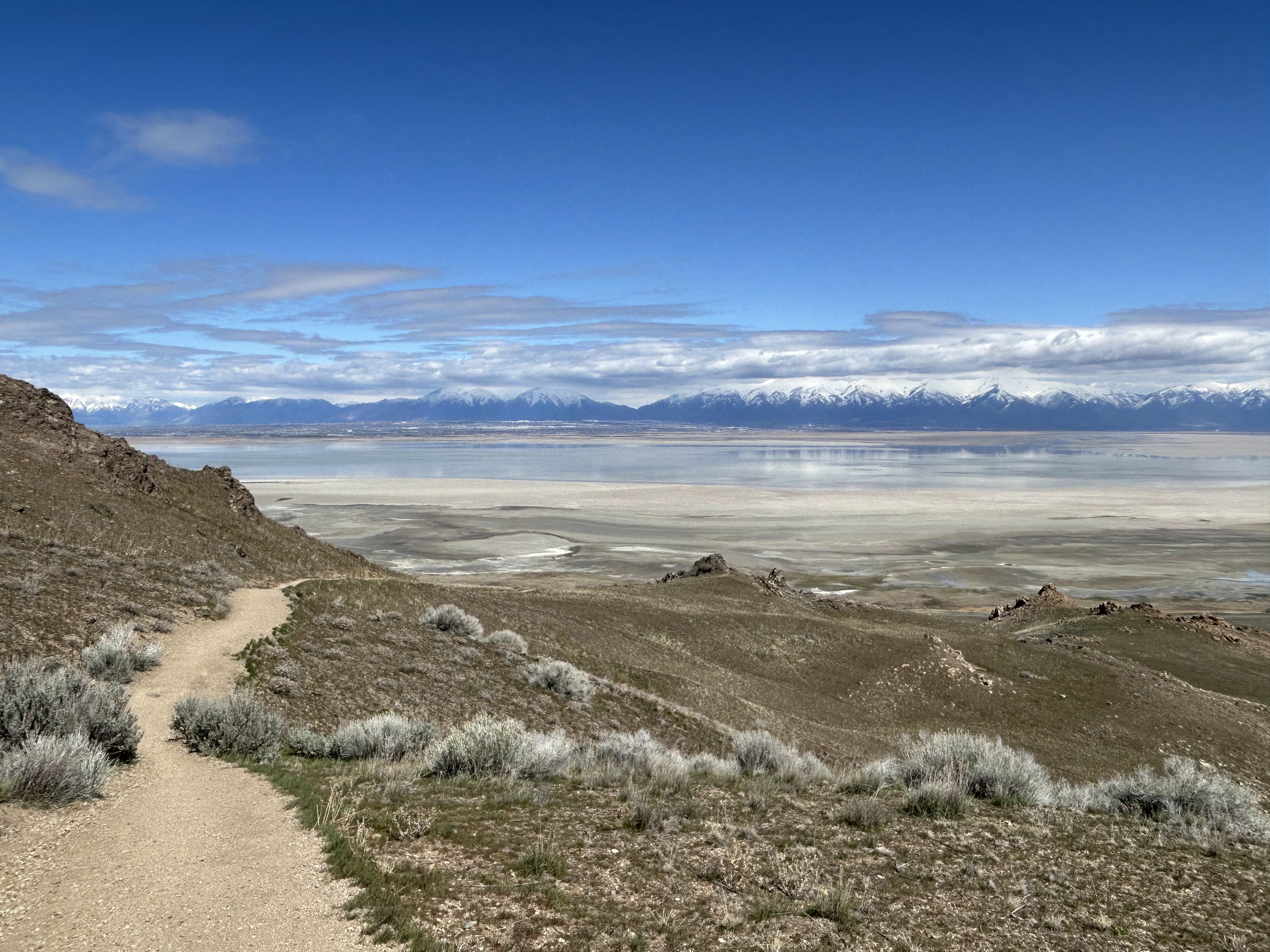
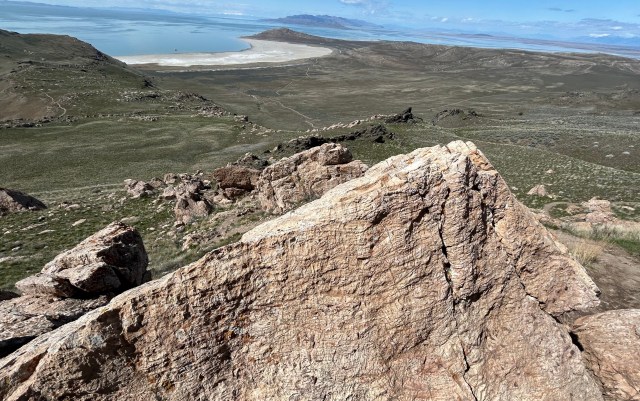
There are many hiking trails in the state park, on this occasion we tried the trail to Frary Peak, as marked on the maps above. We had the optimistic intention of making it all the way to the top but bailed out about half-way.
The view looking down from the trail to Frary Peak
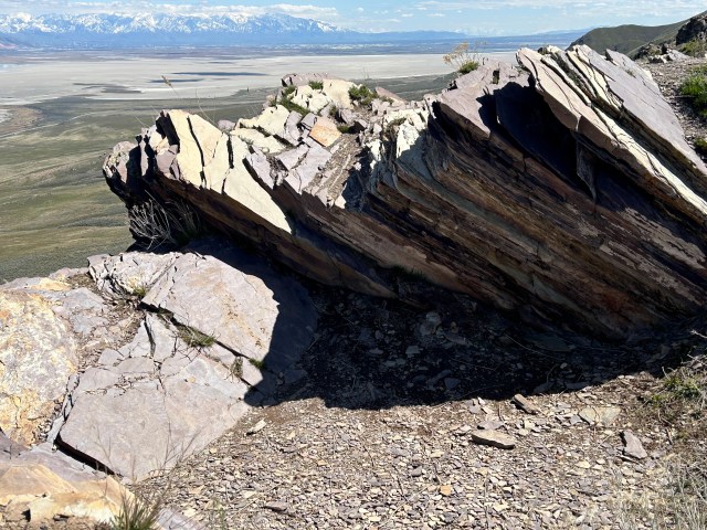
Walking up the trail you pass rock layers of diamictite (above left), dolomite (center), and slate (above right). Diamictite capped by the carbonate dolomite is an assemblage found in several sites world-wide and is cited as evidence of “Snowball Earth” in pre-Cambrian times.
There are similar outcrops of diamictite in the nearby Wasatch Mountains. Once I find these, I hope to do a follow-up post focusing on why these rocks cause geologists to hypothesize that the earth was completely covered in ice 700 million years ago.
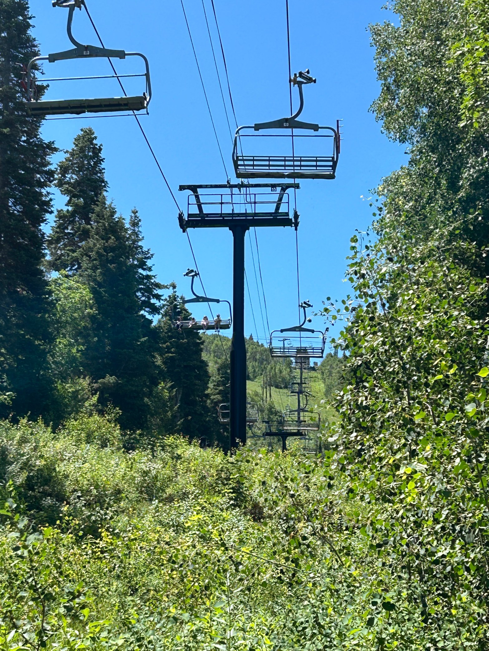
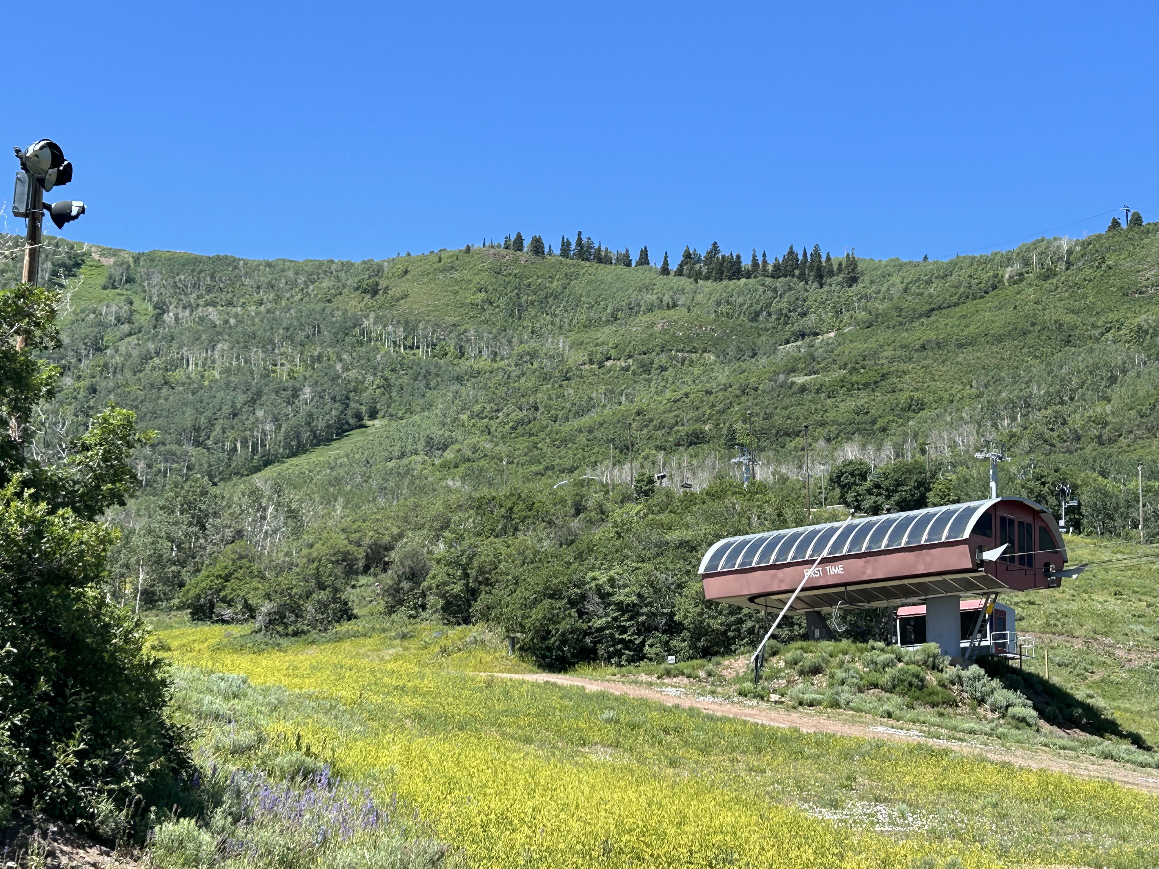
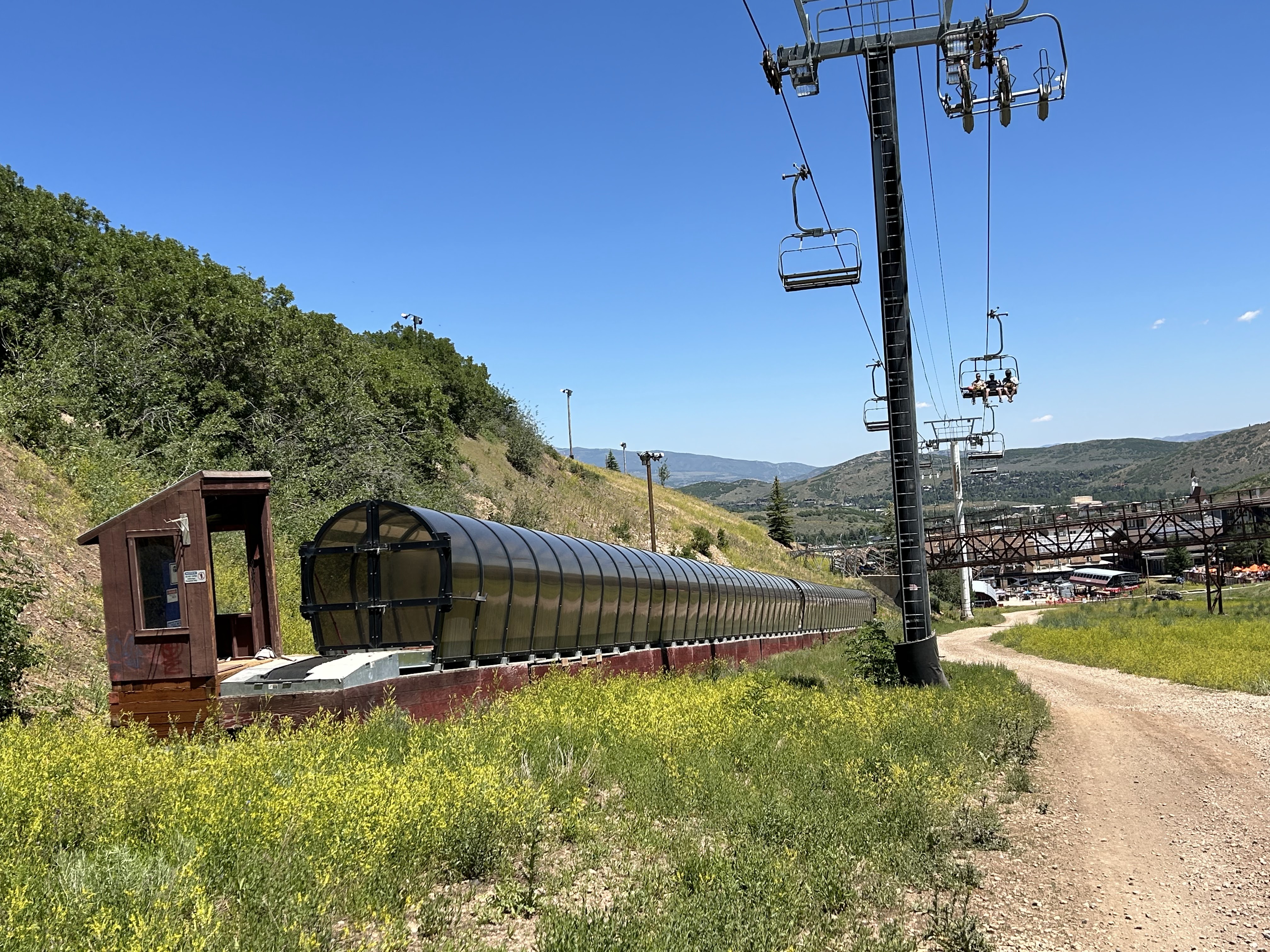
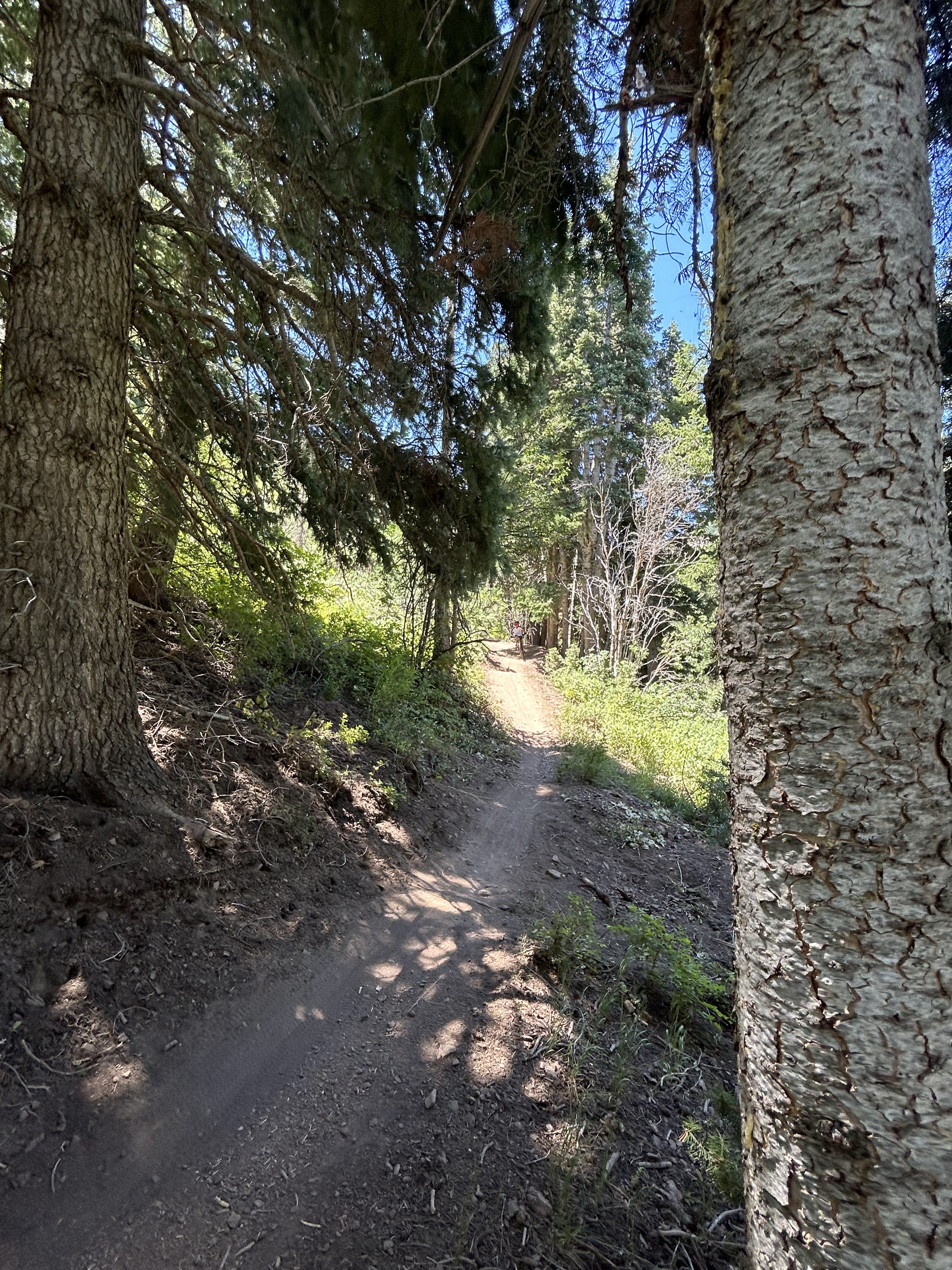
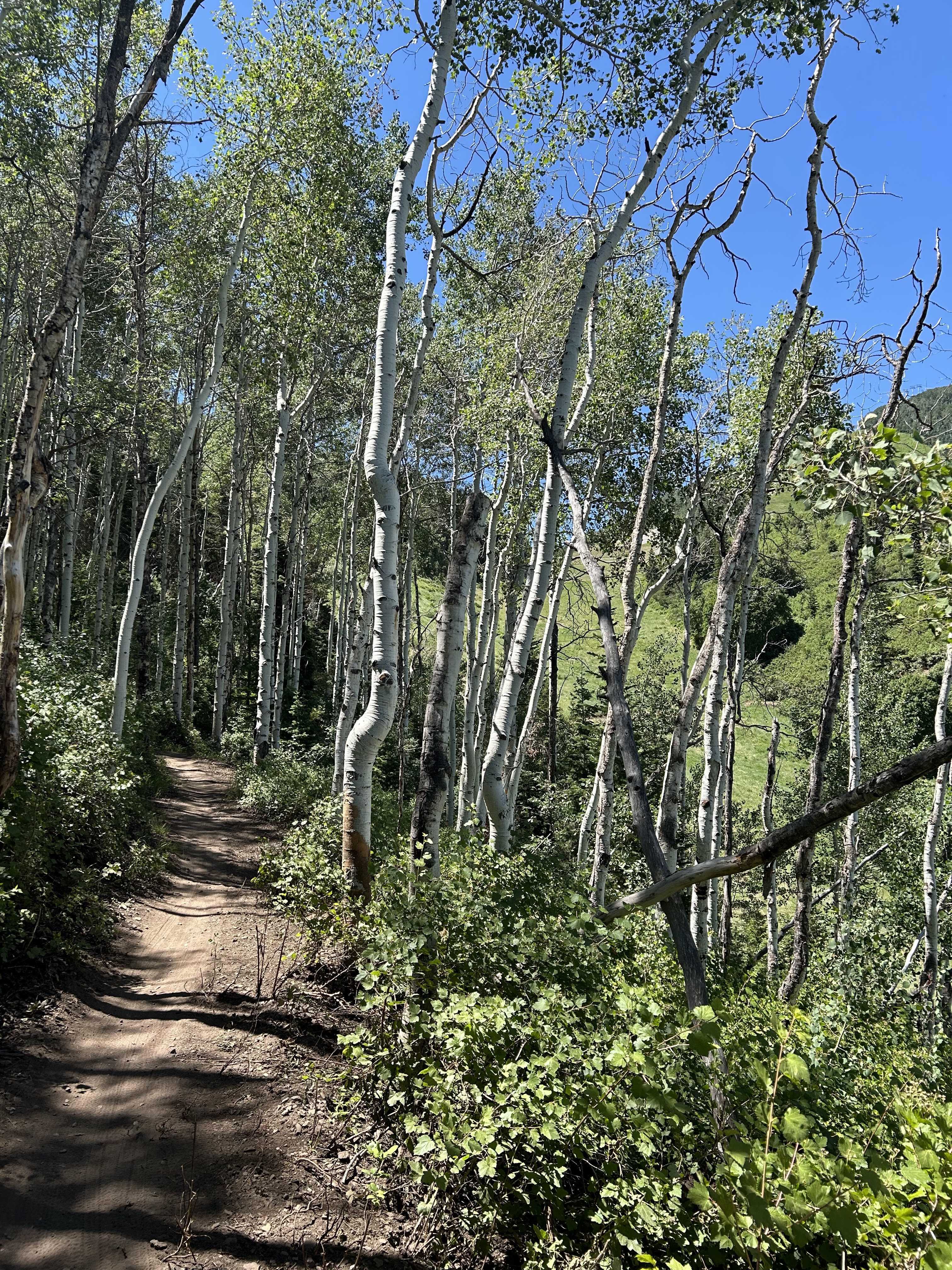
Being familiar with the Park City ski slopes in winter, it was an interesting experience to hike partway up the mountain in summer. I mostly followed a trail designated as Jenny’s Trail. A person hiking here has to be aware of the mountain bikers who are also enjoying the trails; parts of the trail are designated as one-way to avoid collisions.
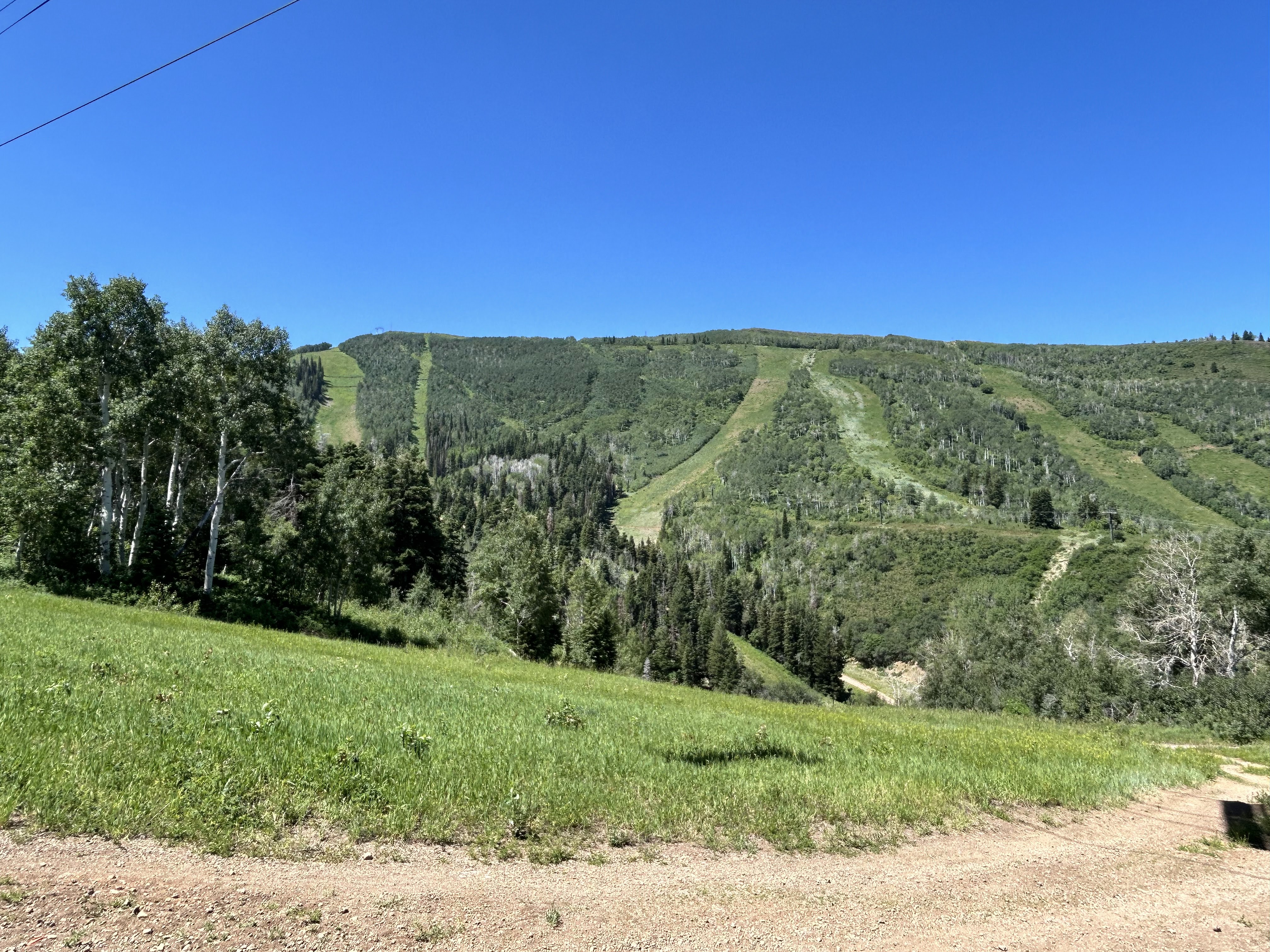
Green ski slopes
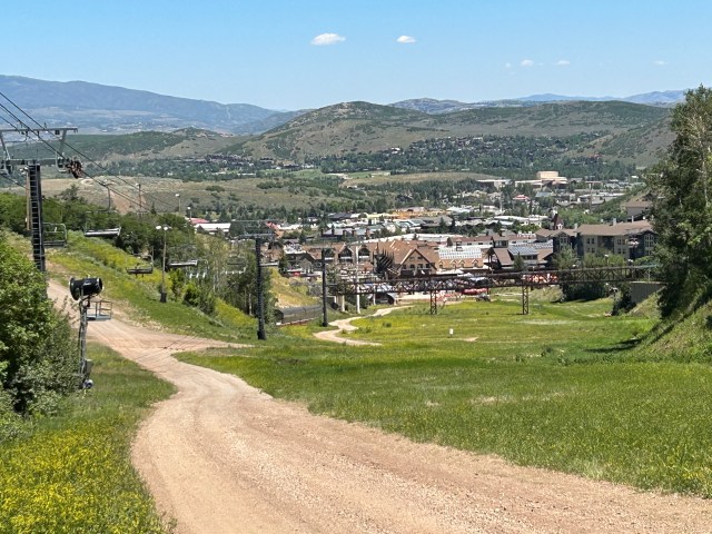
Looking down on Park City
The structures used in skiing look strange with no snow.
The trail wound in and out of trees. You can see why it is fun for mountain bikers!
A sign pointing out green and black diamond ski slopes loses its meaning in summertime.
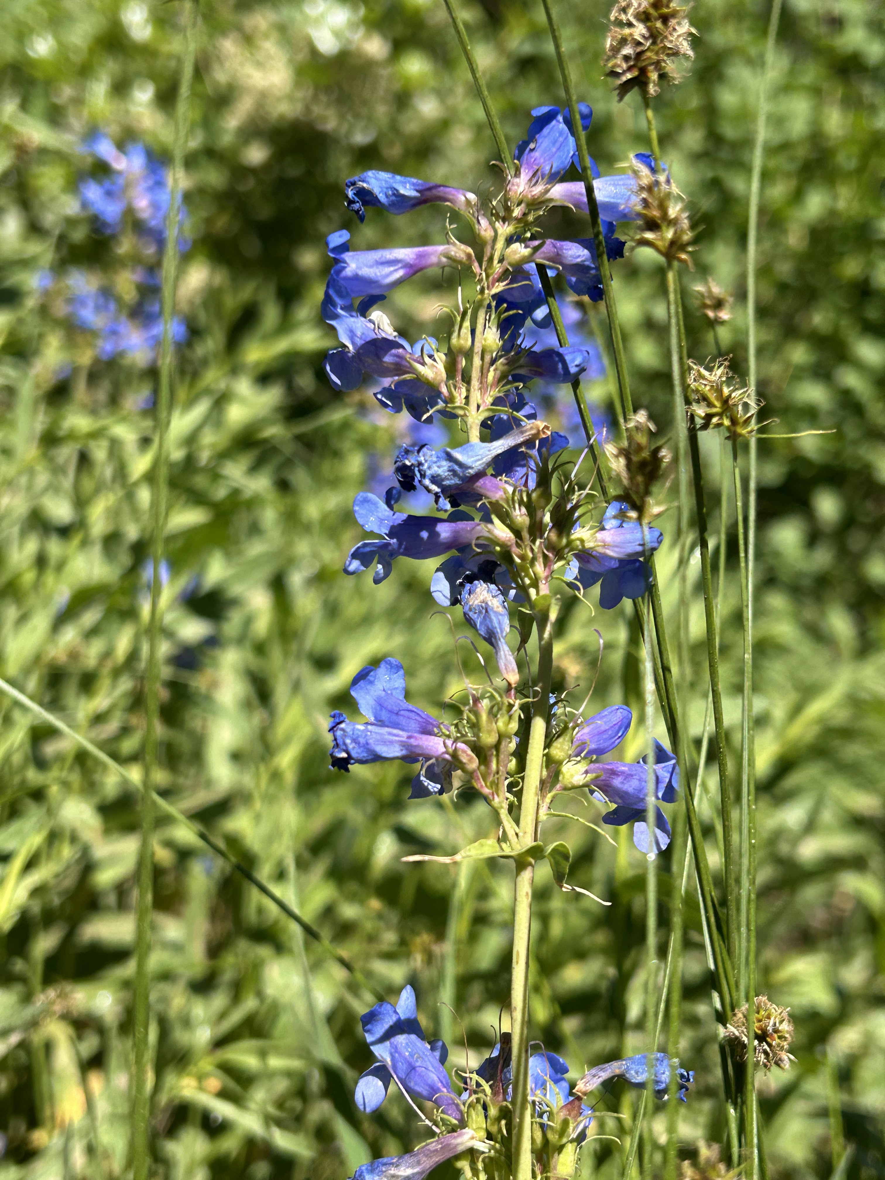
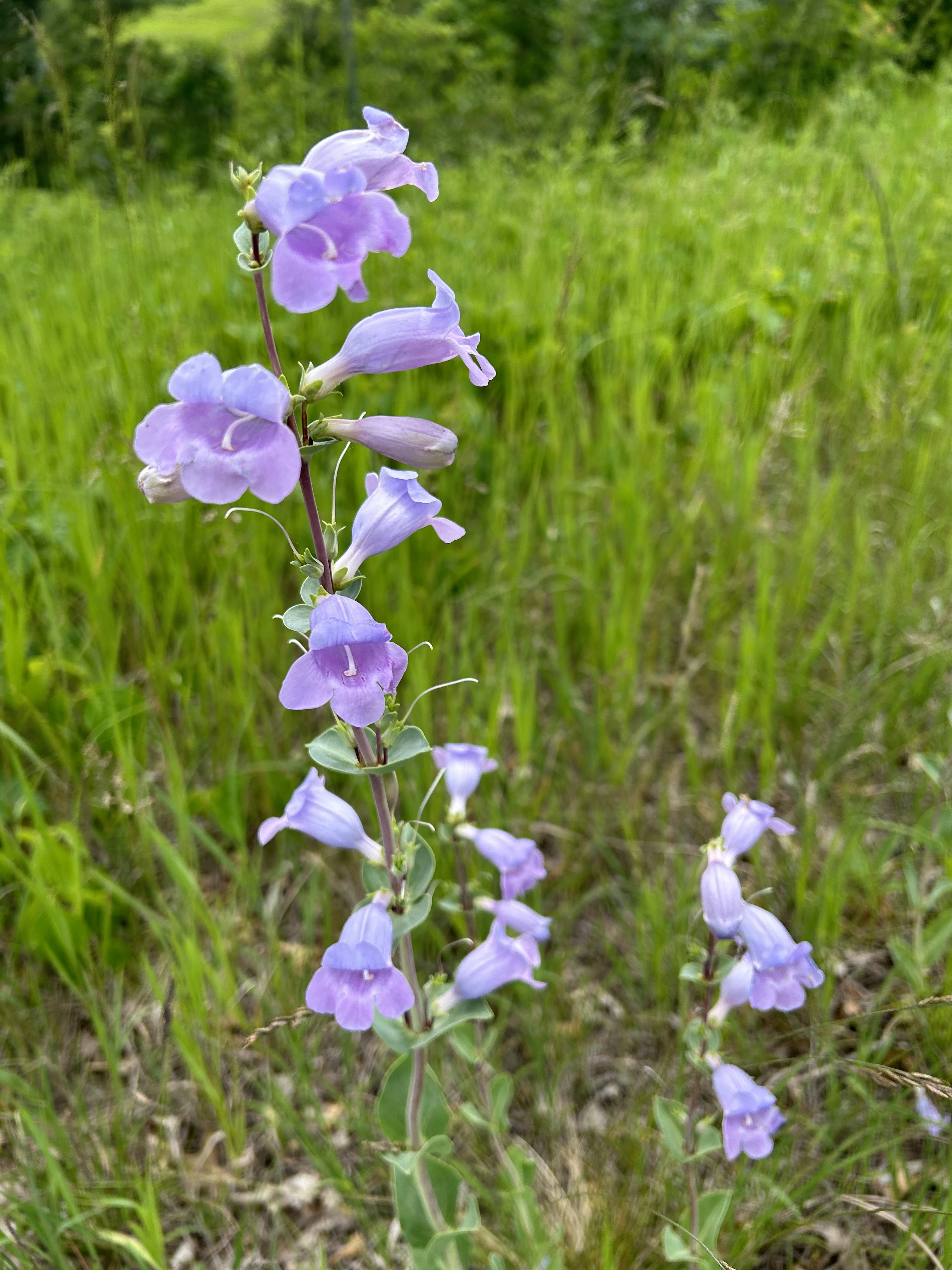
The picture on the left is Wasatch Penstemon (Penstemon cyananthus) which was seen during this hike in Park City. A closely related flower, Large Beardtongue (Penstemon grandiflorus) is shown in the picture on the right. It grows along Heartland Trail in the Minnesota lake country. It is interesting that these related plants are found in such different habitats.
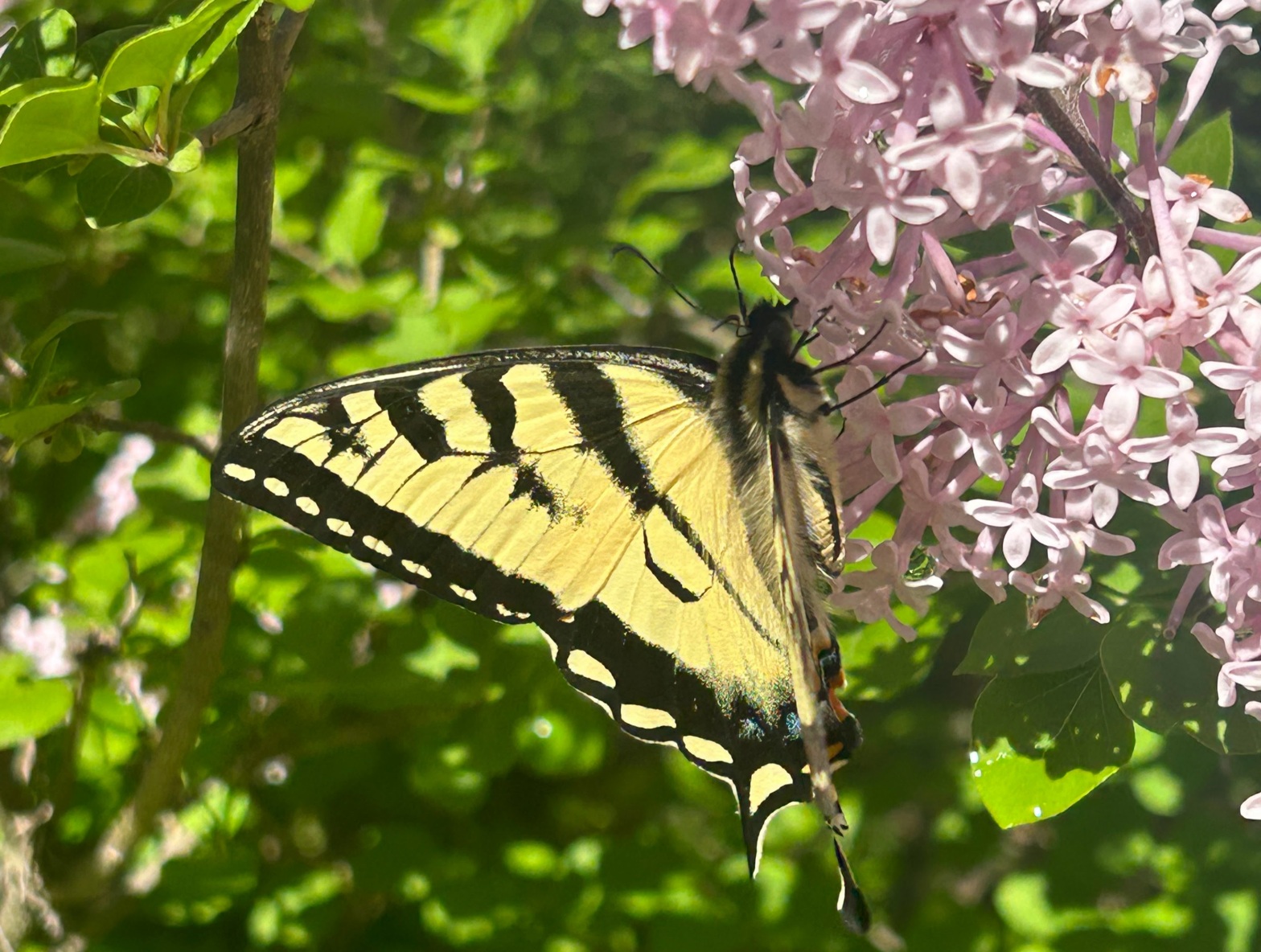
In mid-June this year the two lilac bushes in our yard bloomed profusely. Several different kinds of bugs shared in our enjoyment of the lilac flowers. The photos below show the larger insects in the lilacs. There were more bugs that were too small and fast to photograph.
Eastern Tiger Swallowtail Butterfly
Papilio glaucus
Male Eastern Swallowtail Butterflies are yellow, and females are either black or yellow.
Hobomok Skipper Butterfly
Lon hobomok
Snowberry Clearwing Moth
Hemaris diffinis
This moth resembles a small hummingbird; accordingly, it is sometimes referred to as a “hummingbird moth”. Another strange nickname for it is “flying lobster”.
Two-spotted Bumblebee
Bombus bimaculatus
These bees live in underground nests, commonly in forested areas. They rely upon pre-existing holes for the nests, such as abandoned rodent burrows. Unlike many other species of bees with declining populations, the two-spotted bumblebee is thriving.
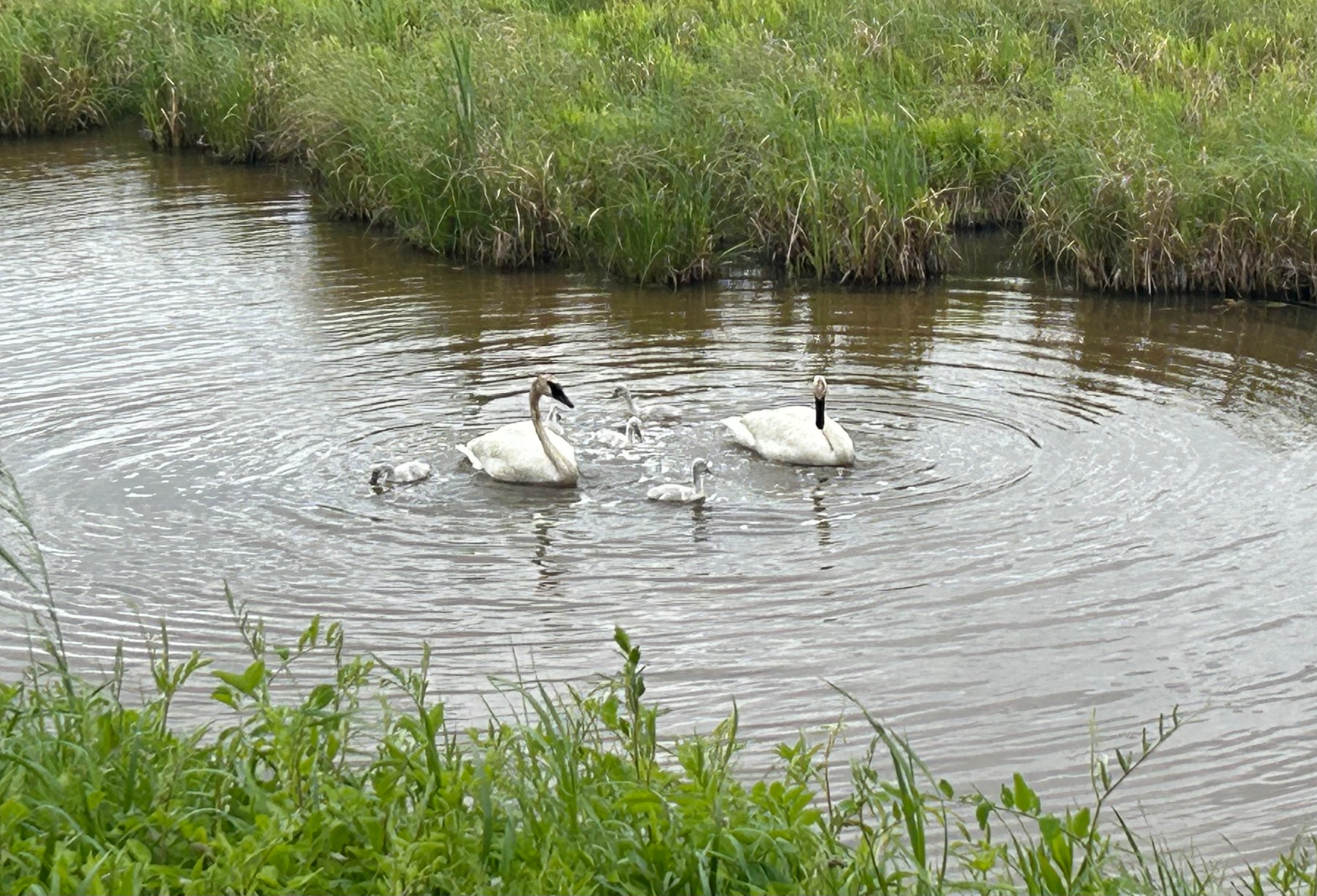
Today we were lucky to see two adult trumpeter swans and their five cygnets very close to the Paul Bunyan bike trail in the Chippewa National Forest.
In the videos below the adult swans are seen waddling back and forth apparently stirring up muck from the bottom of the pond. The FAQ page of The Trumpeter Swan Society confirms that parent swans stir up plant material at the bottom of ponds for the cygnets to eat.
Kicking up pond muck to provide for your family is a pretty ingenious strategy. Maybe better than a 9-to-5 job?
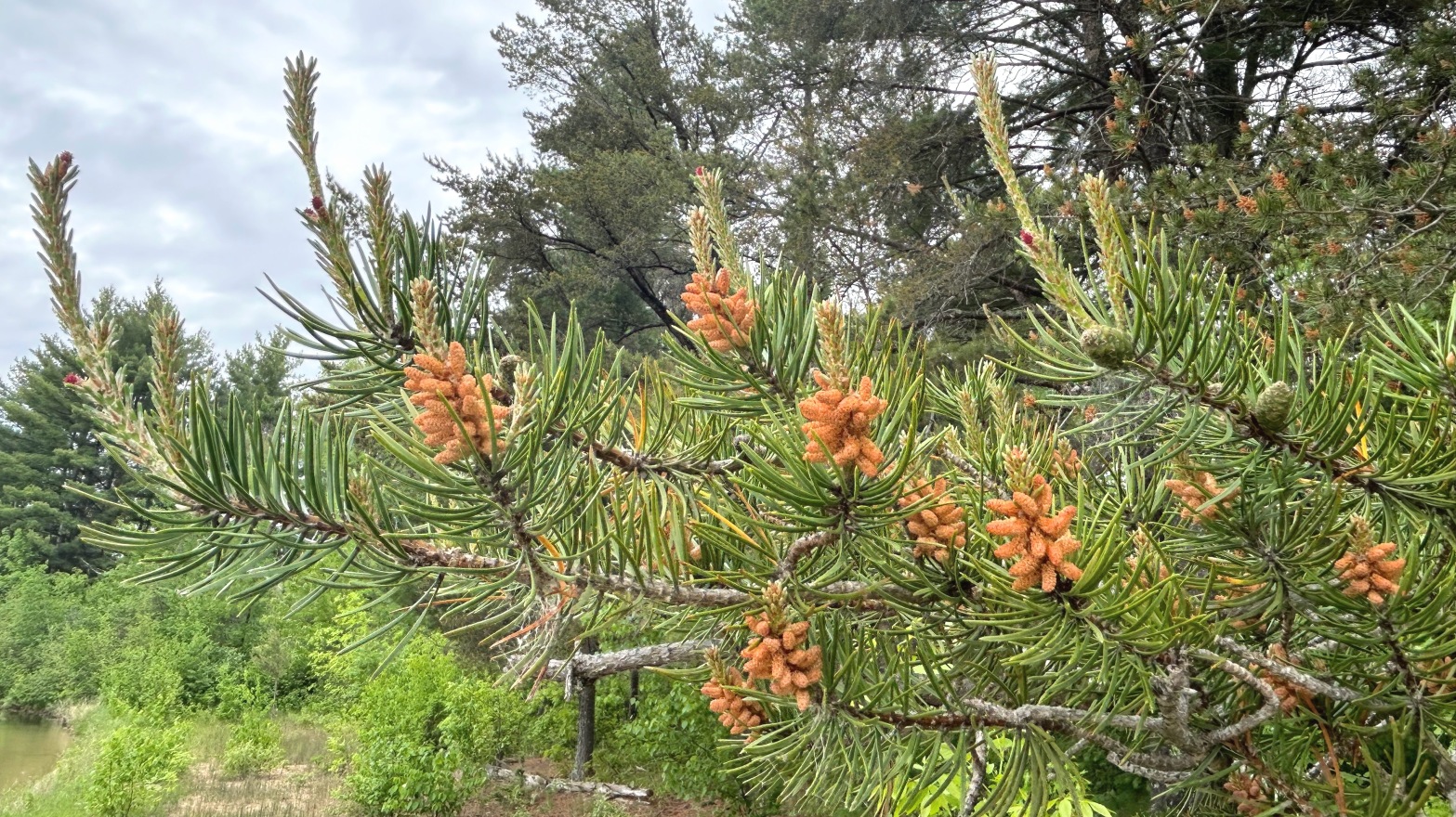
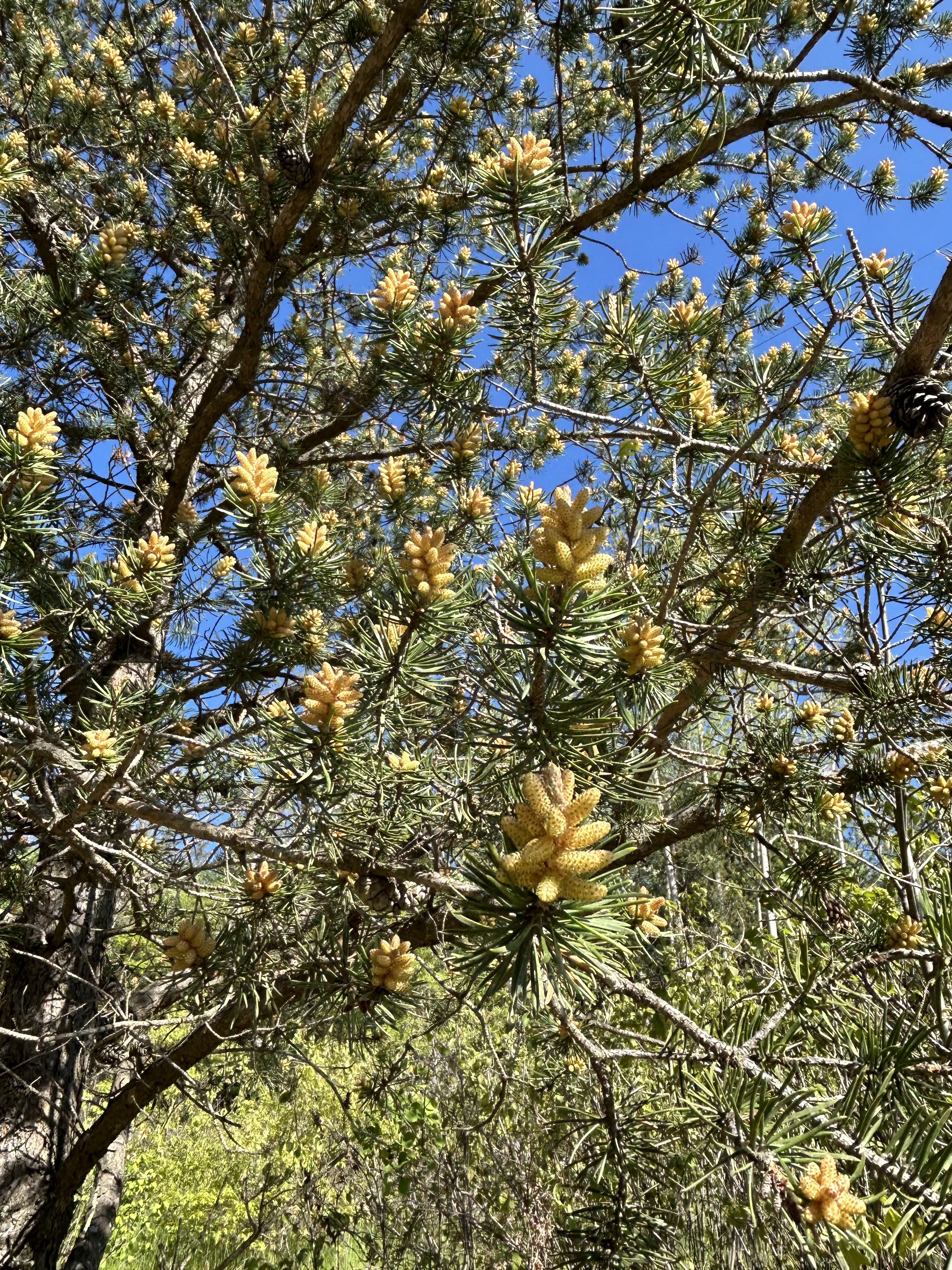
Three pines are native to North-Central Minnesota, The Red (Norway) Pine, the Eastern White Pine, and the Jack Pine. Jack Pine is somewhat less desirable than the other two, both commercially and aesthetically. However, it successfully exploits its niche as the northern conifer best able to thrive after wildfires.
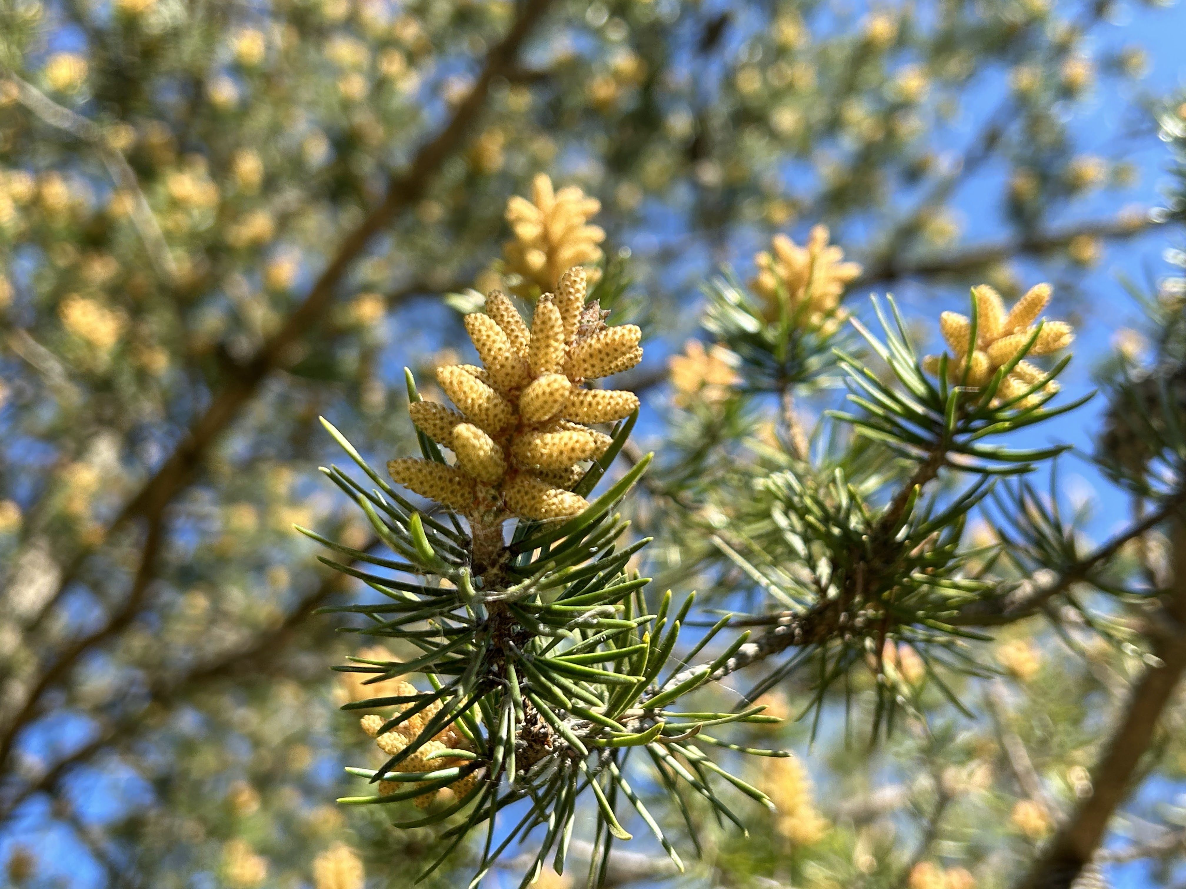
A single Jack Pine has both male and female cones on different branches. Copious amounts of yellow pollen are produced by male cones and distributed by the wind in late May to fertilizes female cones. Seeds mature in the female cones for 2-3 years. Cones remain on the tree for many years and seeds within the cones remain viable for more than 20 years.
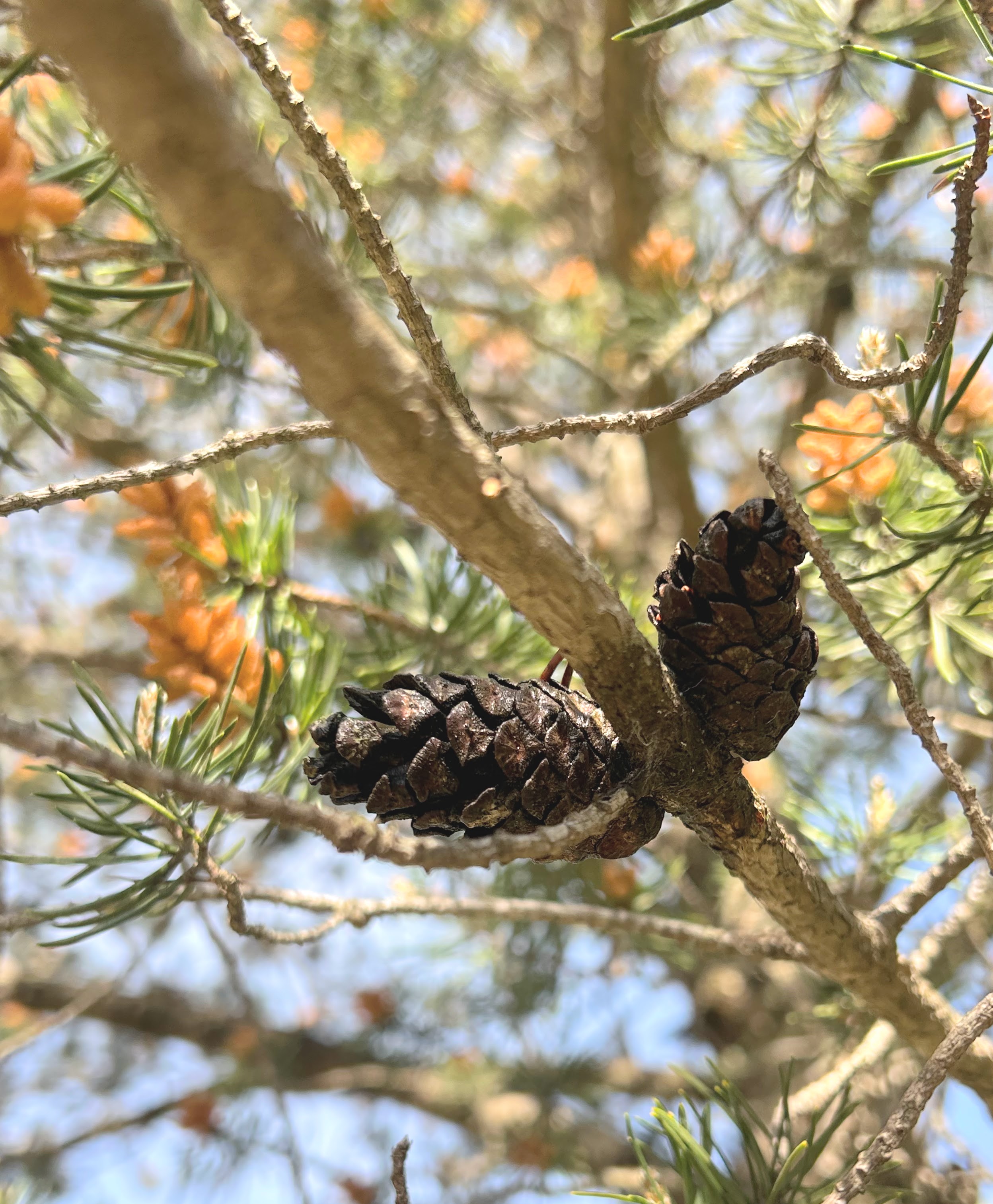
The ways in which Jack Pine has adapted its reproductive strategy to dominate after wildfires are ingenious. Its cones are usually sealed with resin. Seeds within these serotinous cones are only released when the resin melts at high temperature (120 – 140 degF). So, the Jack Pine essentially stores up the seeds it produces throughout its life until the high temperature of a forest fire releases them.
Jack Pine seedlings have evolved to thrive in sections of newly burnt forest. They need soil with minimal organic matter, plenty of sun exposure, and little competing vegetation.
Jack Pines produce some non-serotinous cones as well, especially in the southern parts of their range. These cones do not require fire to release the seeds, which means that Jack Pines are not completely dependent on fire to reproduce.
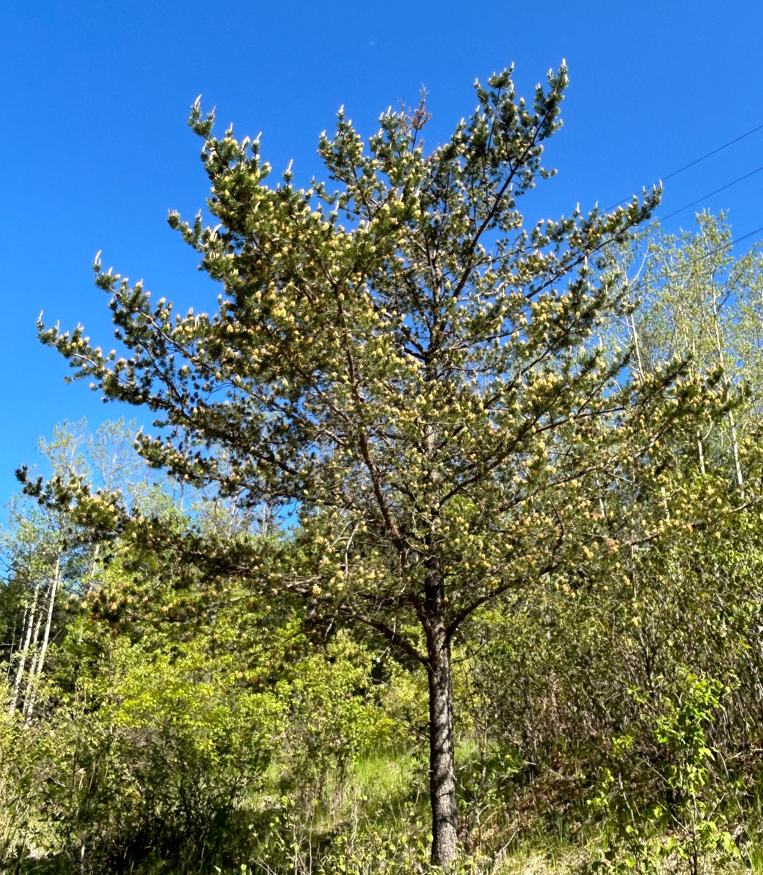
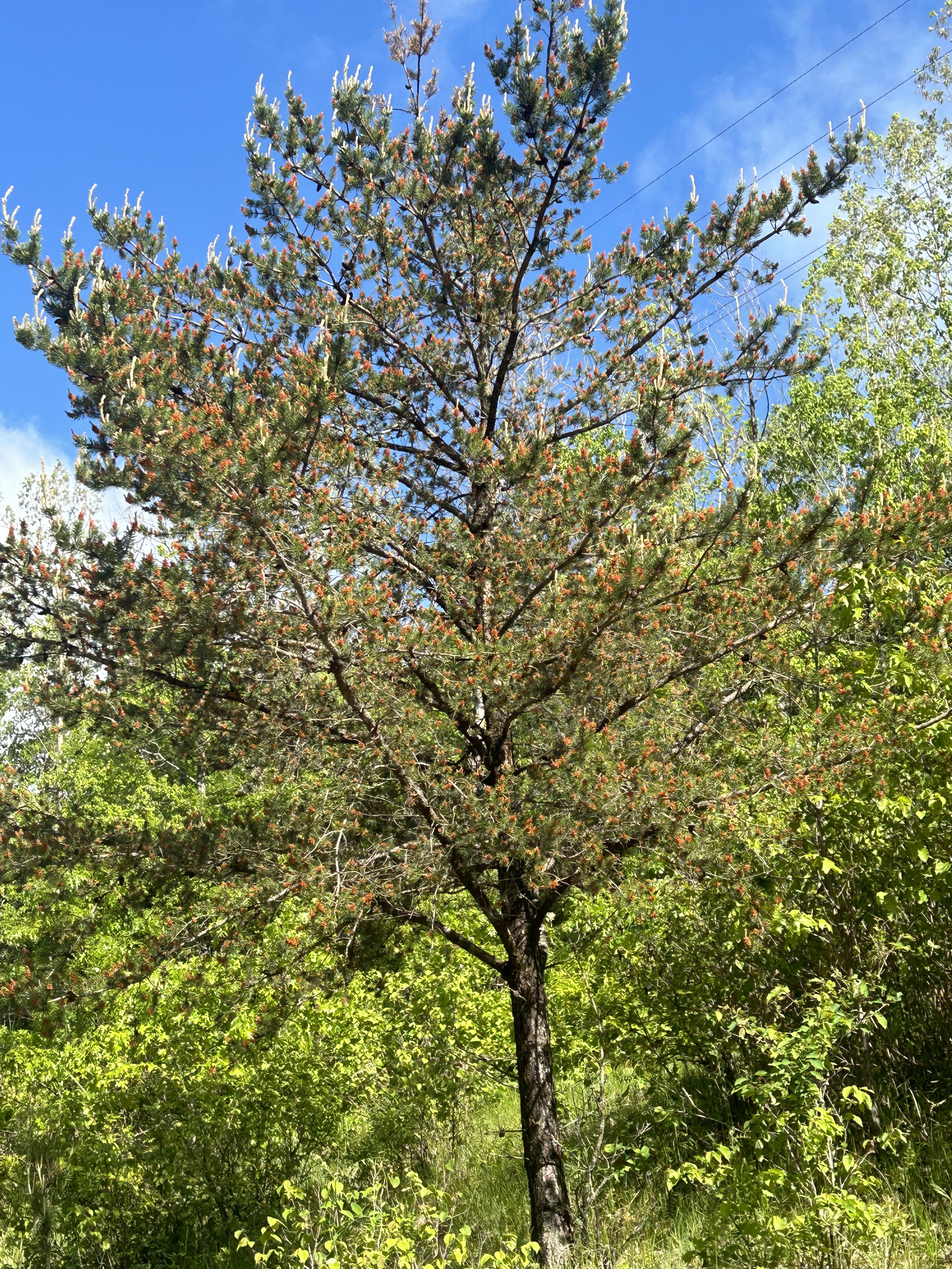
One of the pictures above shows a Jack Pine tree in late May, when the tree is dotted by male cones with their yellow pollen. The underlying picture shows the same tree about two weeks later after it has released its pollen.
Views of Jack Pines in mid-May when male cones are yellow with pollen.
Views of young seed-bearing female cones on Jack Pines. In their first year these serotinous cones are green and tightly sealed by resin.
Some older cones of the Jack Pine are non-serotinous and open to release seeds without aid of fire (picture on the left above). Other older cones remain tightly sealed (right-hand picture).