The Remix option in Goggle Photos uses Generative AI to significantly restyle photos. From Wikipedia I learned that Generative AI uses models that have learned underlying patterns in existing text, images, or audio to create new content from user prompts.
In the examples in this post the ‘user prompts’ are my original photos and Google’s Generative AI models that are used are called ‘oil painting’ and ‘watercolor’.
Remixing commonly does a good job of focusing attention on the main features of an image. In example photos below Remixing draws attention to hail in a storm, to a rainbow, and to a bee in a wild rose much more effectively than seen in the original photos. Remixing also makes images more colorful and increases relevant detail.
To me, using these Generative AI capabilities feels a bit like cheating. Professional photographers have the expertise and equipment to create striking images. Now with ‘Remixing’ anyone with an iPhone and minimal talent can create comparable images.
I’d like to see others’ thoughts about these new capabilities. Are they just another new tool and no big deal? Or are they shortcuts that encroach on human skills and expertise?
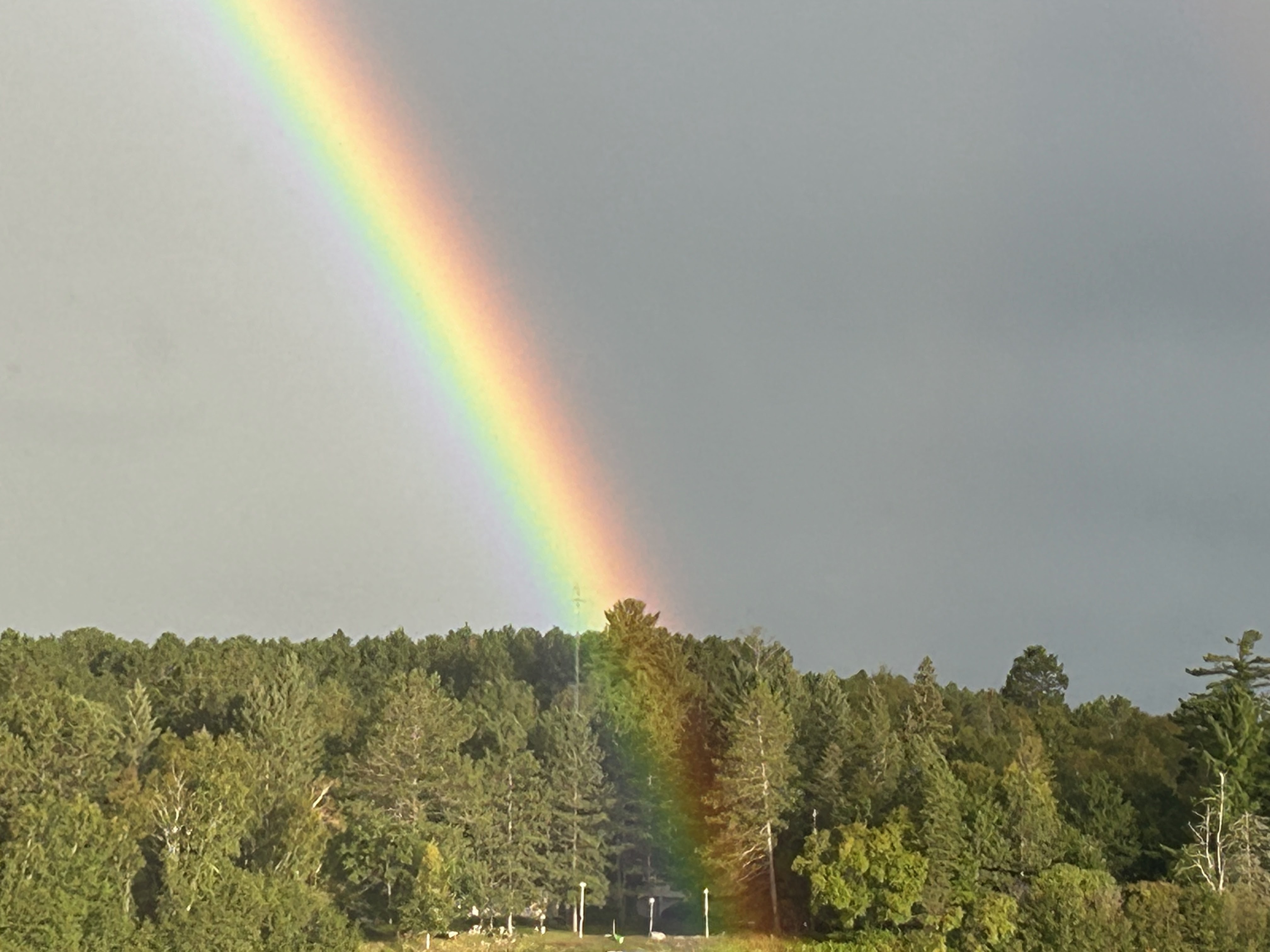
The rainbow is made much more striking by the Oil-painting remix of the original photo.
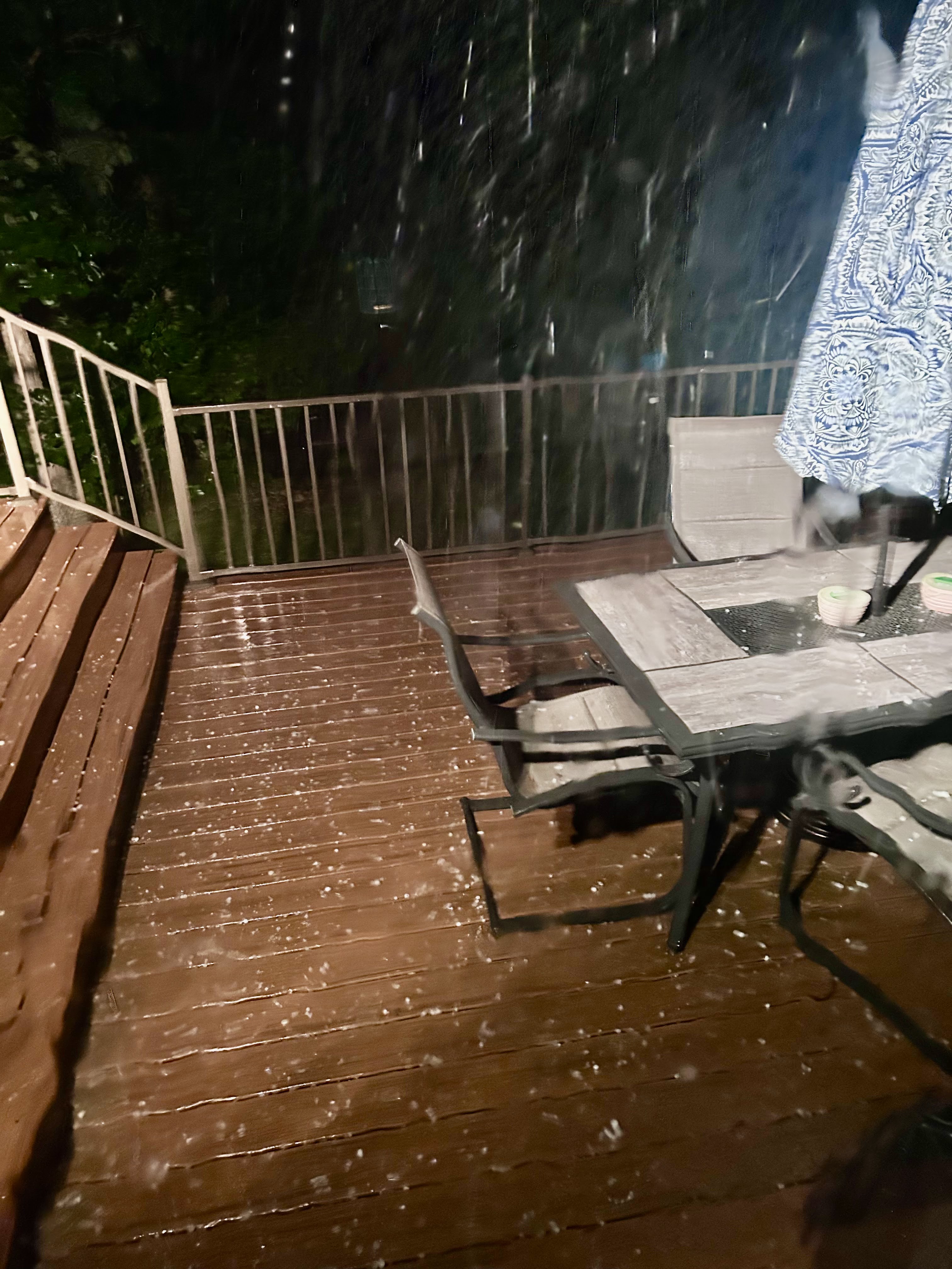
A picture of a recent mild hailstorm is much more dramatic in the Oil-painting remix
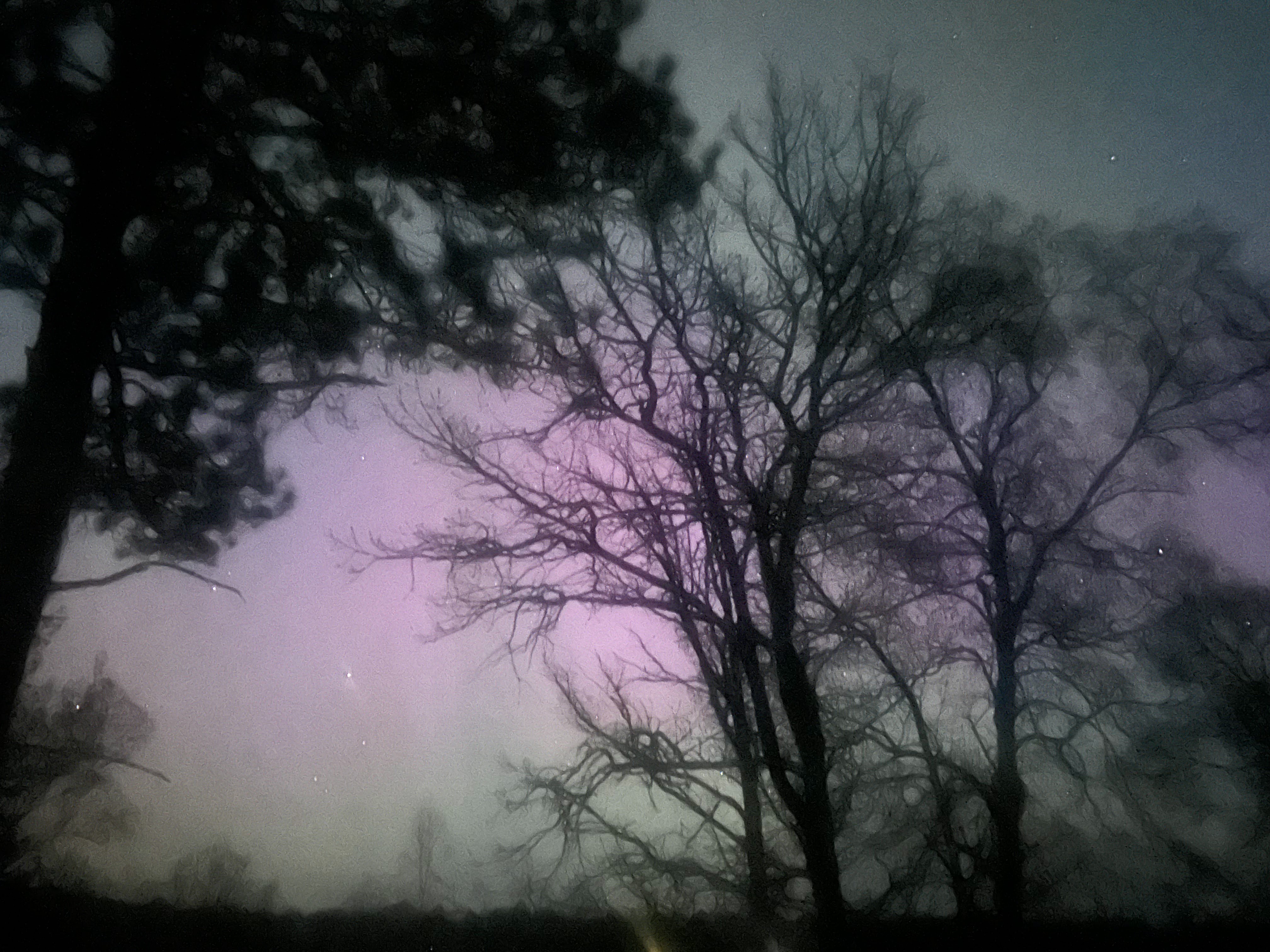
Oil-painting remix brings out colors in the northern lights.
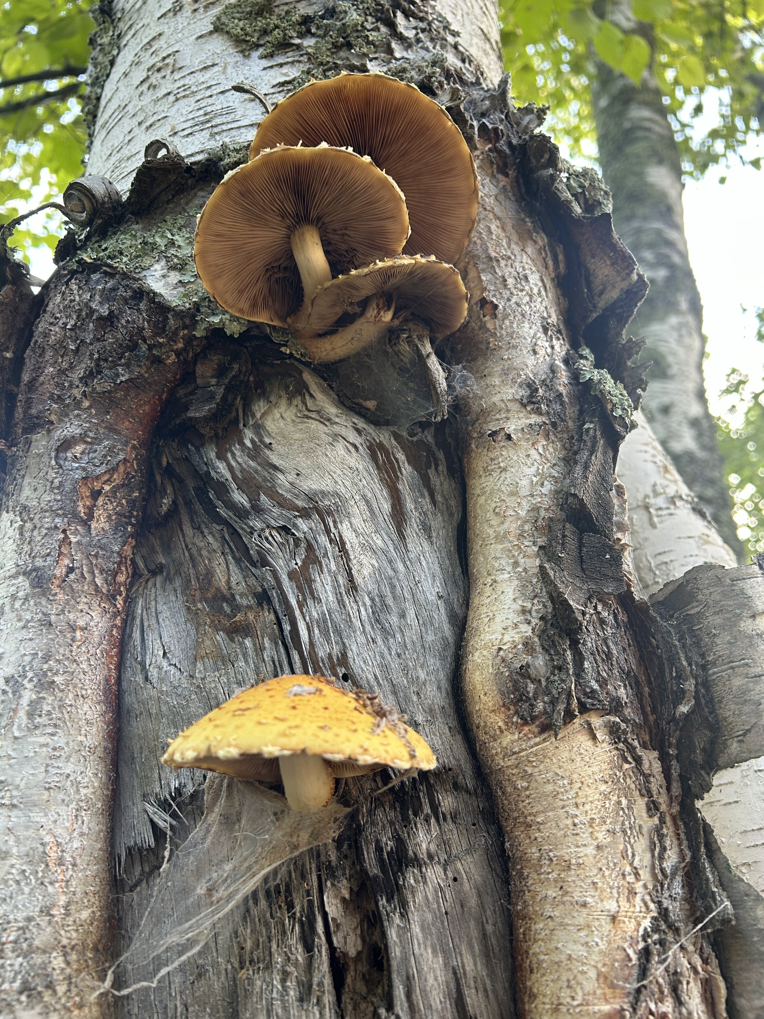
This photo of mushrooms on a birch tree was transformed by Watercolor remixing. The Watercolor remixing has taken liberties in reframing the original image.
Service berry bush blooming in the forest this spring. The Watercolor remix removes extraneous background trees.
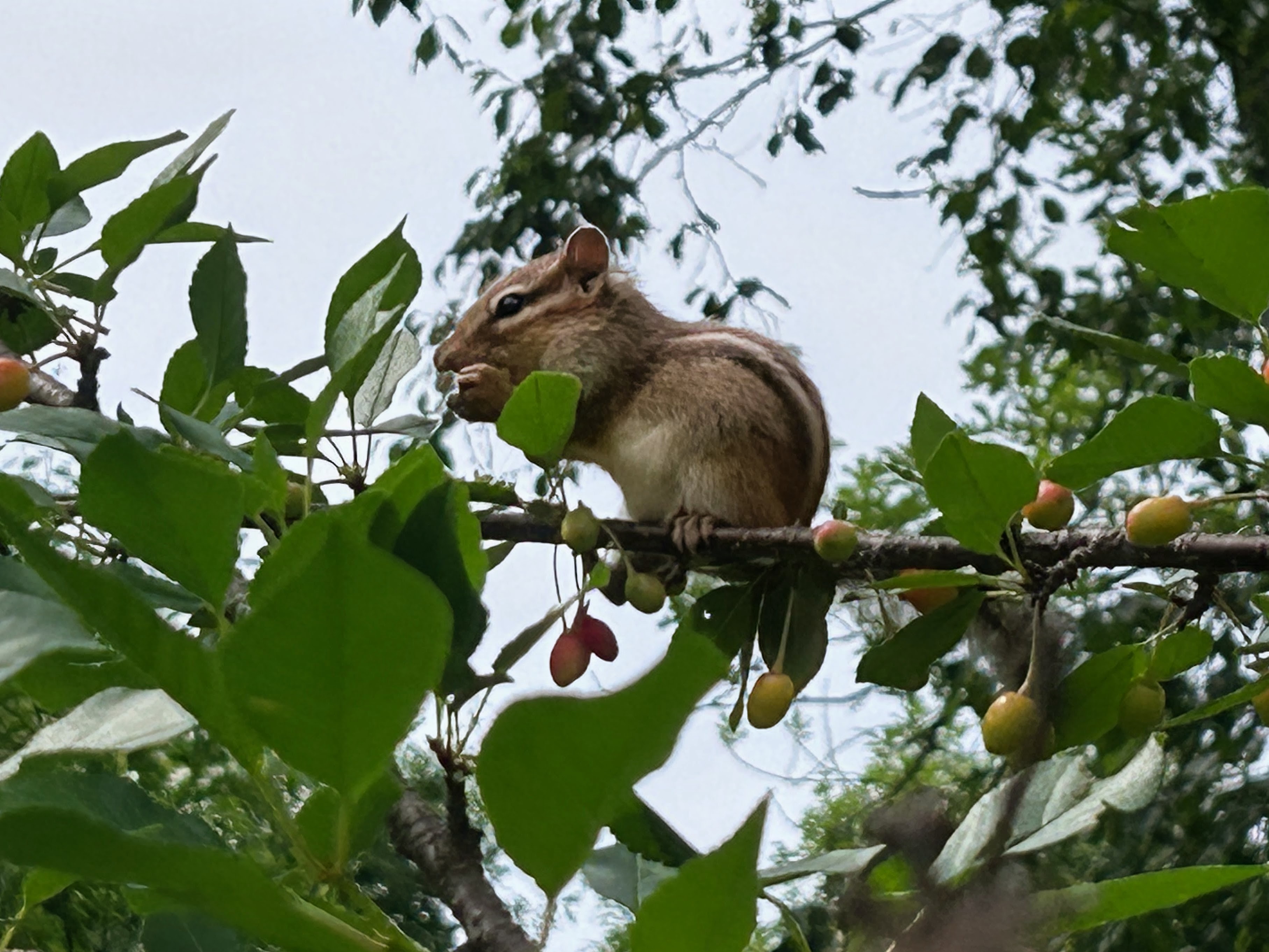
Oil-painting remix clarifies that the chipmunk is eating cherries from our tree.
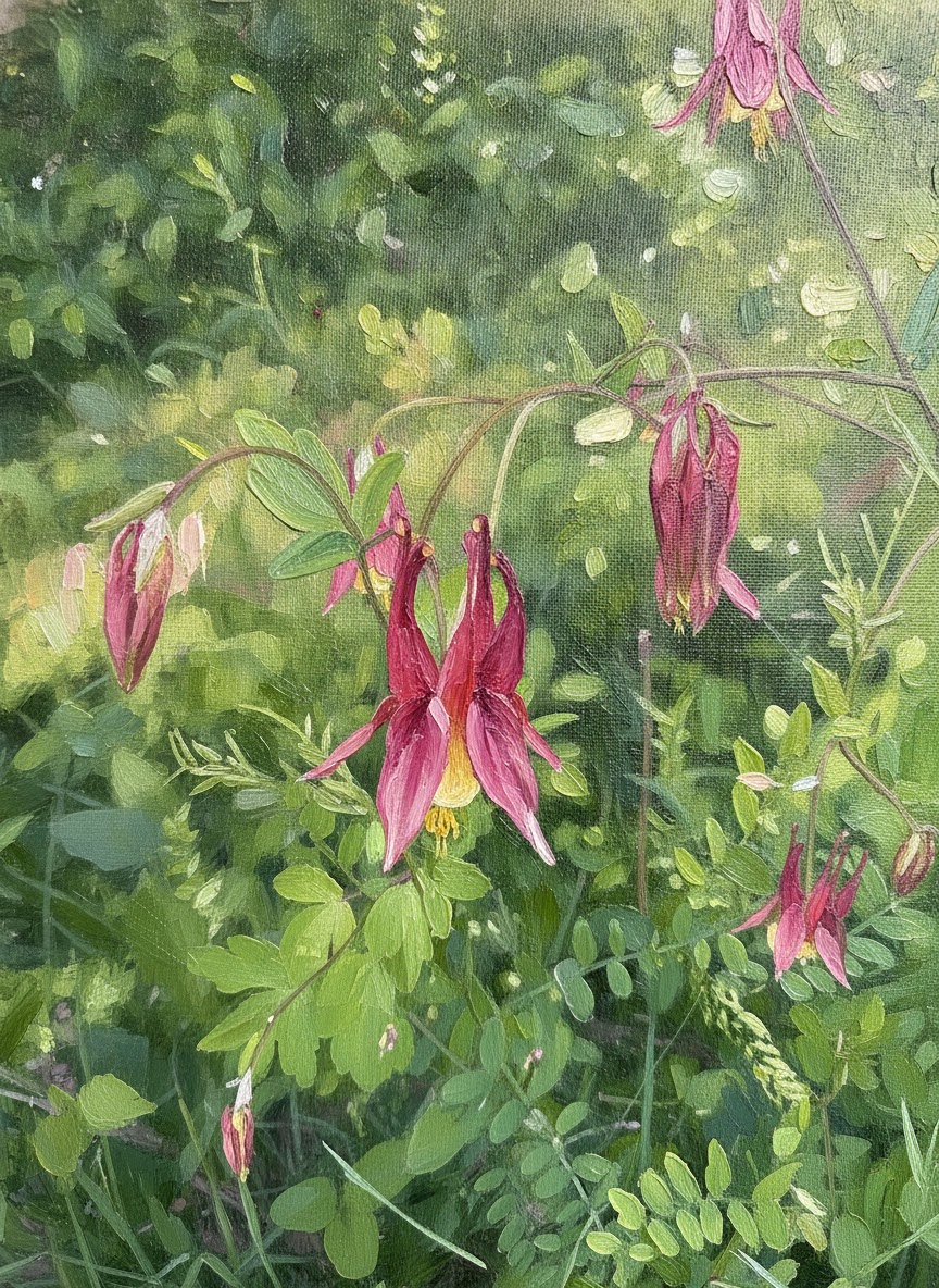
Wild columbine, original photograph remixed by Oil-painting.
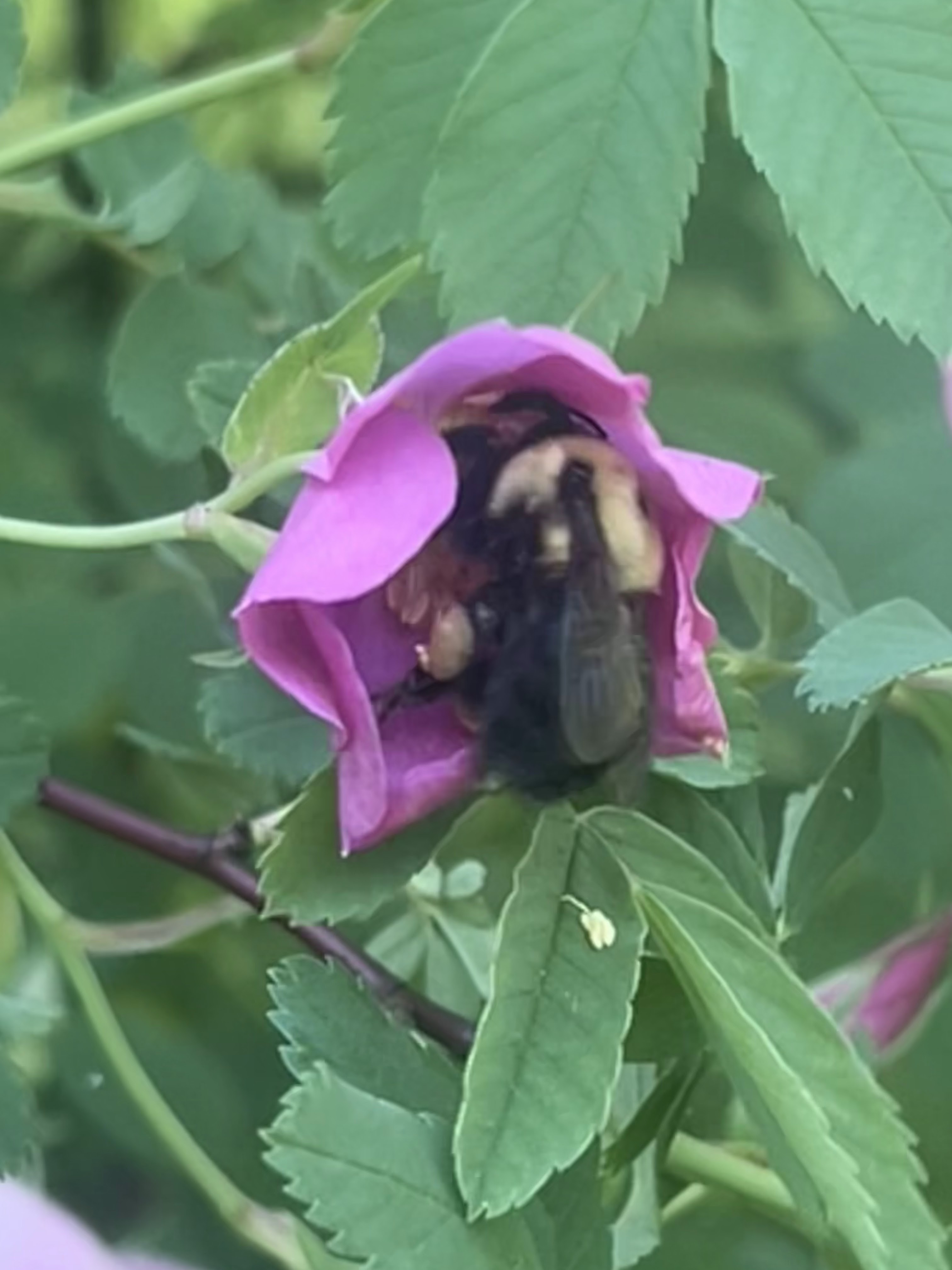
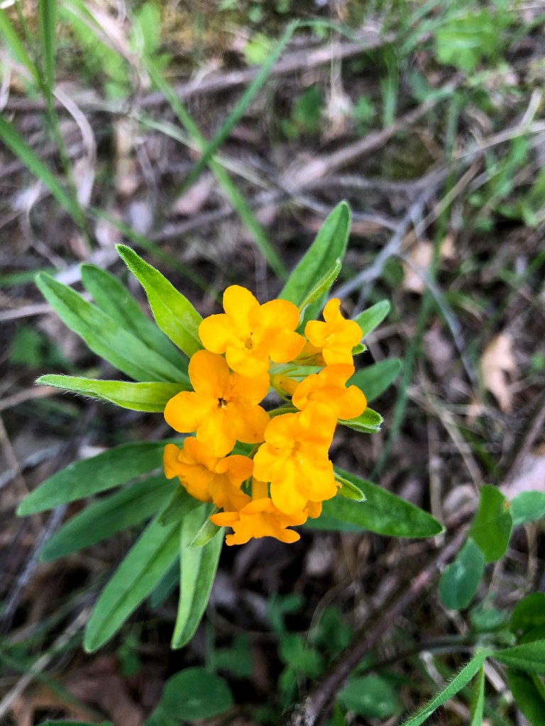
Bee in wild rose, Oil-painting remix adds significant detail to the bee.
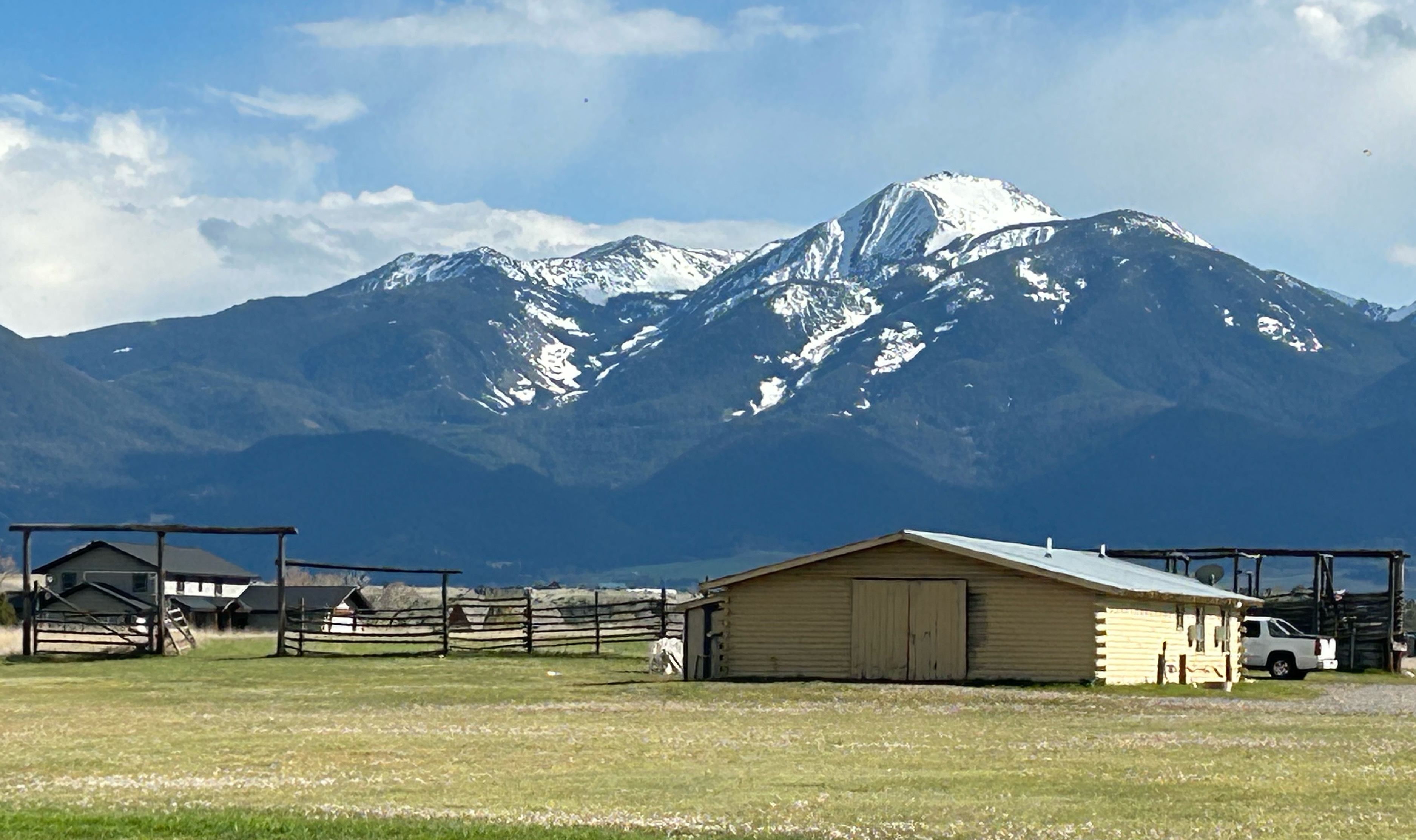
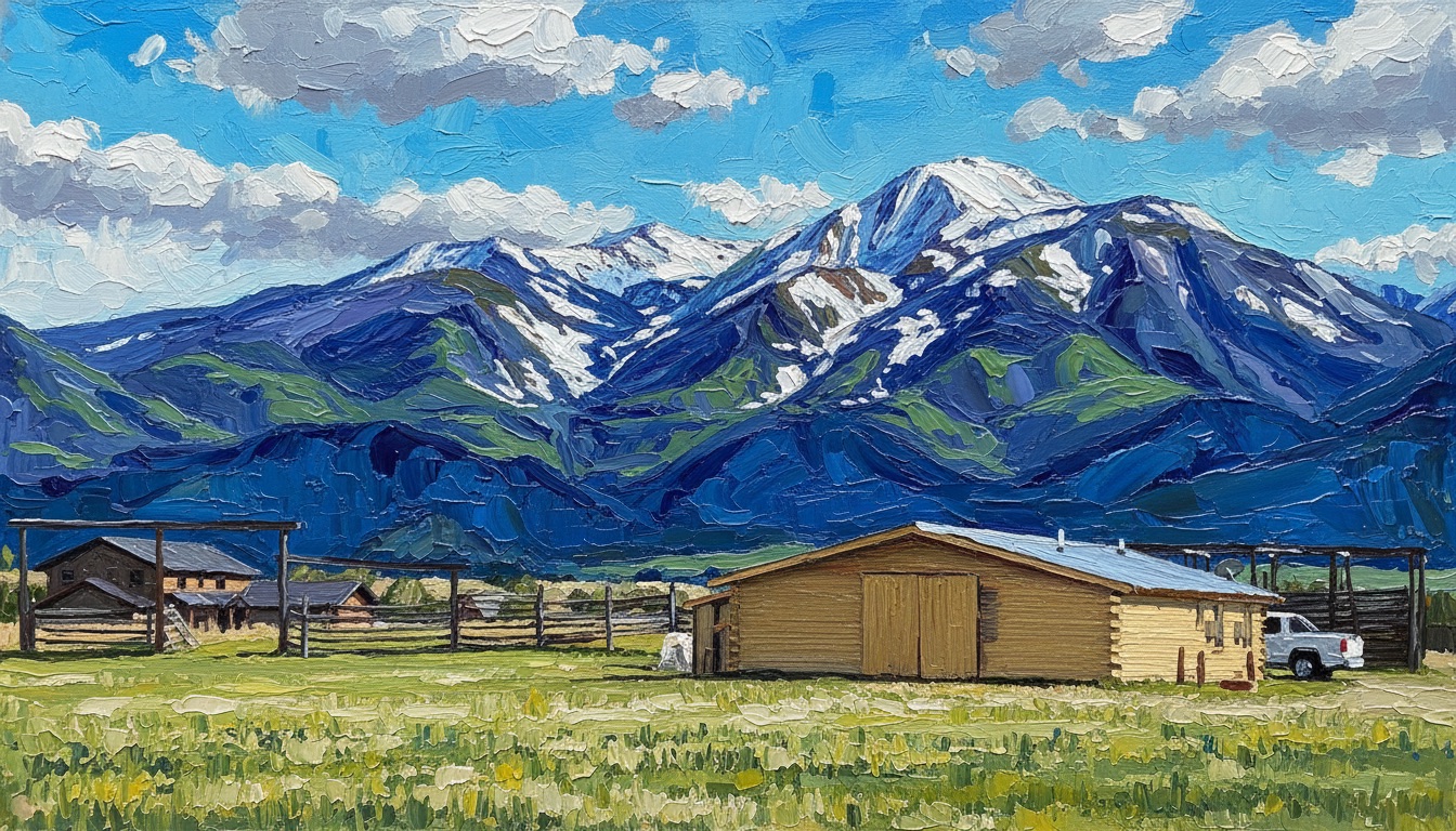
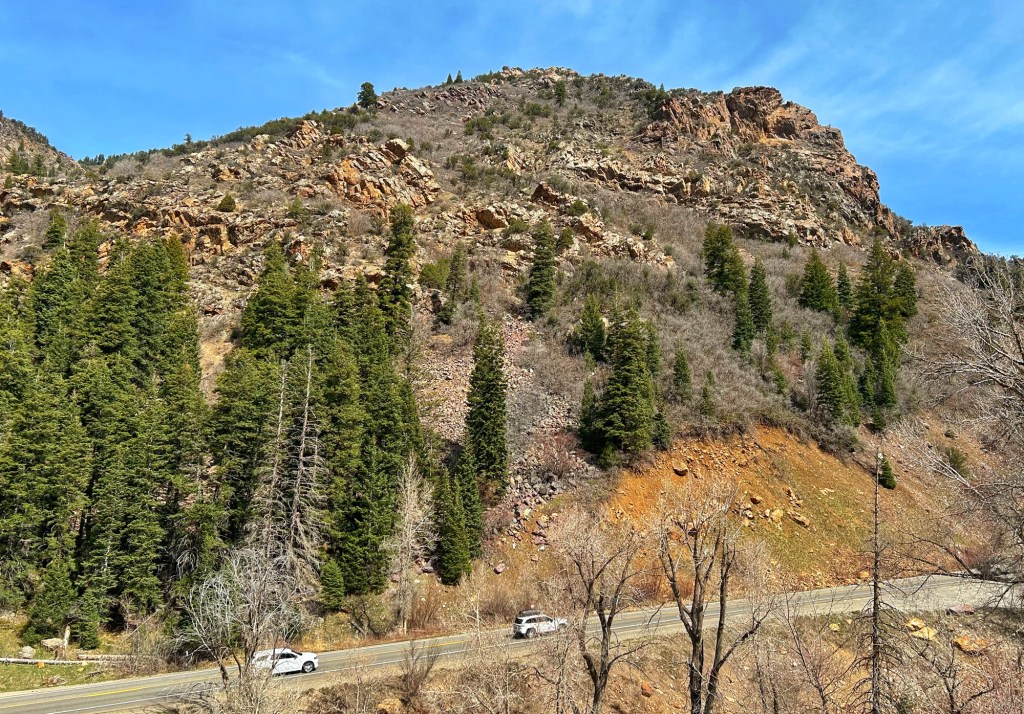
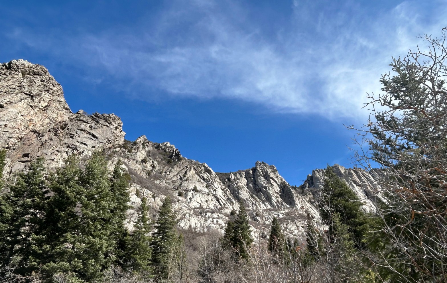
Mineral Fork Trail is accessed from Utah Hwy 190 in Big Cottonwood Canyon, to the east of Salt Lake City. Further up the road are the Solitude and Brighton ski areas. We hiked the trail March 27, 2026.
View from Mineral Fork Trail. Stylized image.
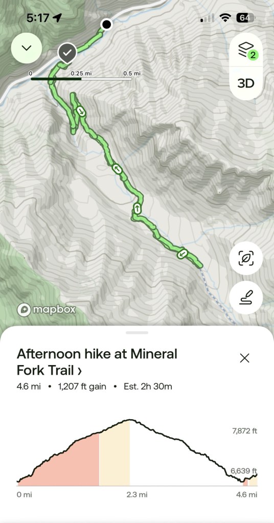
Above is the map of our hike from All Trails. Unsurprisingly we turned around before the end of the trail. Our excuse was that the trail was getting snowy.
Hwy 190 in Big Cottonwood Canyon seen from the start of the trail.Walking the trail, March 27, 2026.Gently curved strata are exposed in the road cut along Hwy 190.A stream ran beside the trail for much of the way. In some places shallow water was actually running down the trail.
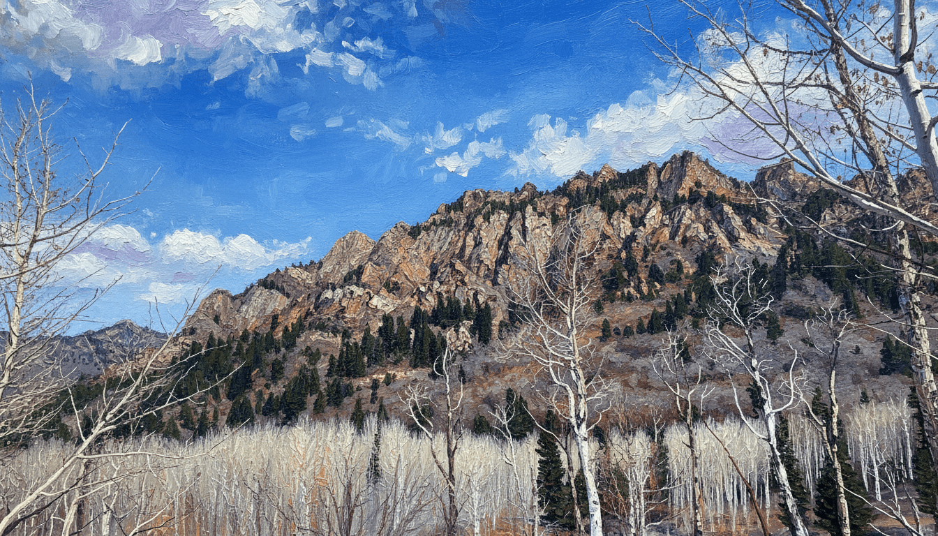
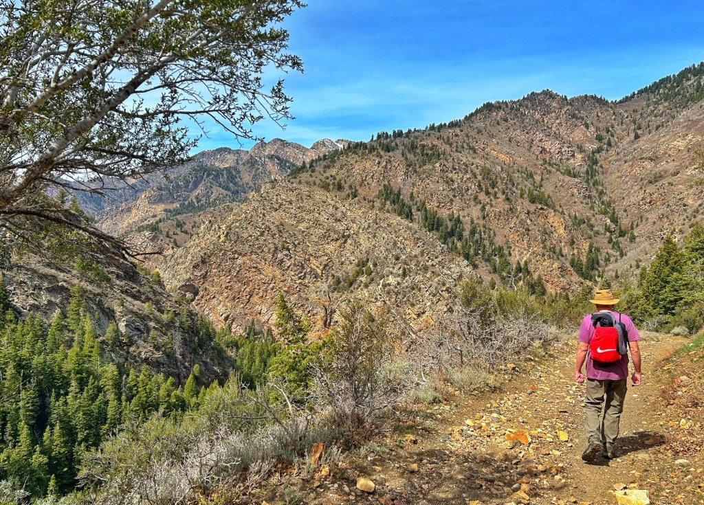
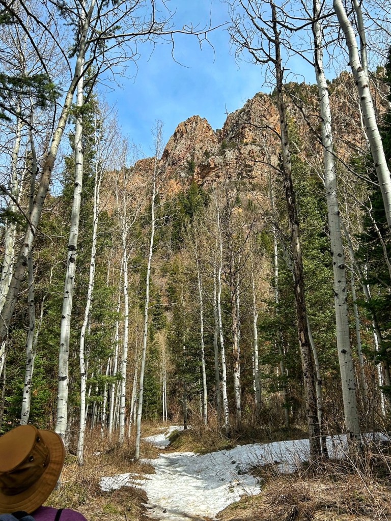
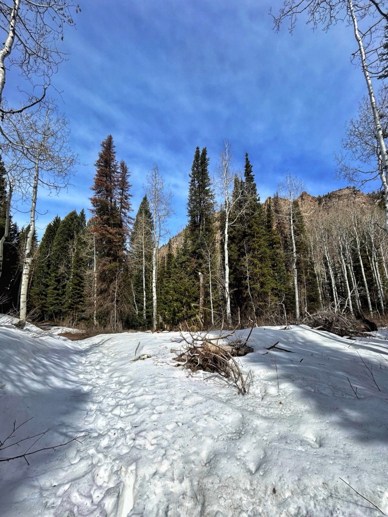
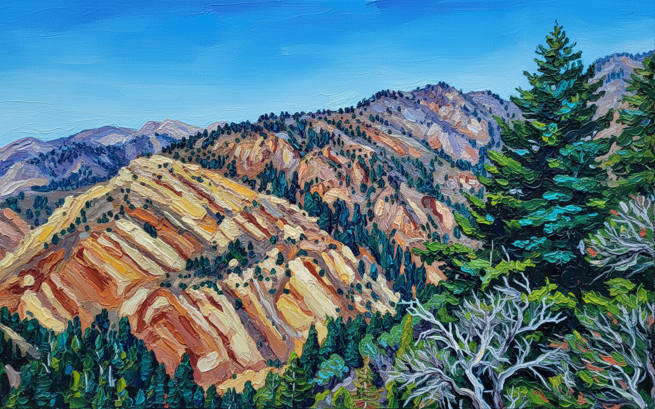
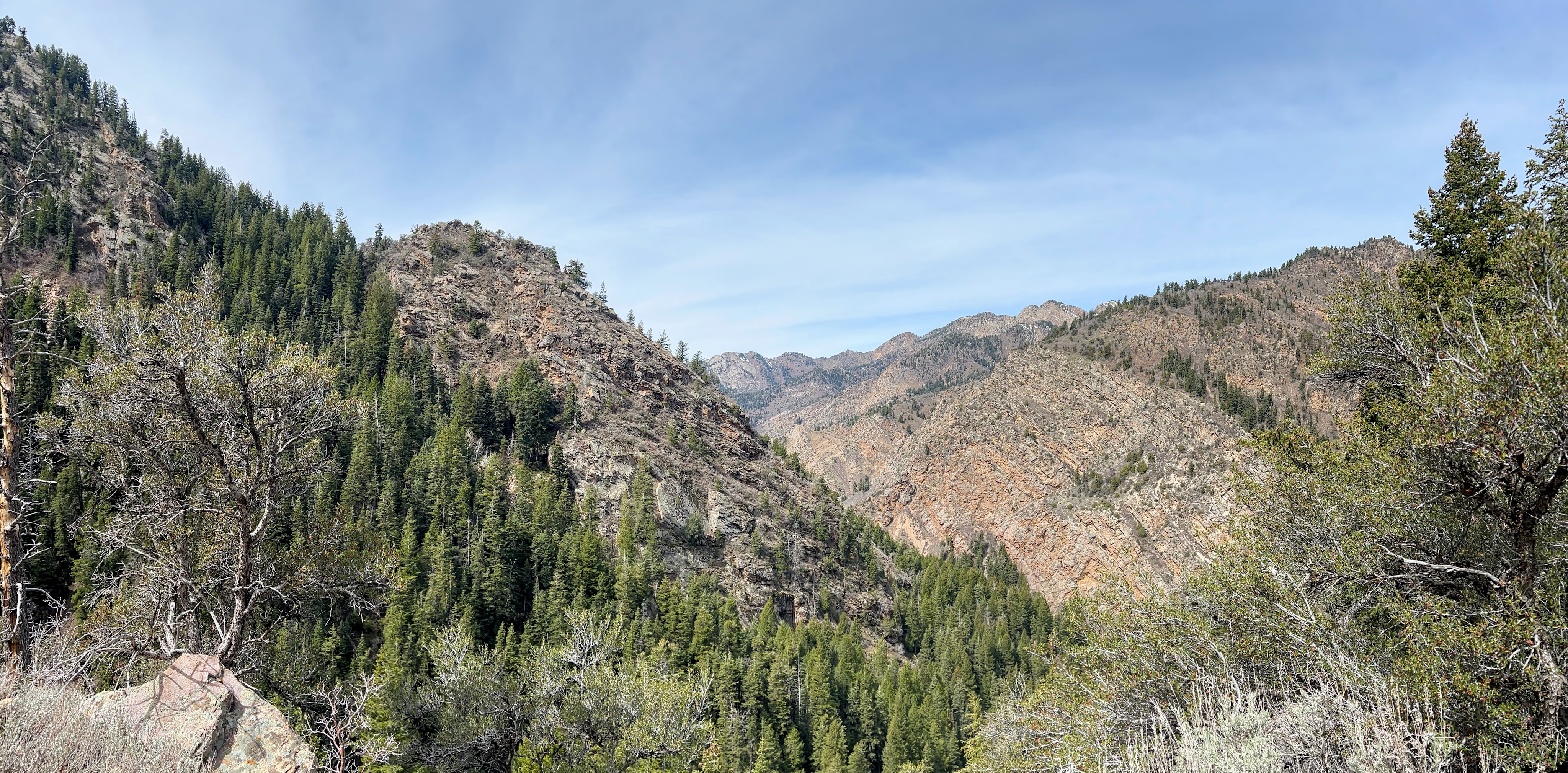
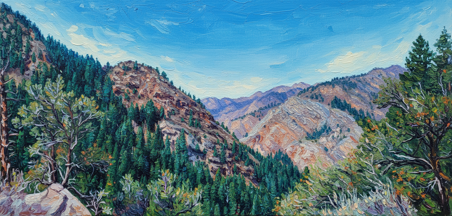
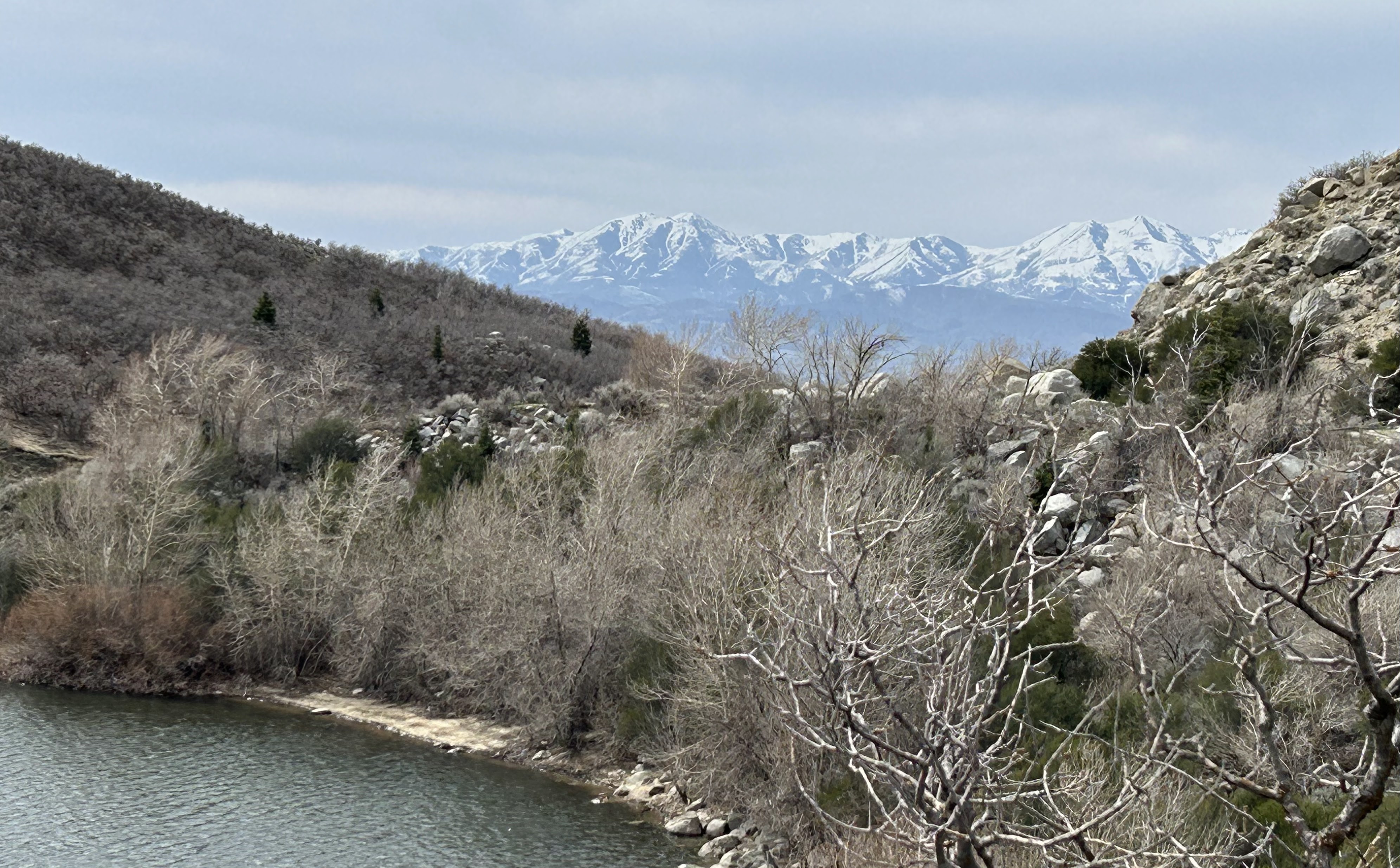
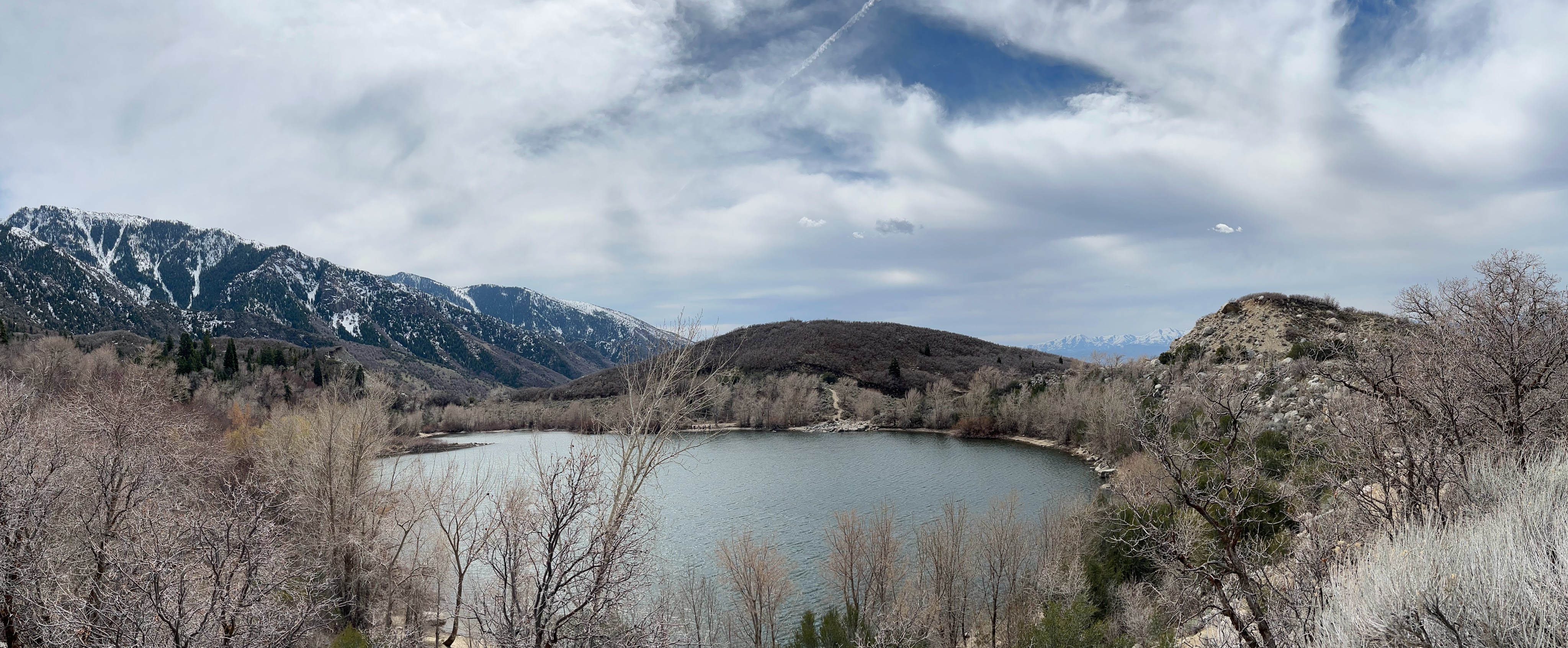
The views above are from near the end of our hike up the trail, at about 2.3 miles. The original photo is followed by a stylized version of the image.
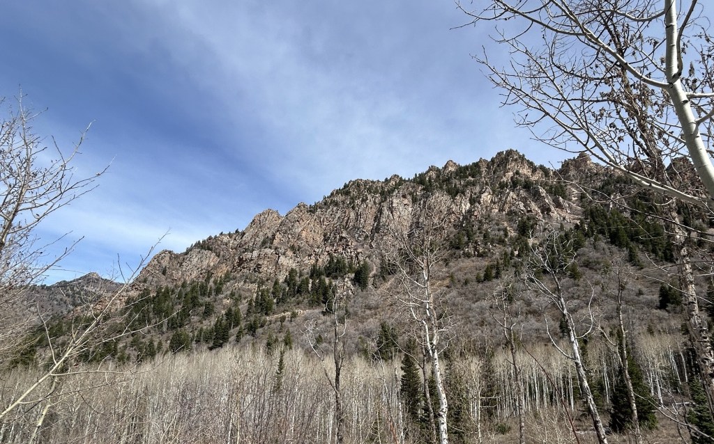
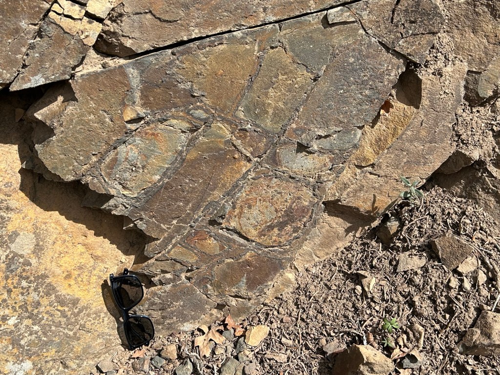
The Mineral Fork Tillite is a Precambrian rock formation exposed in Big Cottonwood Canyon and is seen along the Mineral Fork Trail.
Tillite is a rock type that is interpreted as being deposited by glacial processes. The diagnostic feature of Tillite is large rock clasts embedded in fine grained rock matrix. It is thought that deposition of such large clasts requires transport by ice. The image above is of rock along the trail that I believe to be Tillite, large clasts are evident in the dark fine-grained matrix.
Precambrian rocks interpreted as Tillite are found throughout the world, leading to the theory of ancient “snowball Earth”. There are separate exposures of Mineral Fork Tillite in Utah, including several miles to the west in Antelope Island state park.
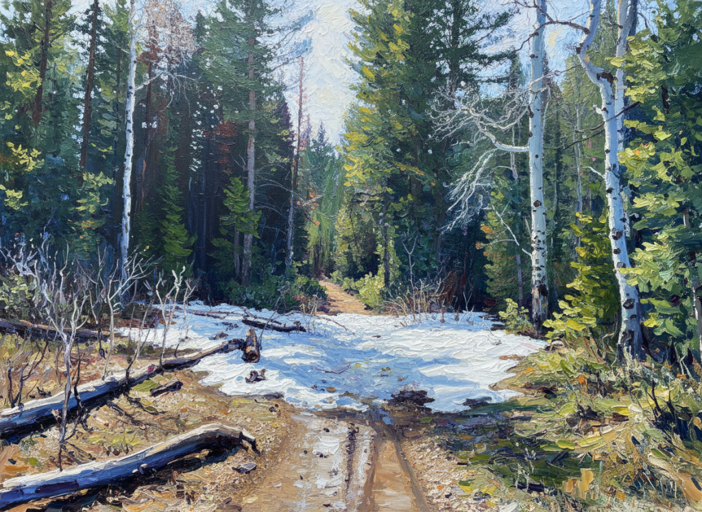
This stylized image shows the occasional snow across the trail.More snow on the trail.This was the end of the trail for us.
Google Photos has a number of image filtering features; this post focuses on a new option that I particularly like in the “Remix” category. The different filters that are available in Remix are not named, the one featured here is the fourth that appears when I open Remix on an iPhone. It transforms photos into images that resemble impressionist paintings.
The remix adds interesting contrast in the snow and sky in this photo of a ski run.
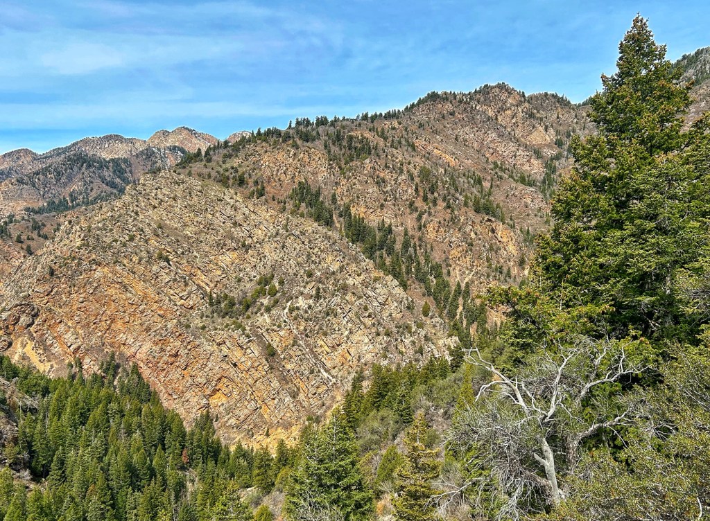
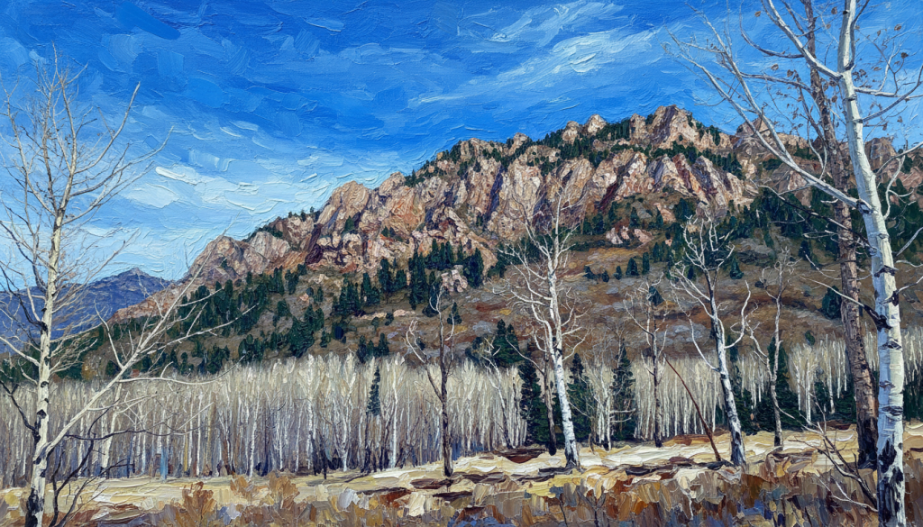
In this photo taken from the Mineral Fork Trail near Salt Lake City, the remix brings out the stratigraphy of the exposed rock.
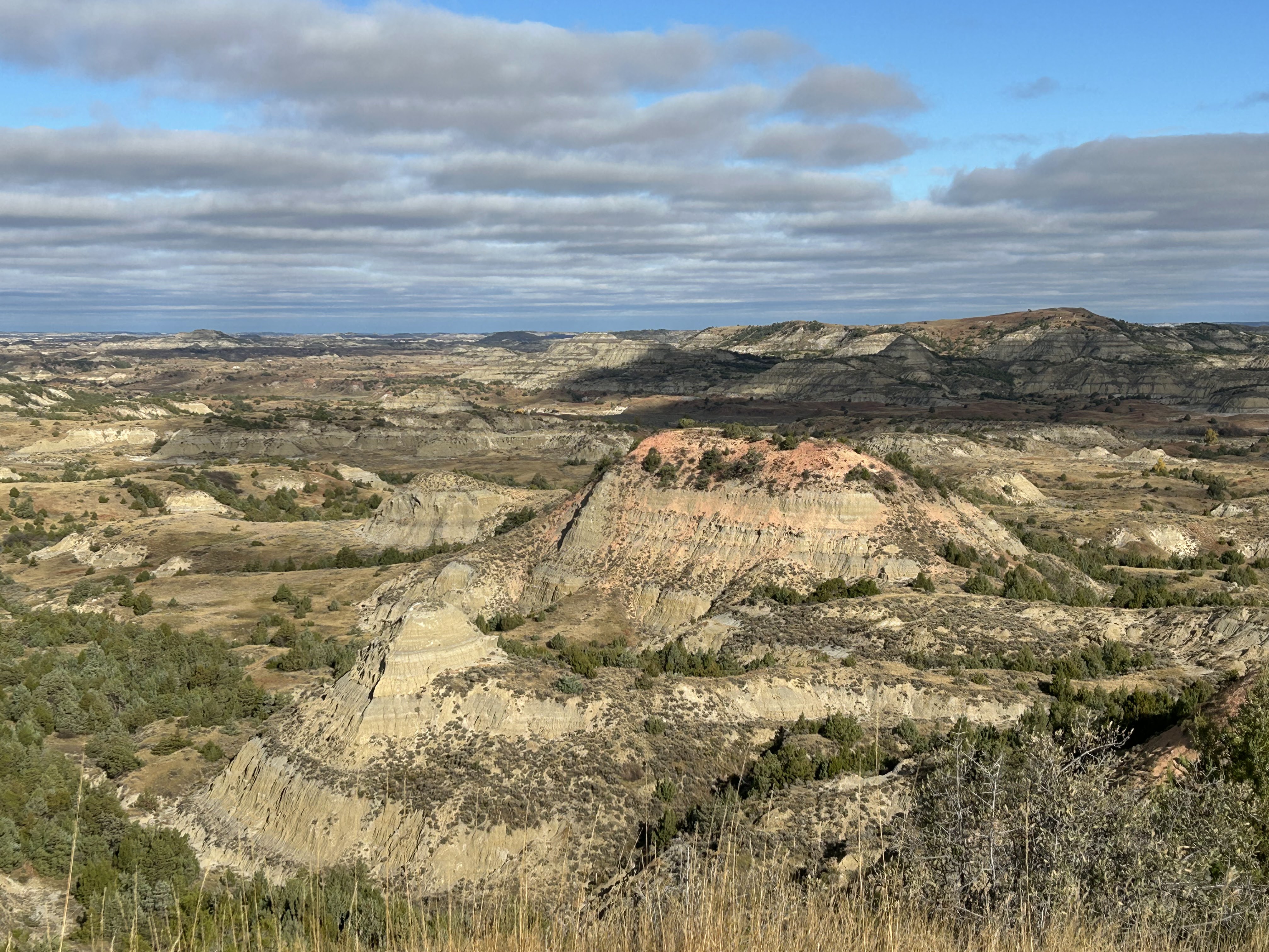
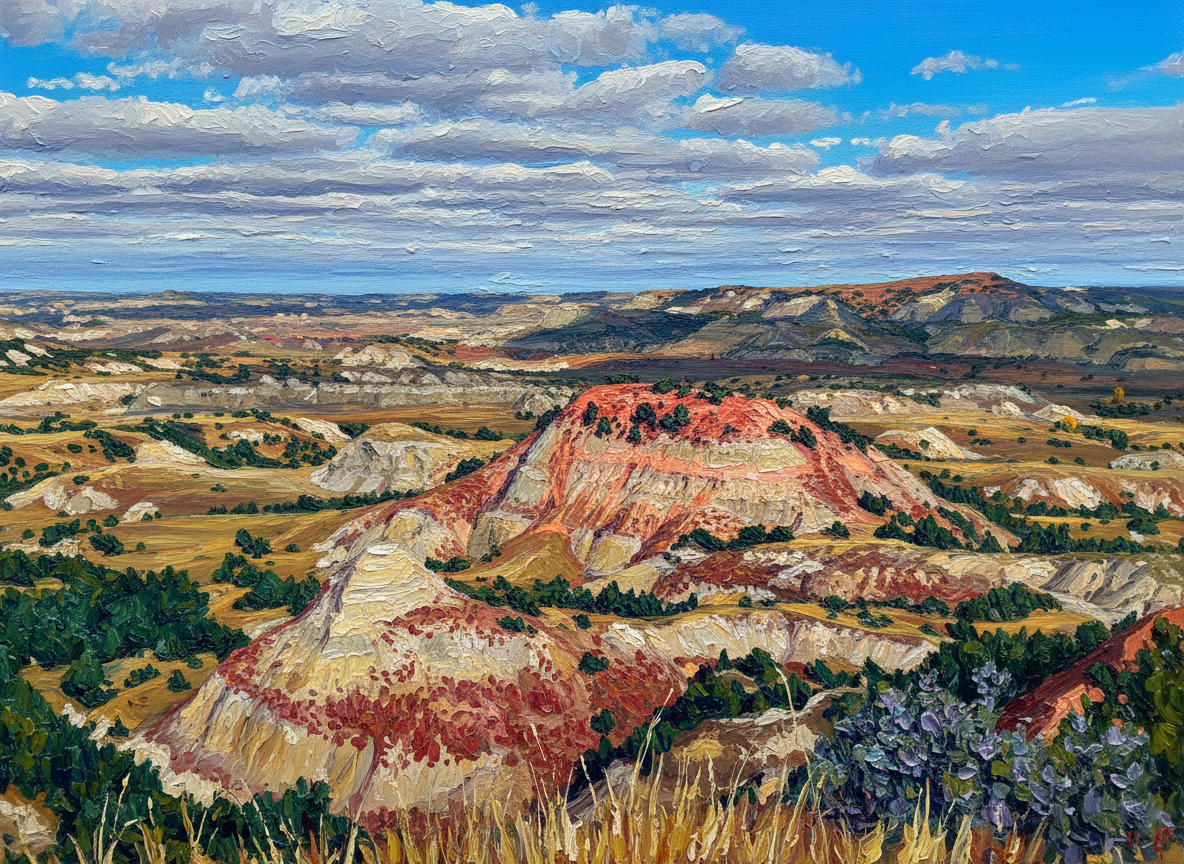
Another example of the Remix bringing out stratigraphy, here in the North Dakota badlands.
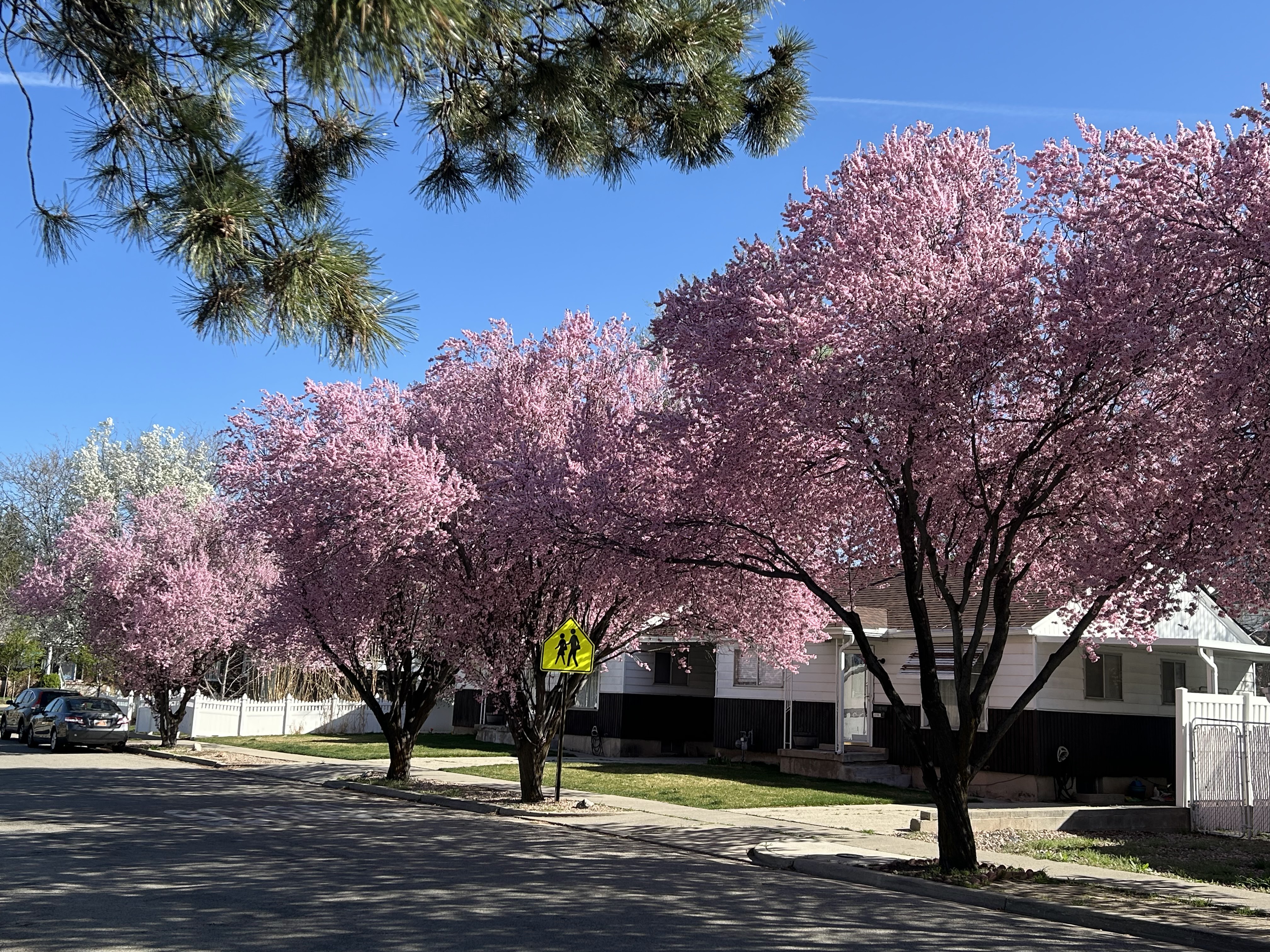
The Remix makes this photo of flowering Japanese cherry trees more striking.
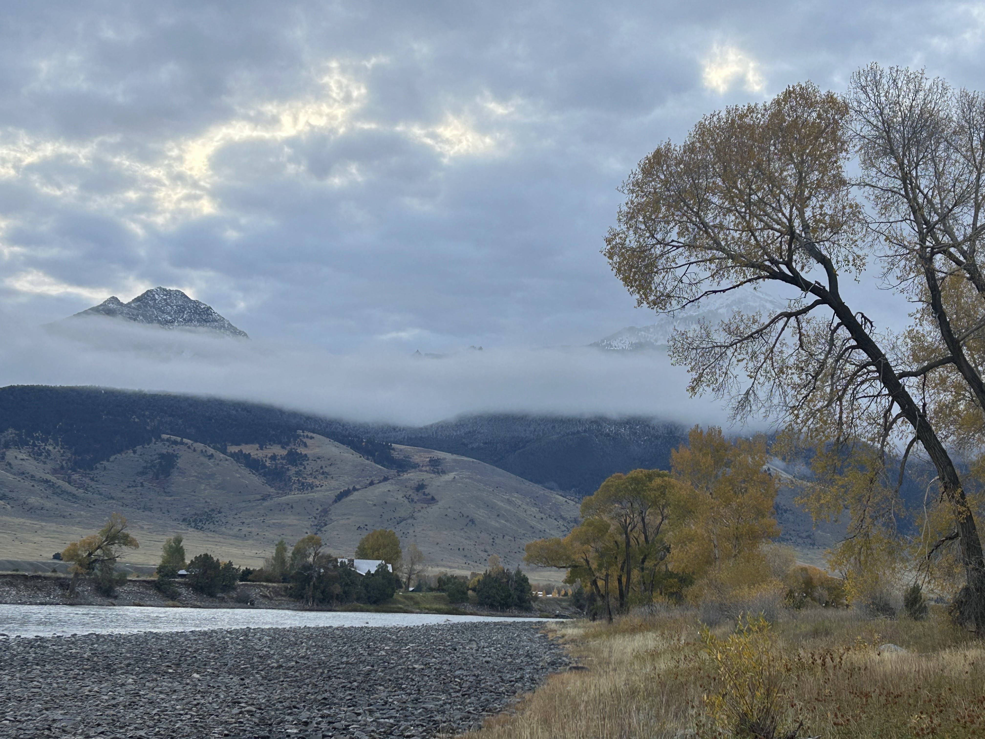
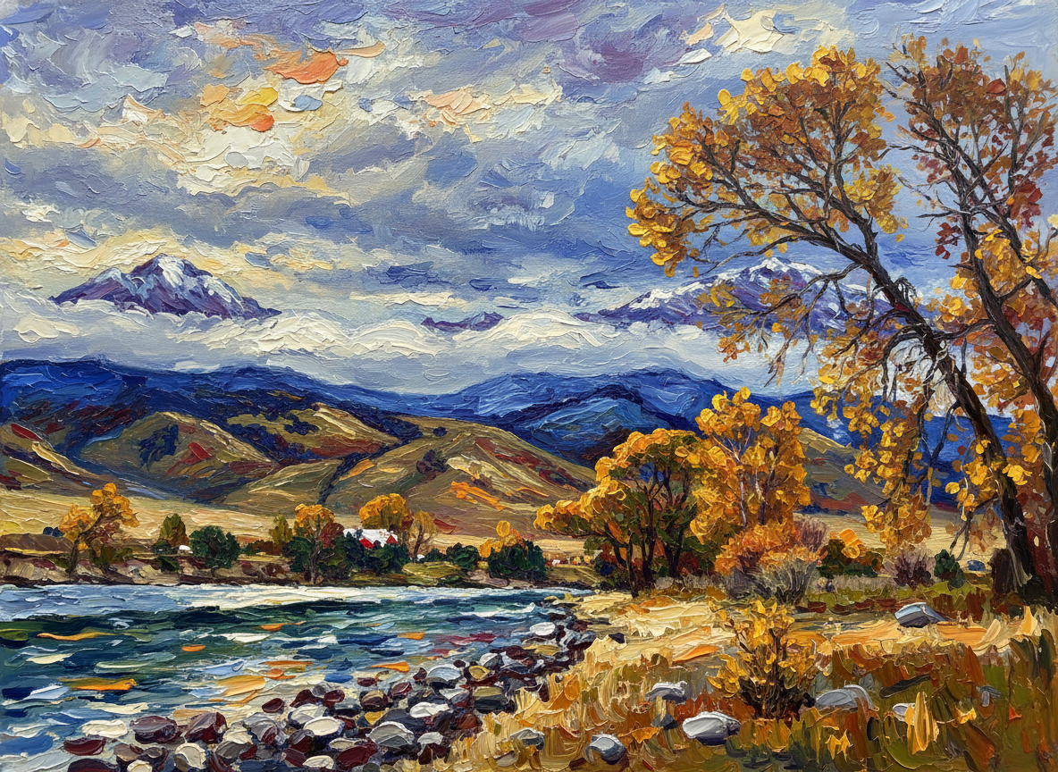
The Yellowstone River in Montana. The Remix enhances reality.
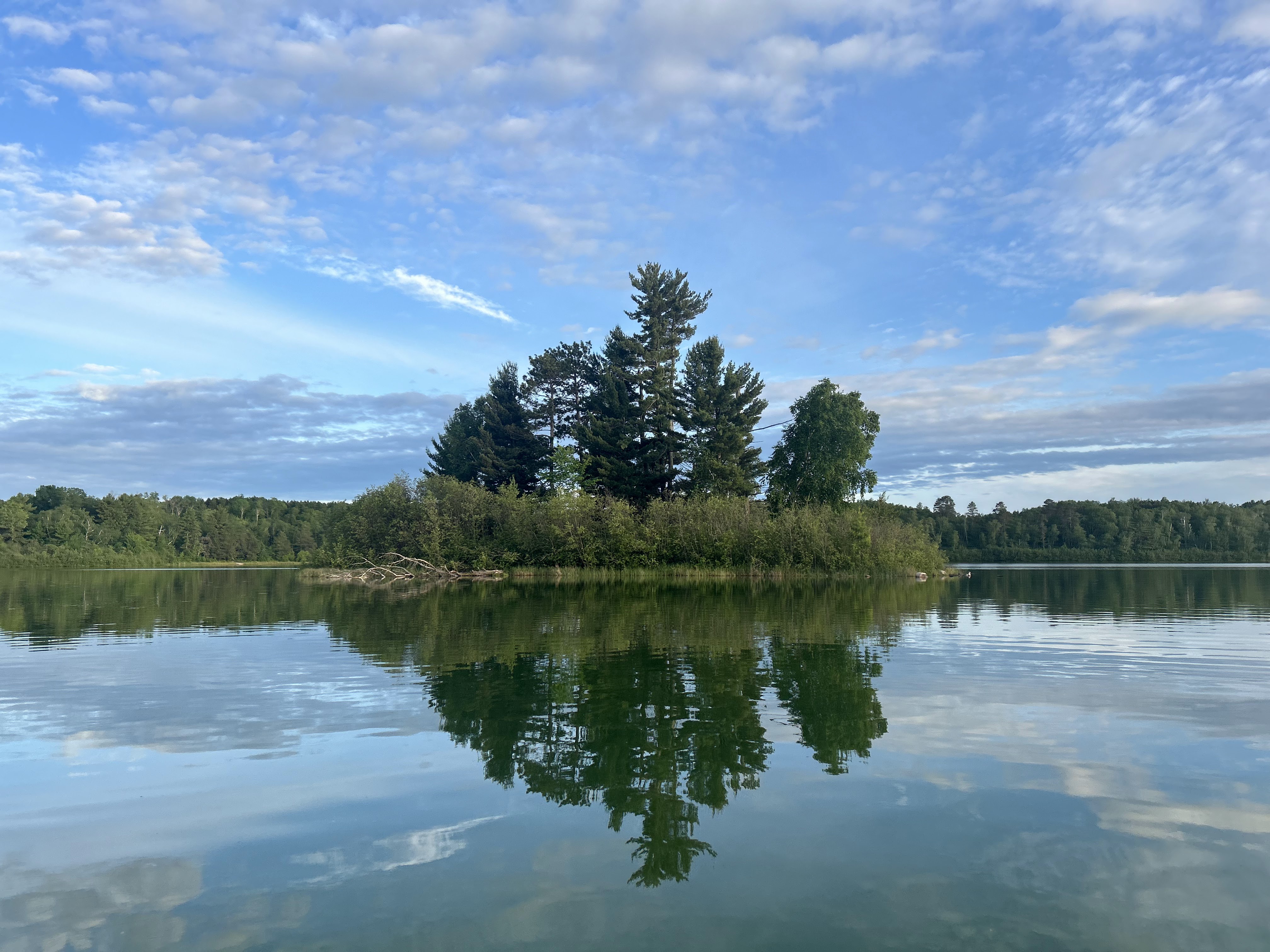
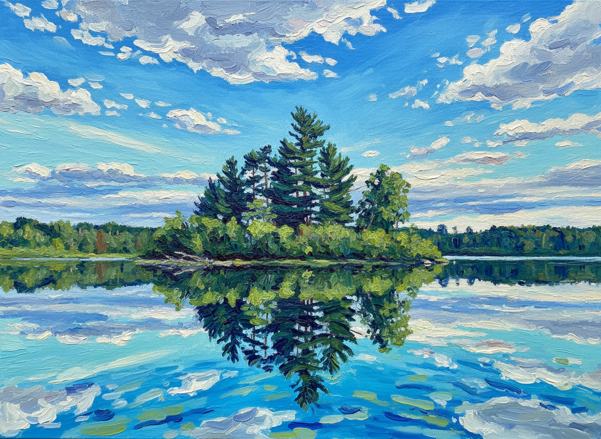
An island in a small Minnesota lake.
This unexceptional photo was Remixed into an image suitable for a Christmas card.
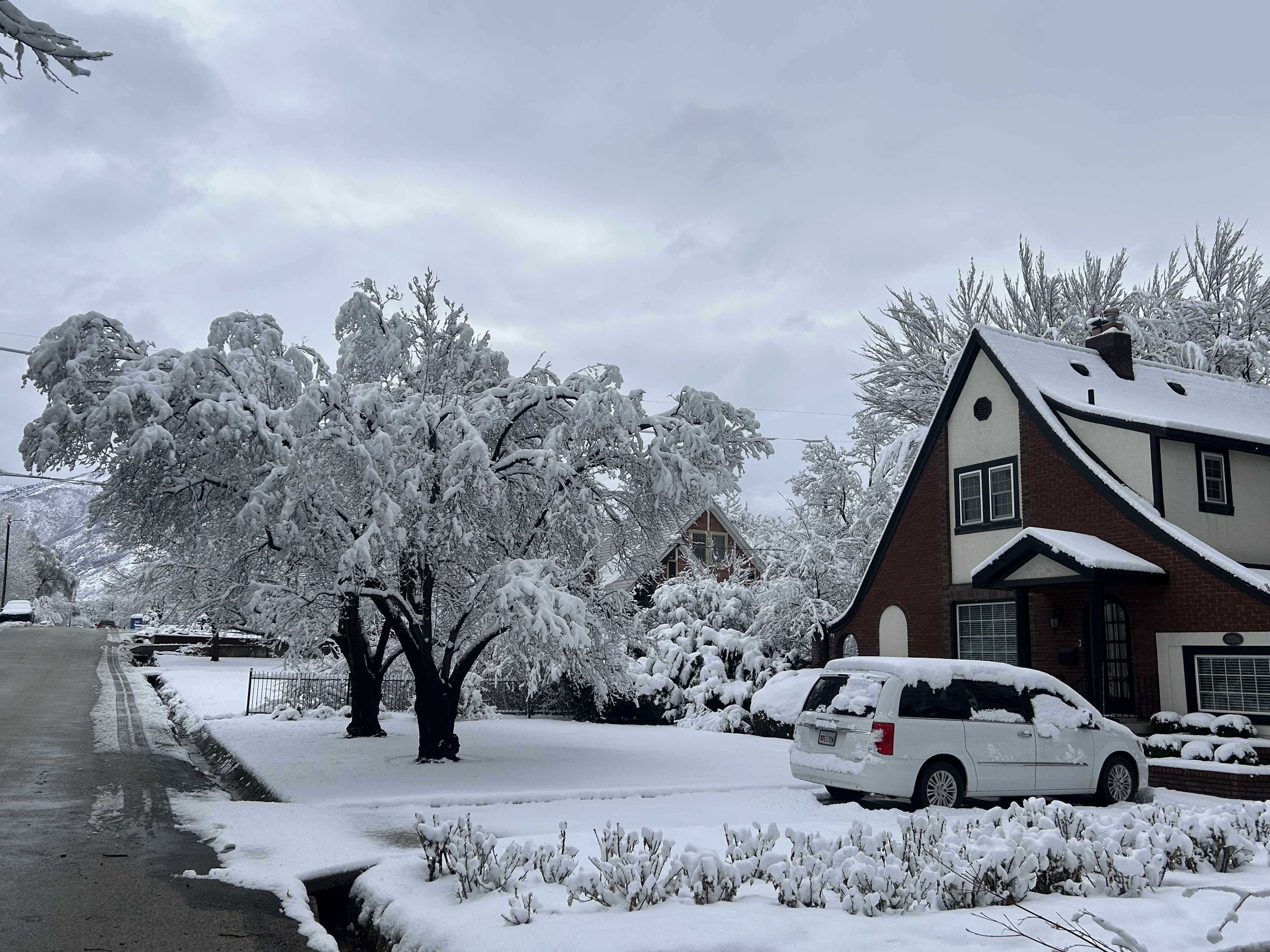
The beginning of the 2025-2026 winter in northern Utah has been unusually warm and snow-free. The snowpack is well below historical averages. The forecast offers hope, with snow predicted during the first week of 2026.
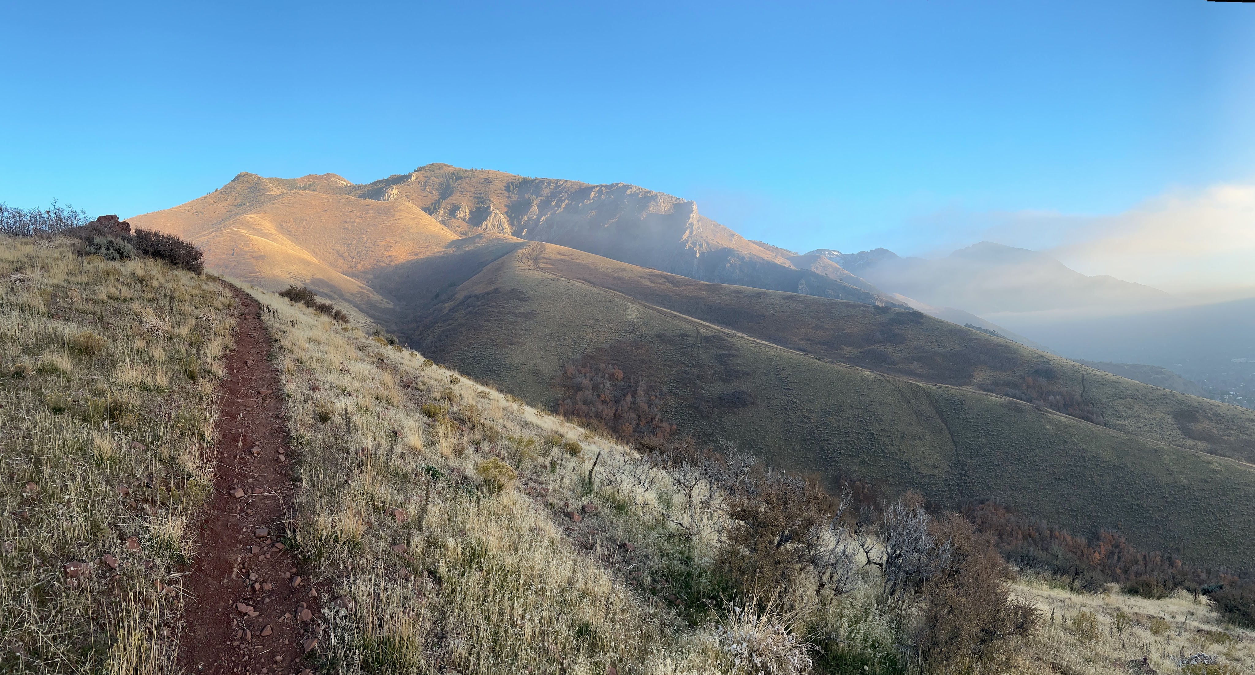
Hiking in the Wasatch just East of Salt Lake City, November 23
No snow in sight
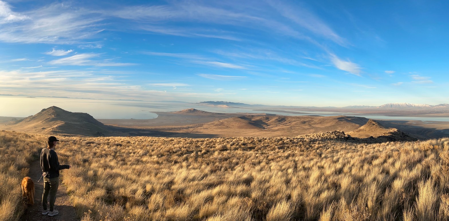
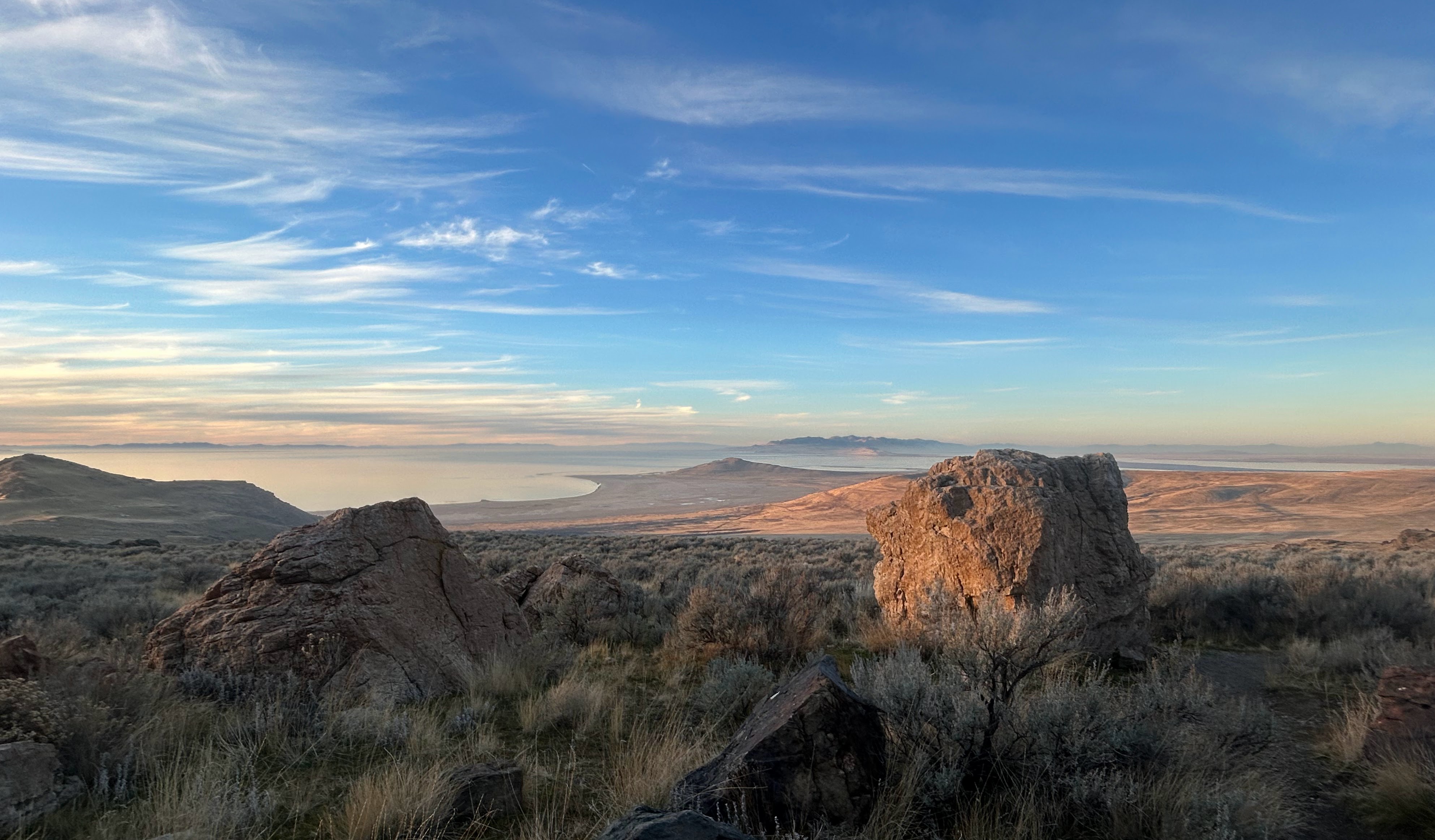
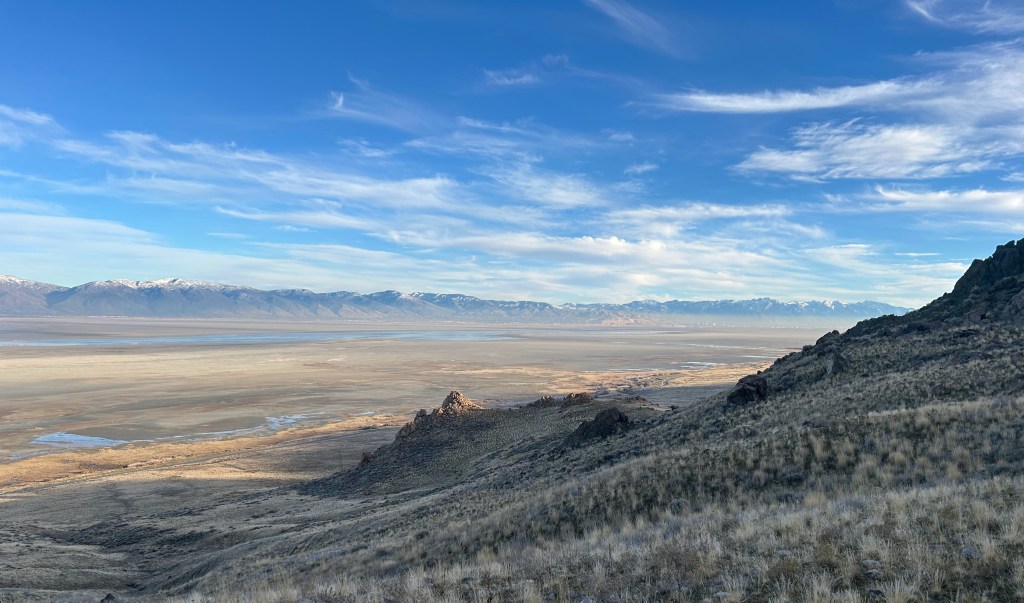
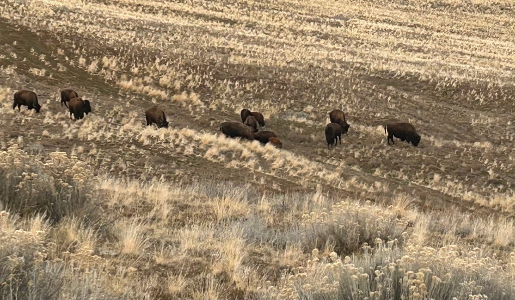
Visit to Antelope Island State Park, December 13
No snow in the park
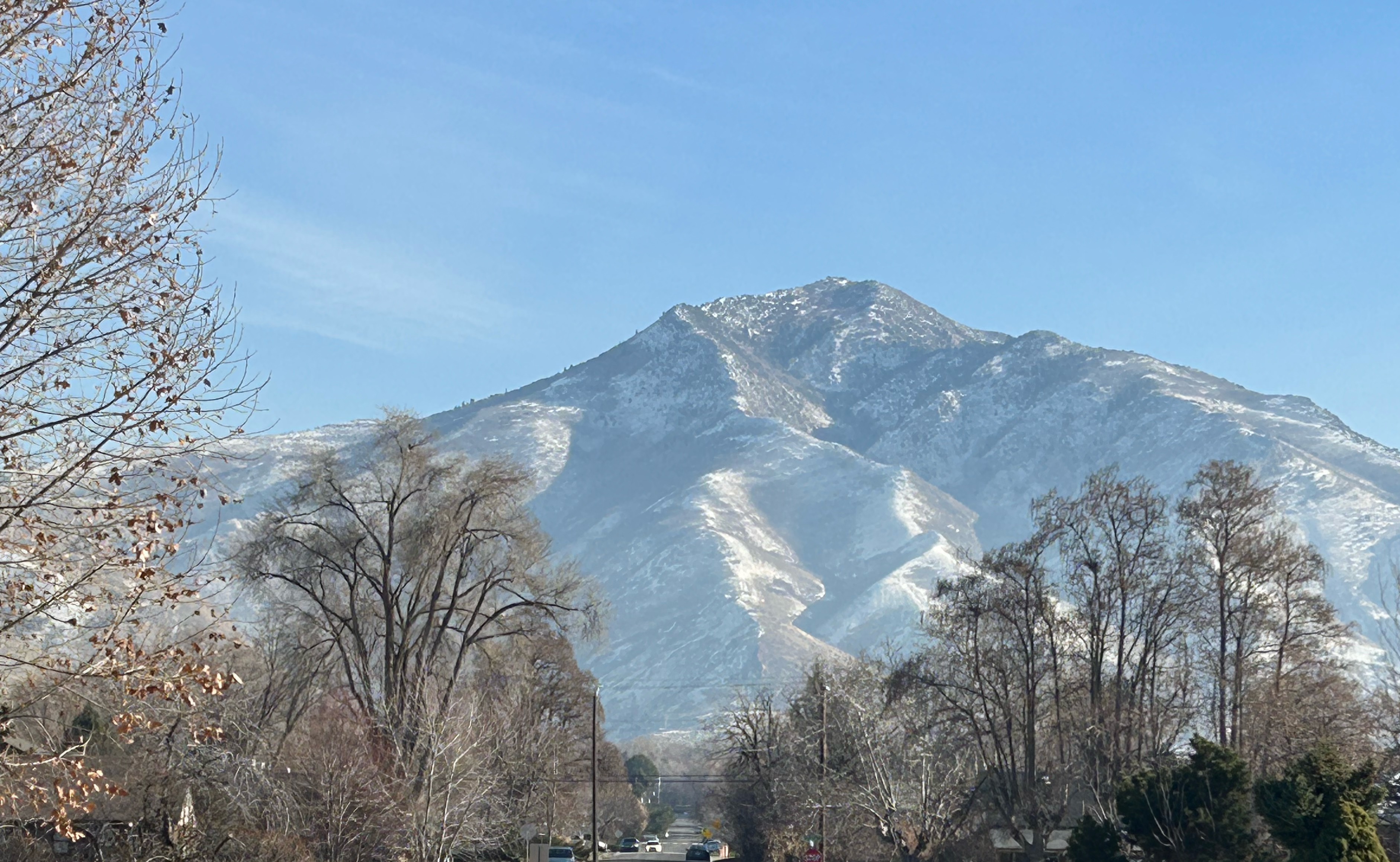
Snow can be seen at the top of the distant Wasatch Front
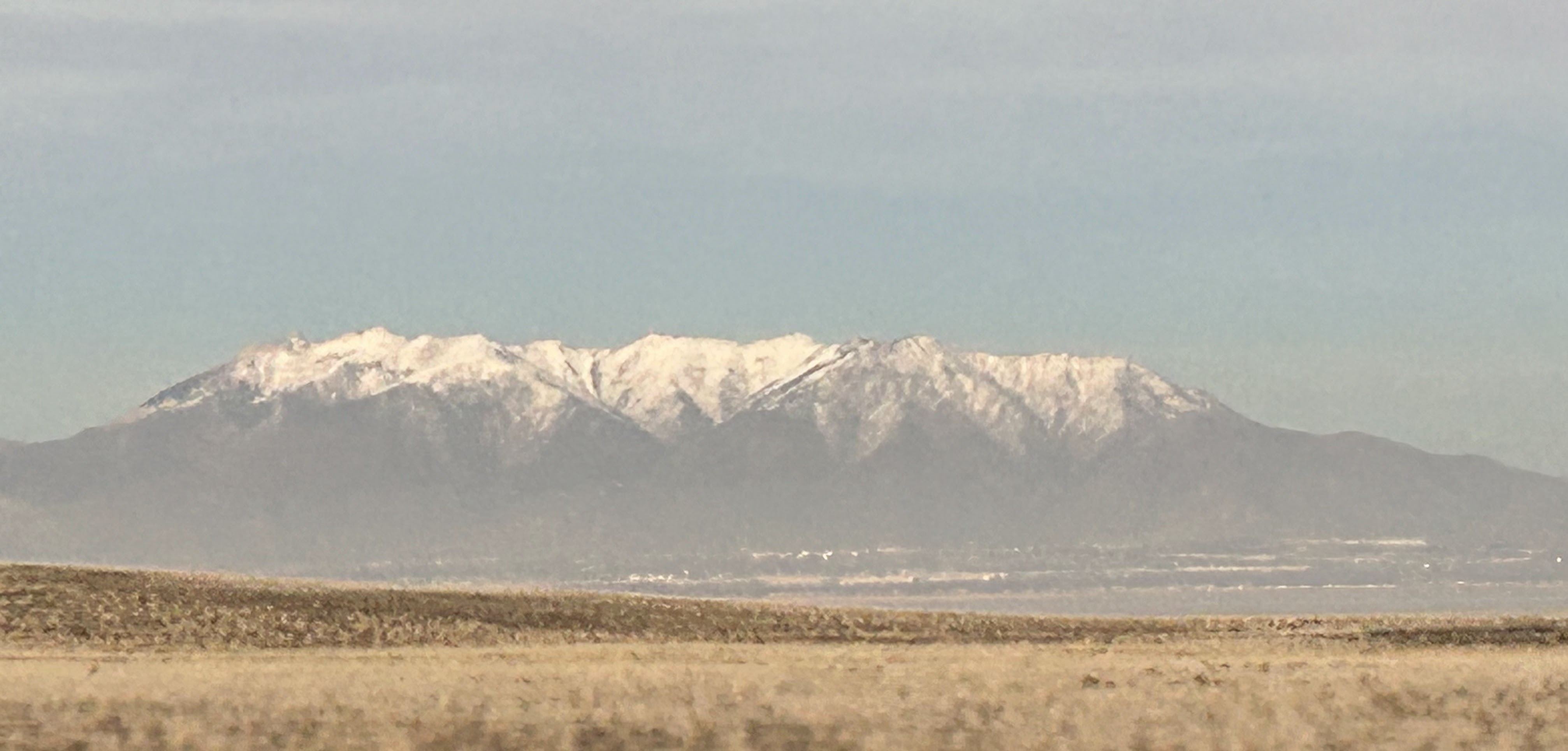
A view of Grandeur Peak from Salt Lake City, December 31
We have been finding many distinctive mushrooms lately when we walk the dogs through nearby woods in Northern Minnesota. Scroll down for images and descriptions of some of the more interesting mushrooms. I am not an expert, so identifications of these mushrooms are best guesses with help from online resources like iNaturalist.
Deer Mushroom
(Pluteus cervinus)
Deer mushrooms are common in Minnesota, usually found growing on stumps or wood chips. I thought it was unusual to find this one growing right out of a downed fir tree. Deer mushrooms are edible, but not particularly tasty. Reportedly they taste somewhat like radish.
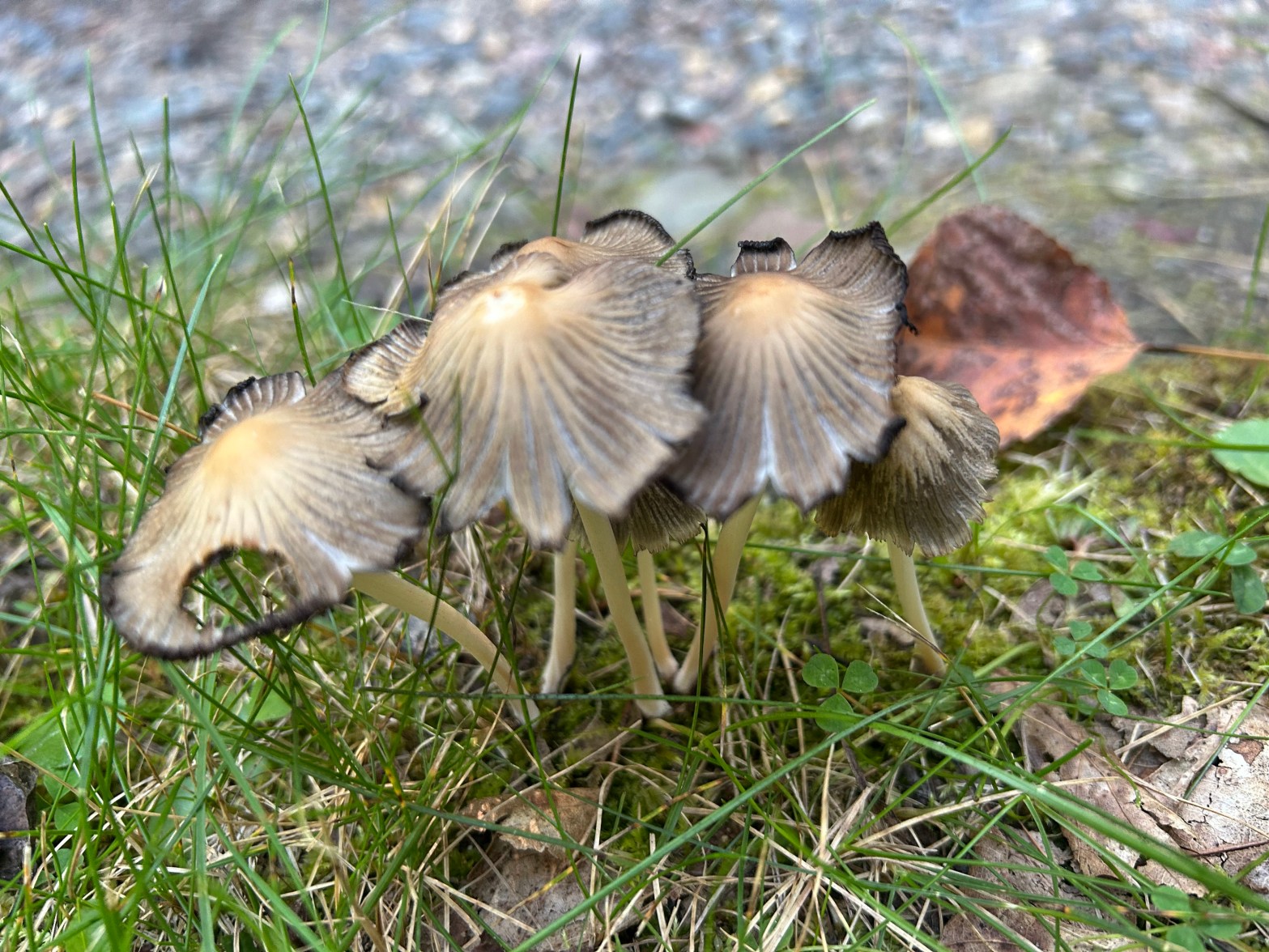
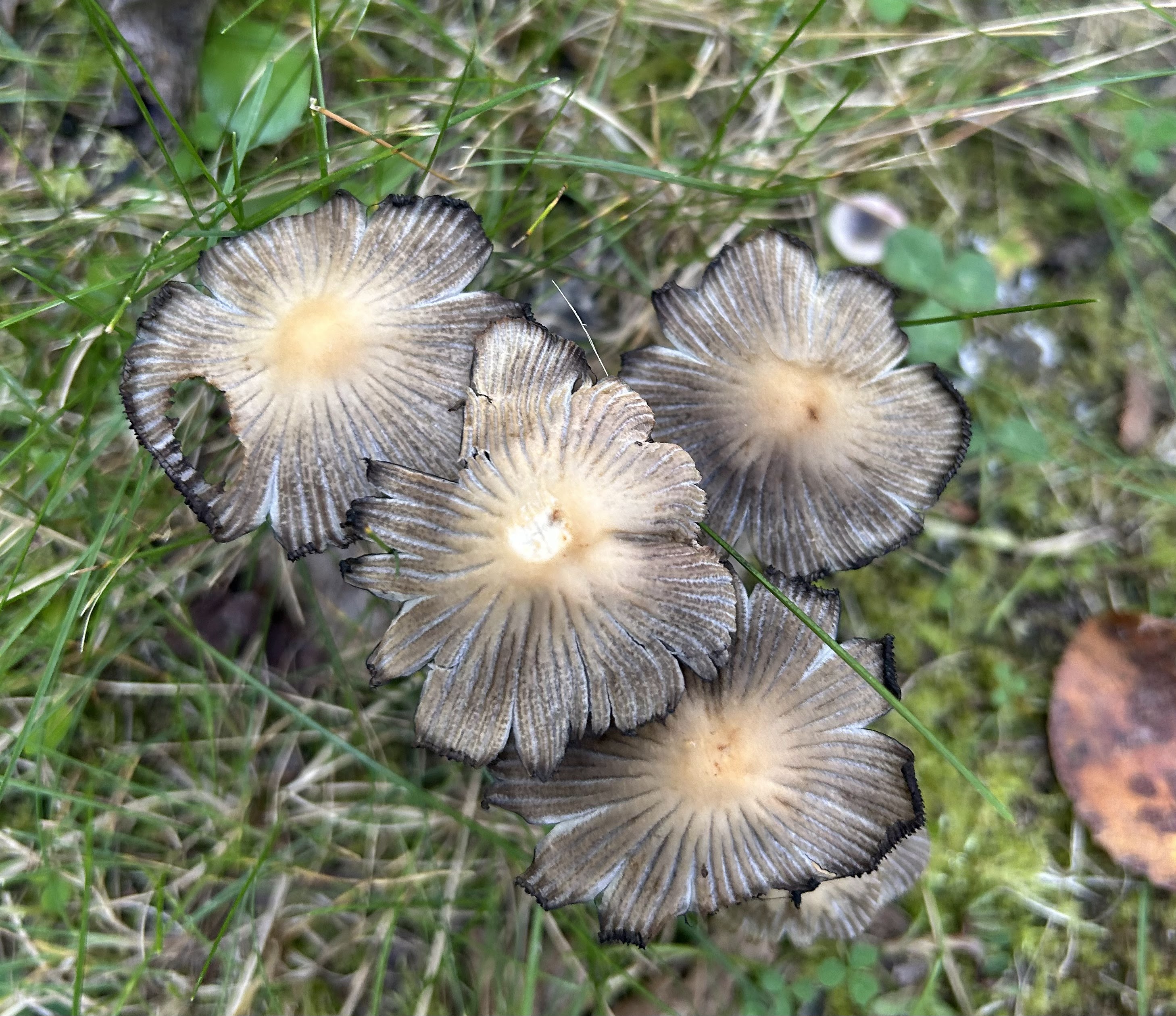
Inky Caps
(Coprinopsis atramentaria)
Inky caps are known for deliquescence, which is a process of self-digestion that turns them into black inky goo as they age. They are edible, but not desirable. Eating them while drinking alcohol is a bad idea. This results in particularly bad hangovers.
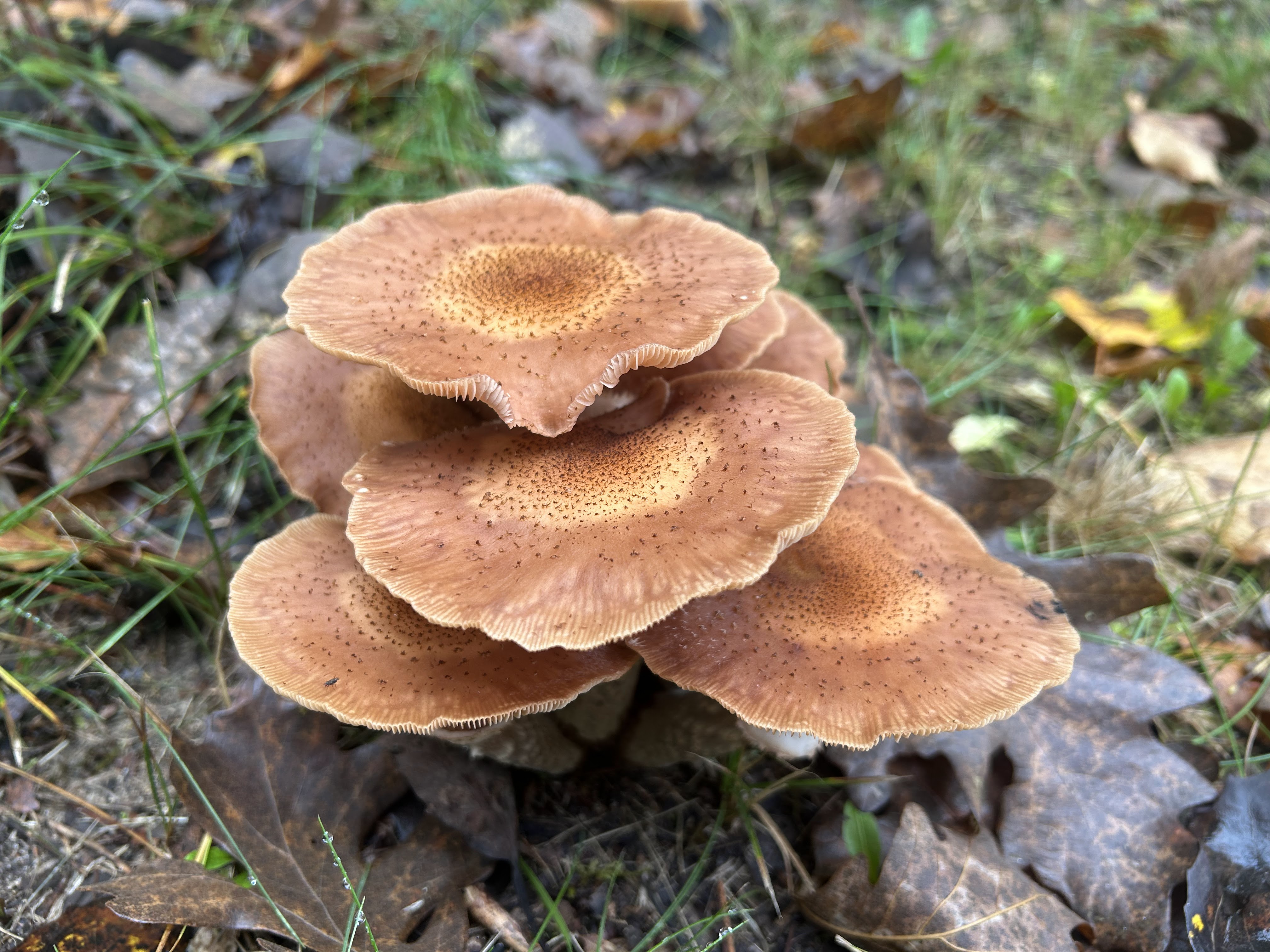
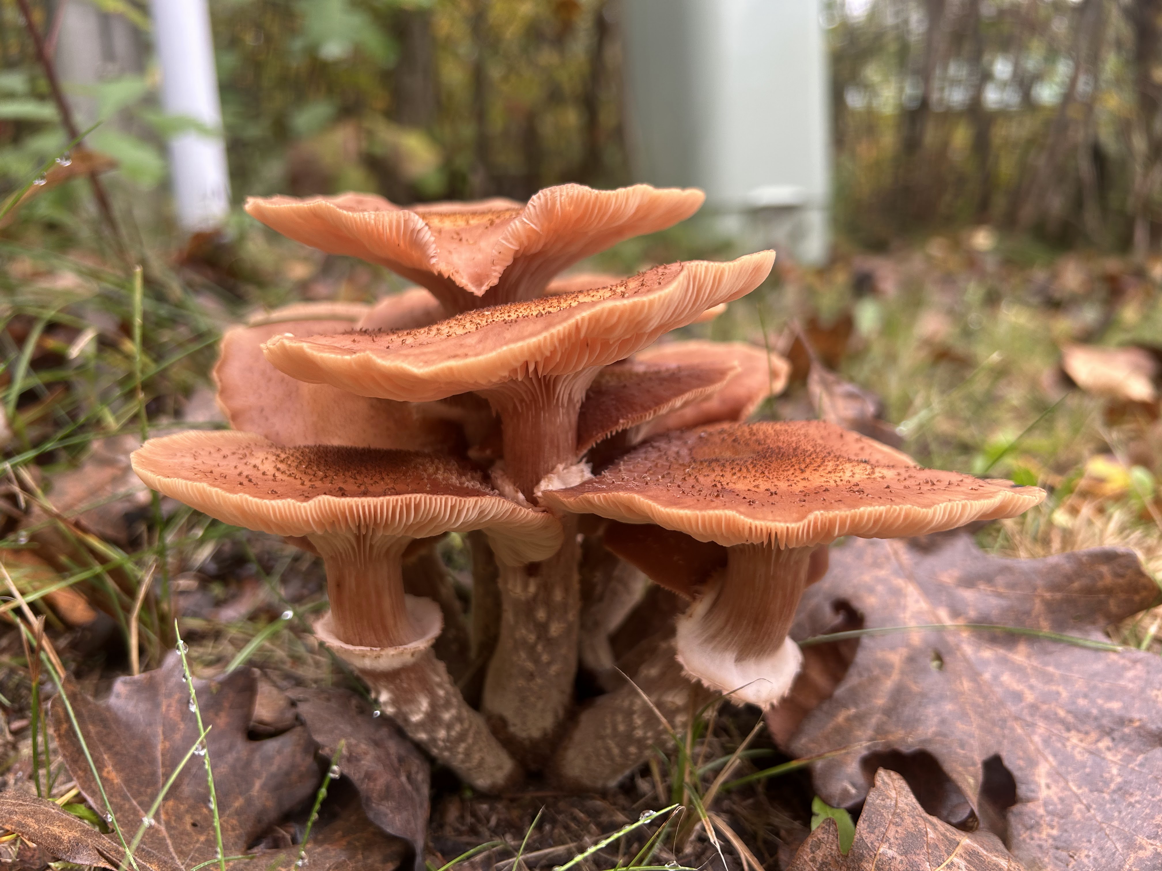
Honey Mushroom
(Armillaria mellea)
Honey mushrooms are bad news for trees. They are a plant pathogen that causes root rot that can kill trees. Some types of young honey mushrooms are edible if cooked thoroughly, but others are considered poisonous.
Brittlestems
(Candolleomyces candolleanus)
Brittlestems are small mushrooms typically found in lawns near trees. Again, these mushrooms are edible — but not desirable. They are too small and there are similar-looking poisonous species.
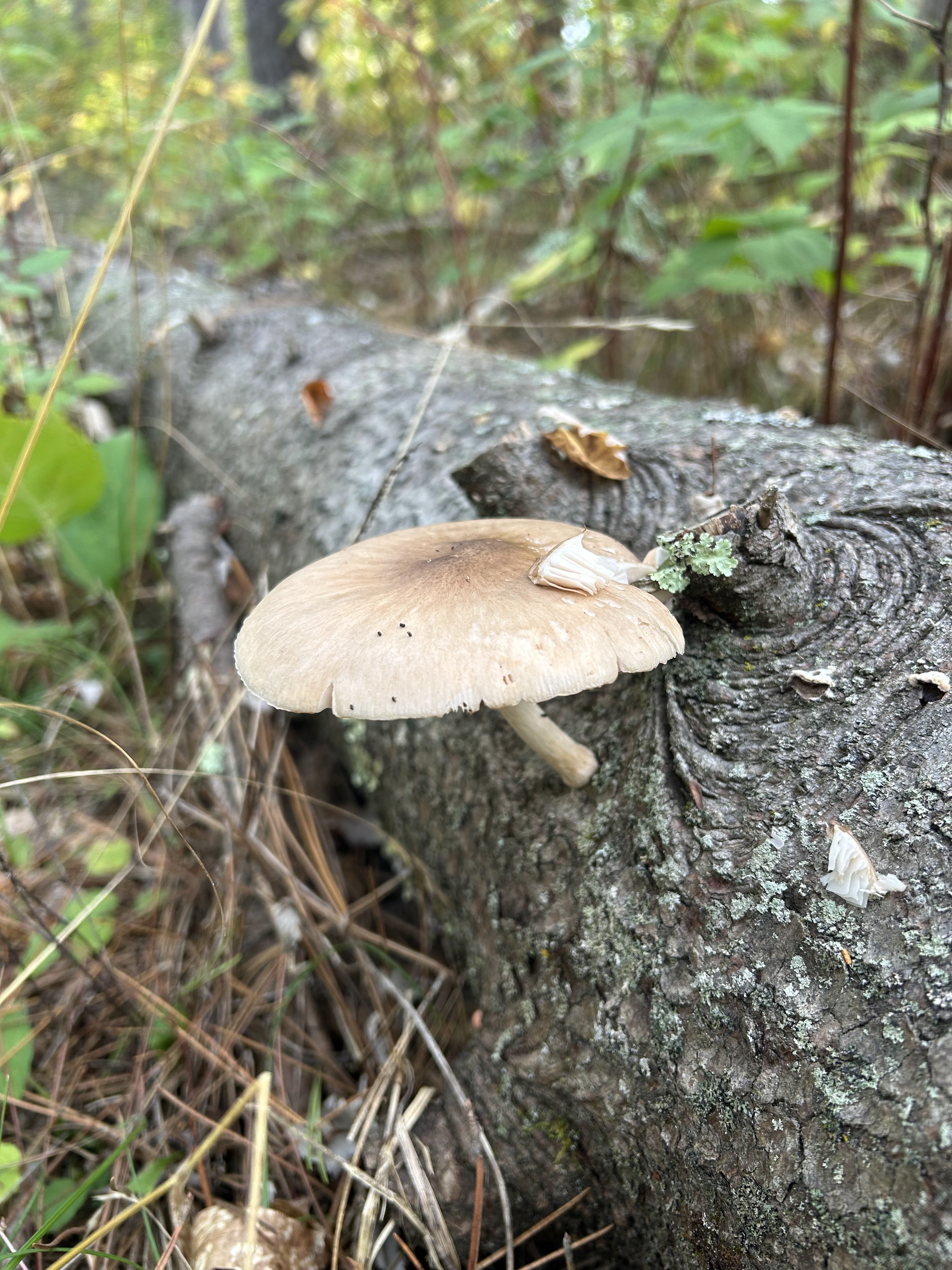
Scaly Caps
(Pholiota squarrosa)
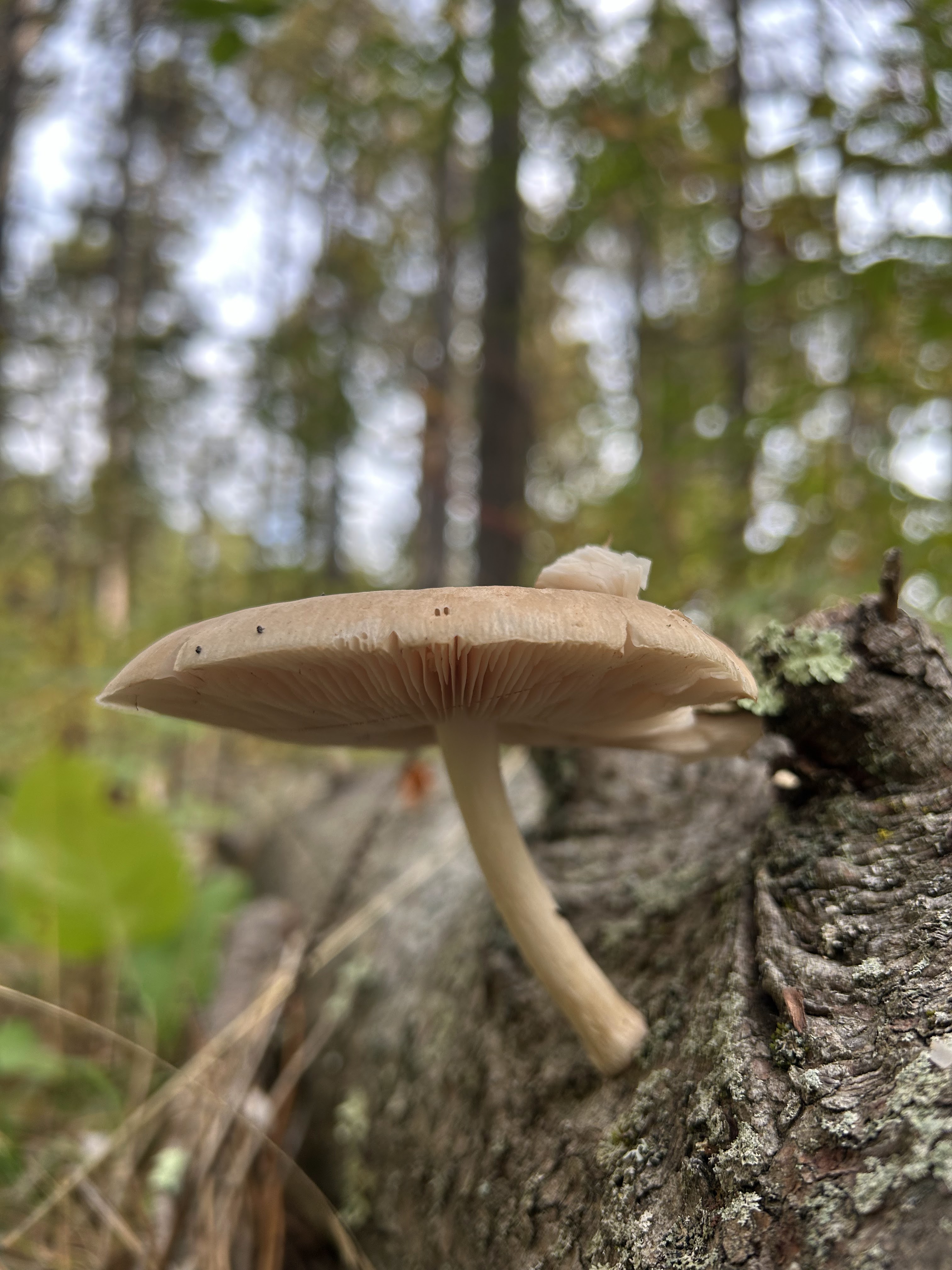
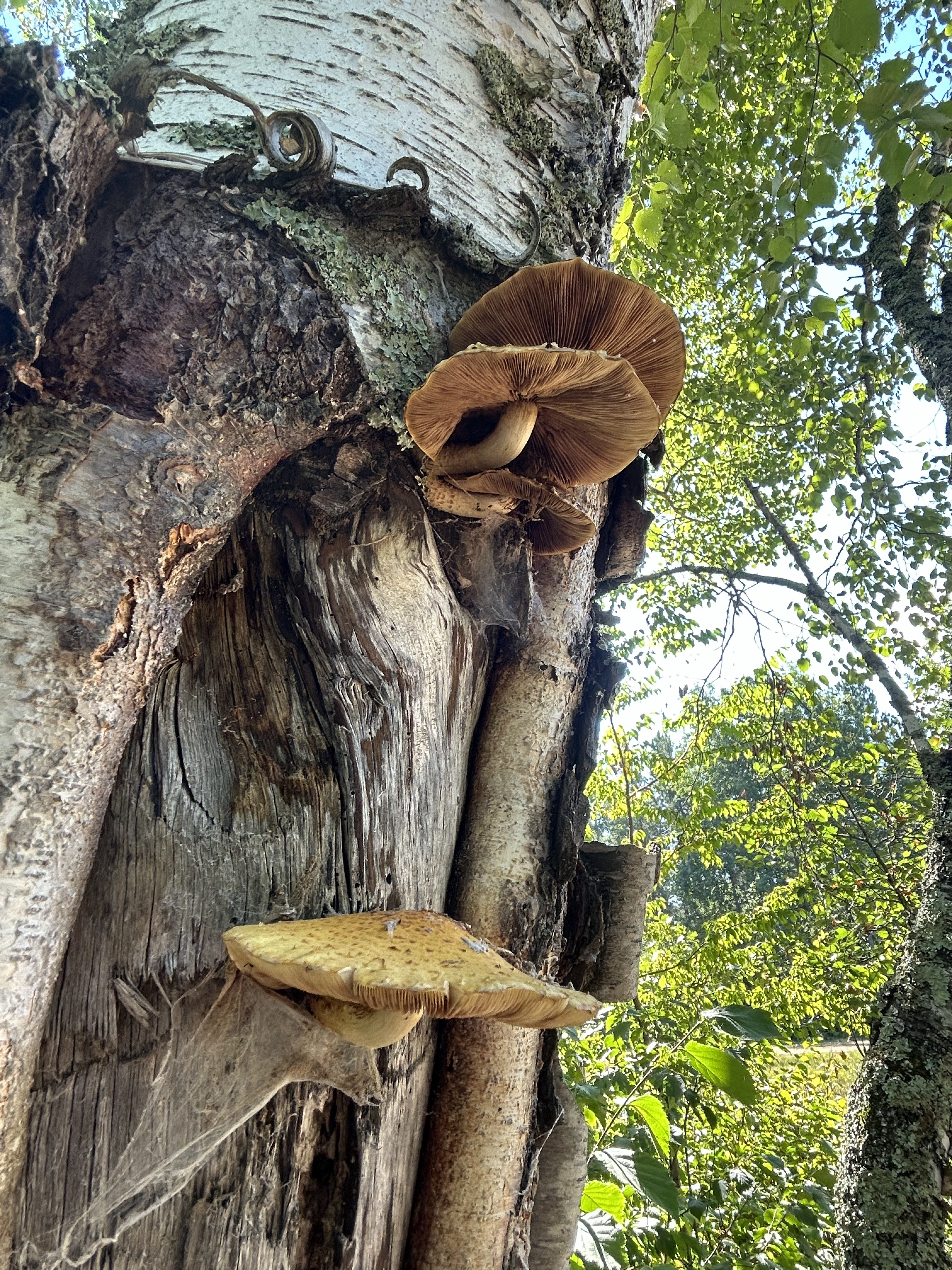
These scaly cap mushrooms were growing out of a scarred area of a birch tree. This is another mushroom that a few people can tolerate eating but more commonly causes severe digestive upset. Like the inky caps, consuming these with alcohol is trouble. They are a favorite food of red squirrels though.
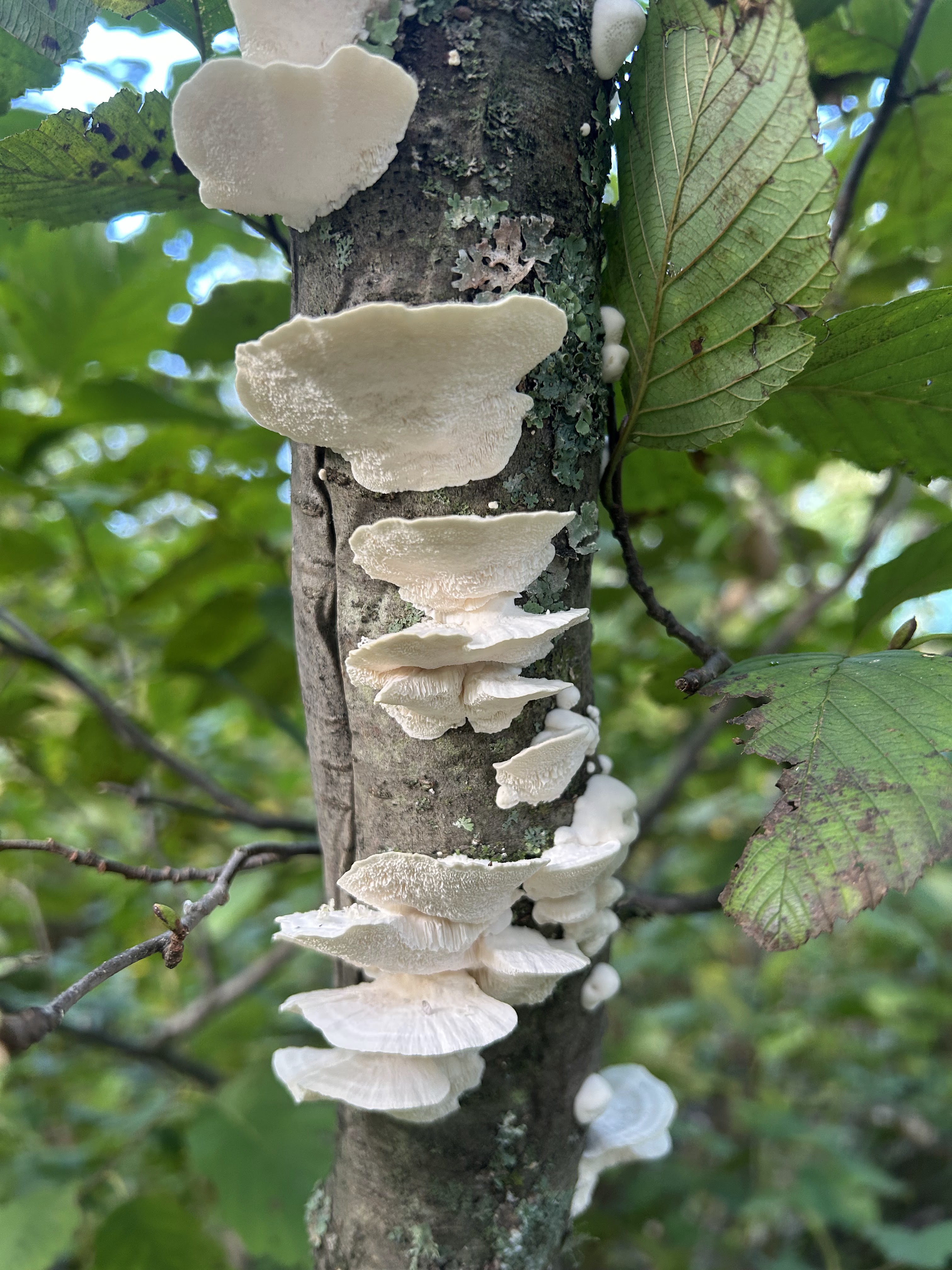
Tinder Polypore
(Fomes fomentarius)
This tinder polyphore fungus was found on a dead aspen tree. Seeing this growing on a living aspen is a sign the tree is in serious decline. As suggested by its name, this fungus has been used for many years as tinder for building fires. It was found with Otzi the 5000-year-old iceman, presumably to be used as tinder.
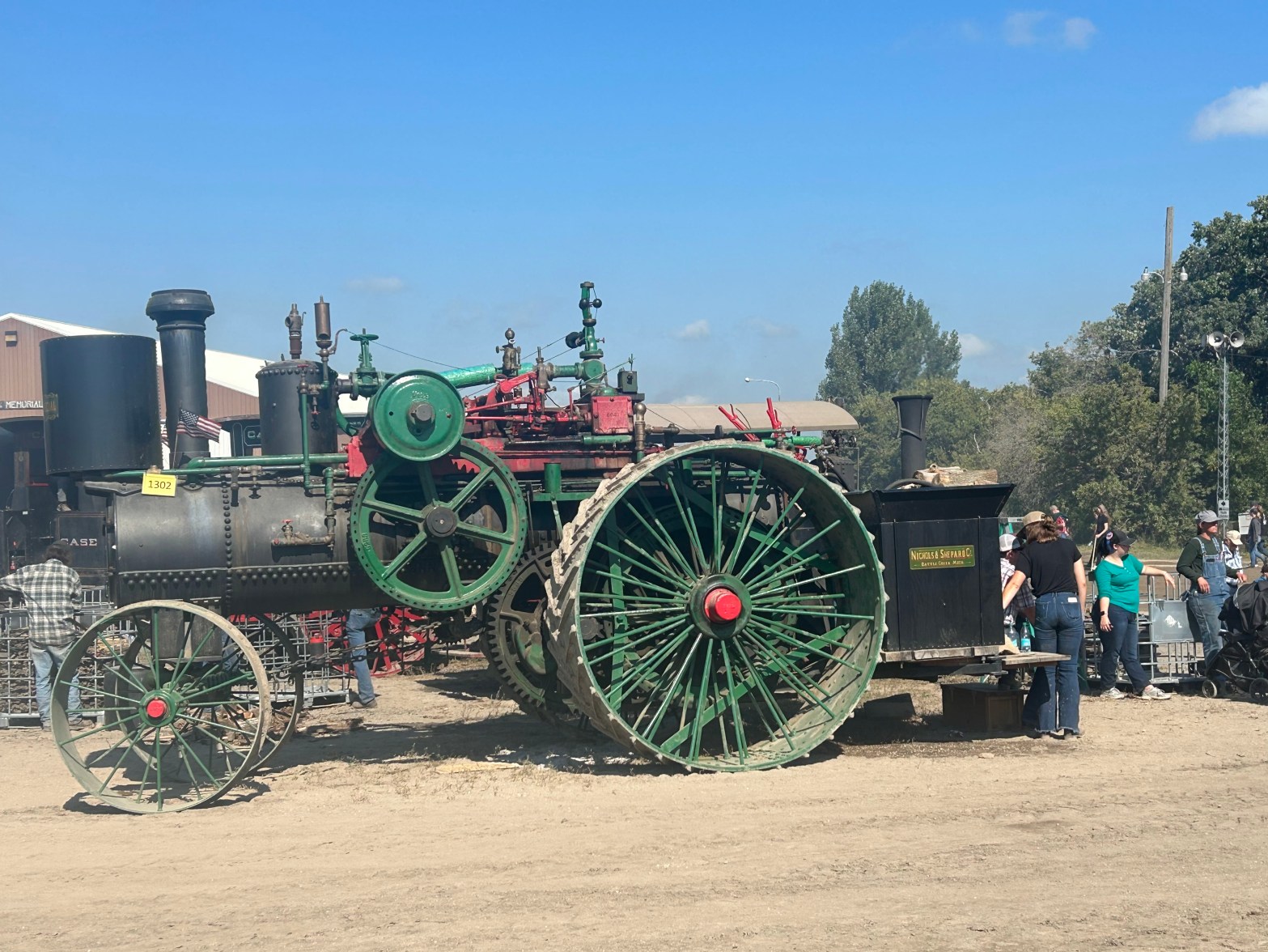
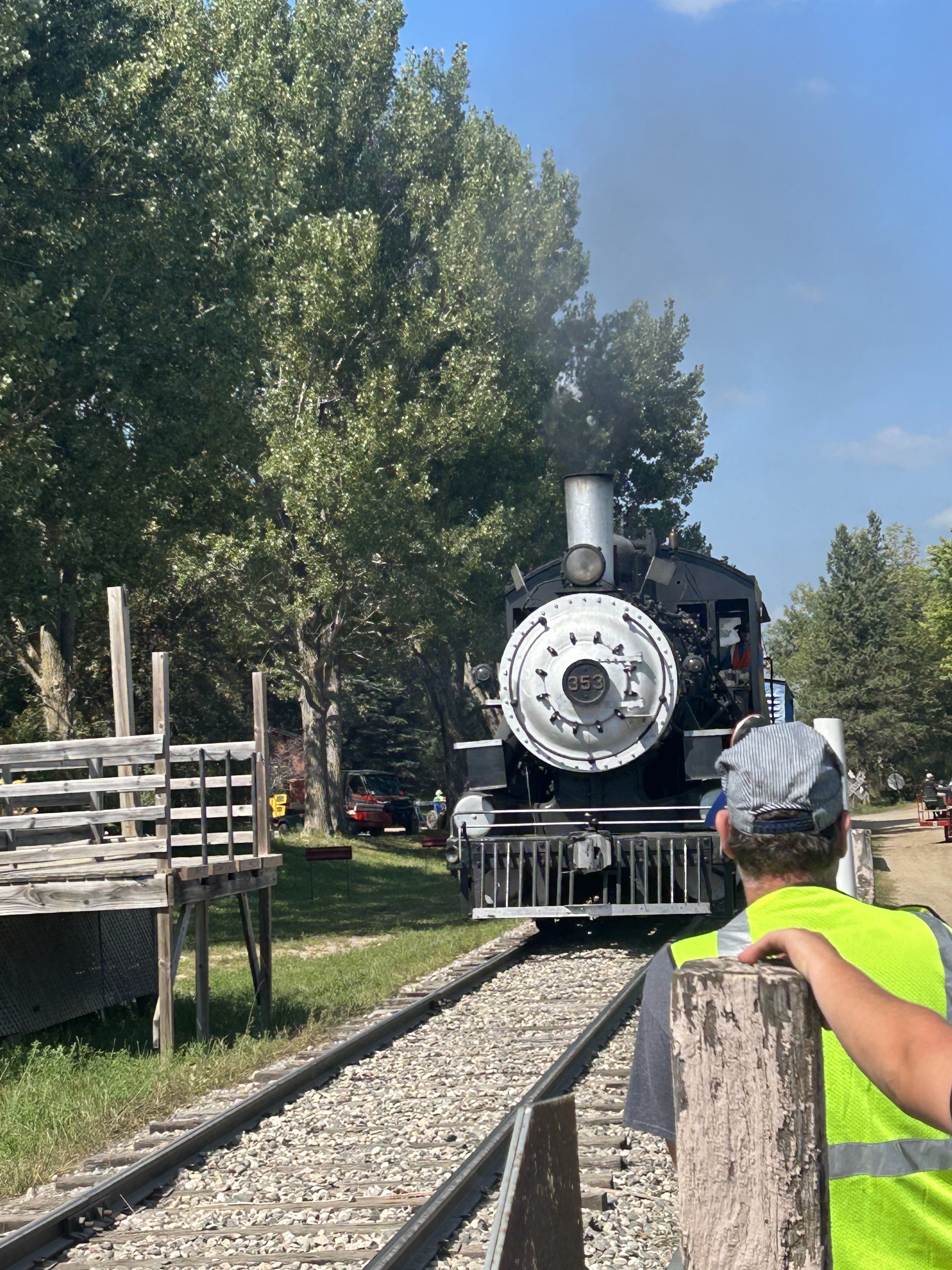
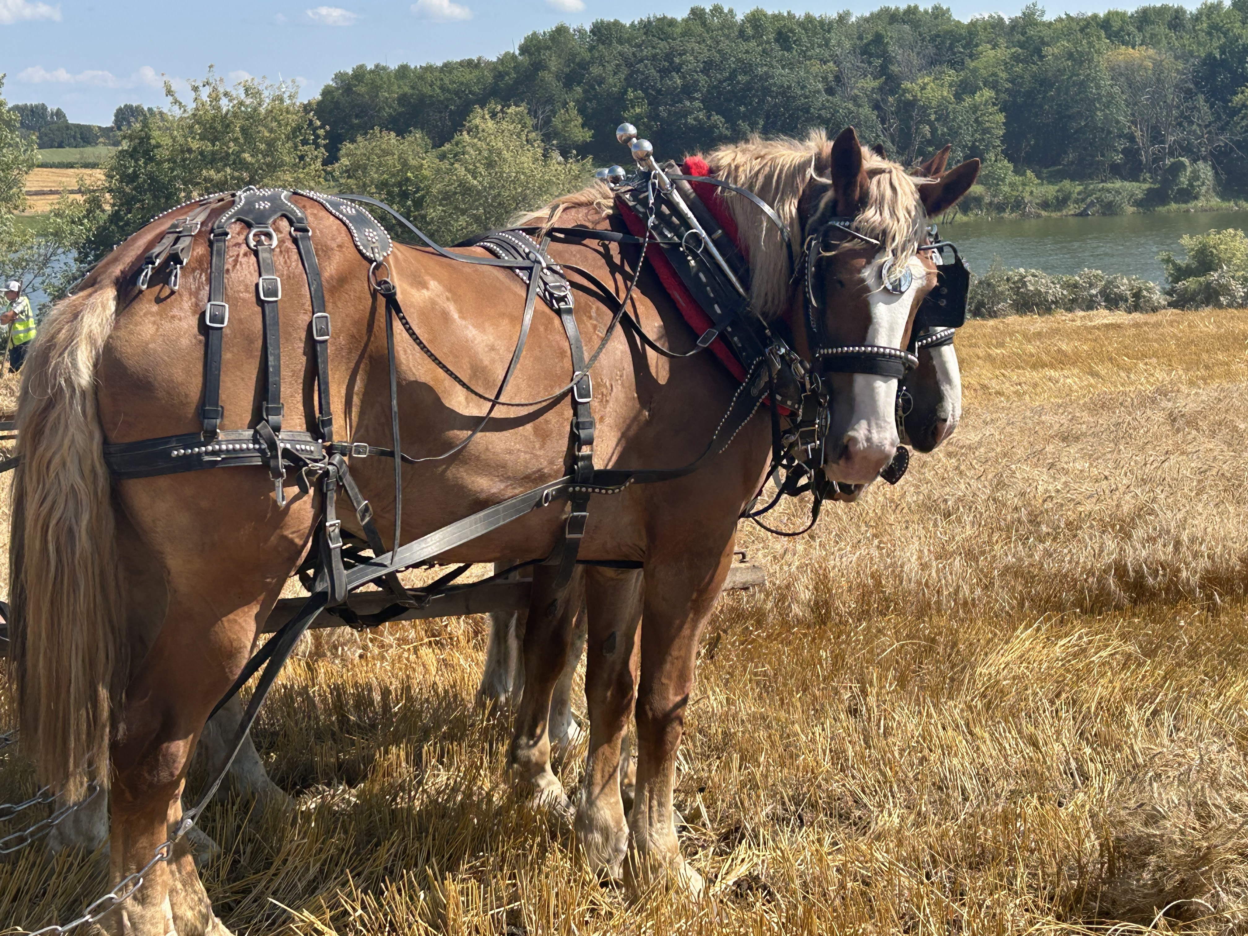
In Rollag Minnesota over the Labor Day weekend old farming methods are recreated at an event called the Western Minnesota Steam Threshers Reunion (WMSTR). This idea dates from 1940 when a group of farmers fired up an old steam thresher to harvest grain the old way. In 1954 the WMSTR group invited the public to this exhibition, and it has grown to an event that attracts up to 80,000 people.
The event is staffed by volunteers and has no commercial vendors. Church groups are on site selling hamburgers, cinnamon rolls and lemonade at very reasonable prices. The entry fee for adults is $15; kids get in free.
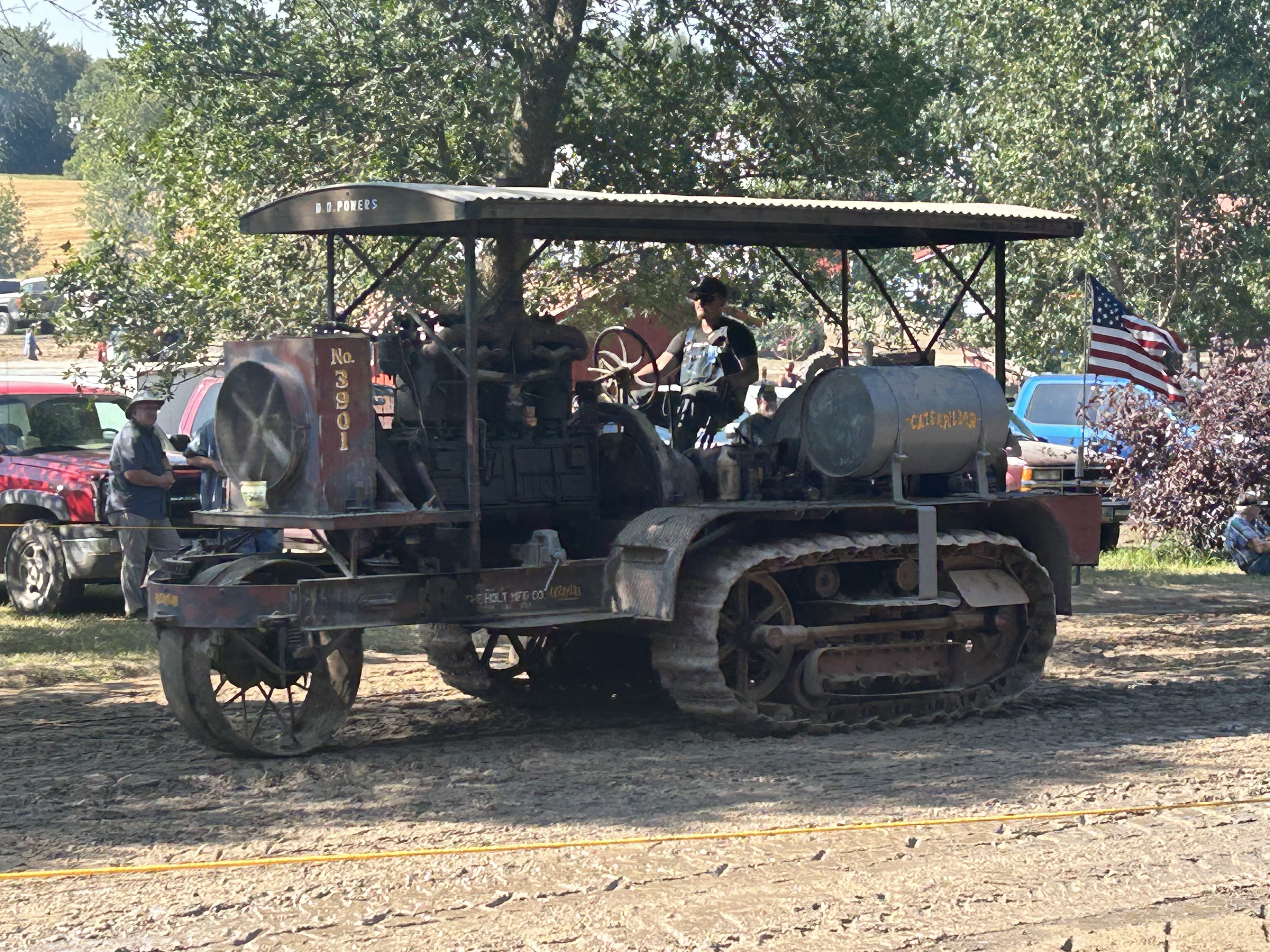
Functioning steam engines, tractors, and farm implements from over the past ~150 years are featured.
Steam engine on parade
A building full of old engines
Animal-powered farm implements were featured this year, and these demonstrations were my favorite.
On June 9th this year we noticed a snapping turtle in our lake-front yard. There are two species of snapping turtle native to North America. The bigger alligator snapping turtle is typically found in the Southeastern United States. Our Minnesotan turtle is a common snapping turtle (Chelydra serpentina), which has a wider range across the eastern US and Canada.
Snapping turtles mainly live in water, but females venture on land in late spring to lay their eggs. If cornered on land snapping turtles will be aggressive, and they can deliver painful bites. In water they generally avoid contact with people.
It is advisable to leave these turtles alone if you see them on your property. We did that and within a couple hours it was gone, back to the lake.
June seems like the premiere month for wildflowers in our part of North-central Minnesota. This post shares photos of some of our local June wildflowers. They are arranged from those appearing early in the month to those that we see now at June’s end.
Early June
Hoary Puccoon
Lithospermum canescens
This is a favorite wildflower, prevalent along our gravel roads from late in May to Late June. The name “puccoon” comes from a Native American word referring to red dye that can be extracted from its roots. Attempts to propagate the Hoary Puccoon to the garden have mostly failed. An ecologist at the Chicago Botanical Garden published a blog post explaining why the Hoary Puccoon resists propagation.
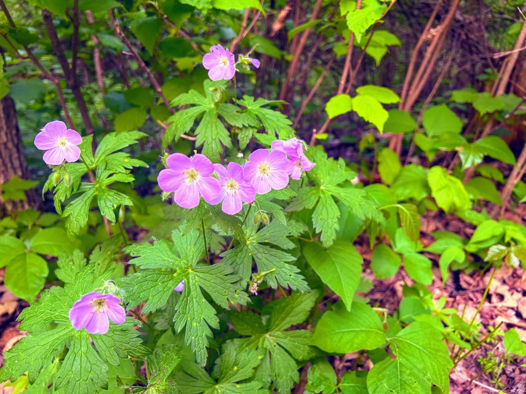
Wild Geranium
Geranium maculatum
Wild Geranium is a beautiful woodland plant that adapts well to shady spots in the garden. When its seeds are mature the plant spreads them in a catapult-like action. The seeds are structured so that changes in humidity cause the seed to drive into the soil. So, it basically plants itself.
Bunchberry Dogwood
Cornus canadensis
Bunchberry Dogwood is a low-growing plant often found as a ground cover in coniferous forests. It prefers moist and cool conditions. Its flowers can open incredibly fast; they have been timed opening in less than 0.4 microseconds. These rapid-opening flowers expel pollen at 24,000 m/sec (really fast).
Mid June
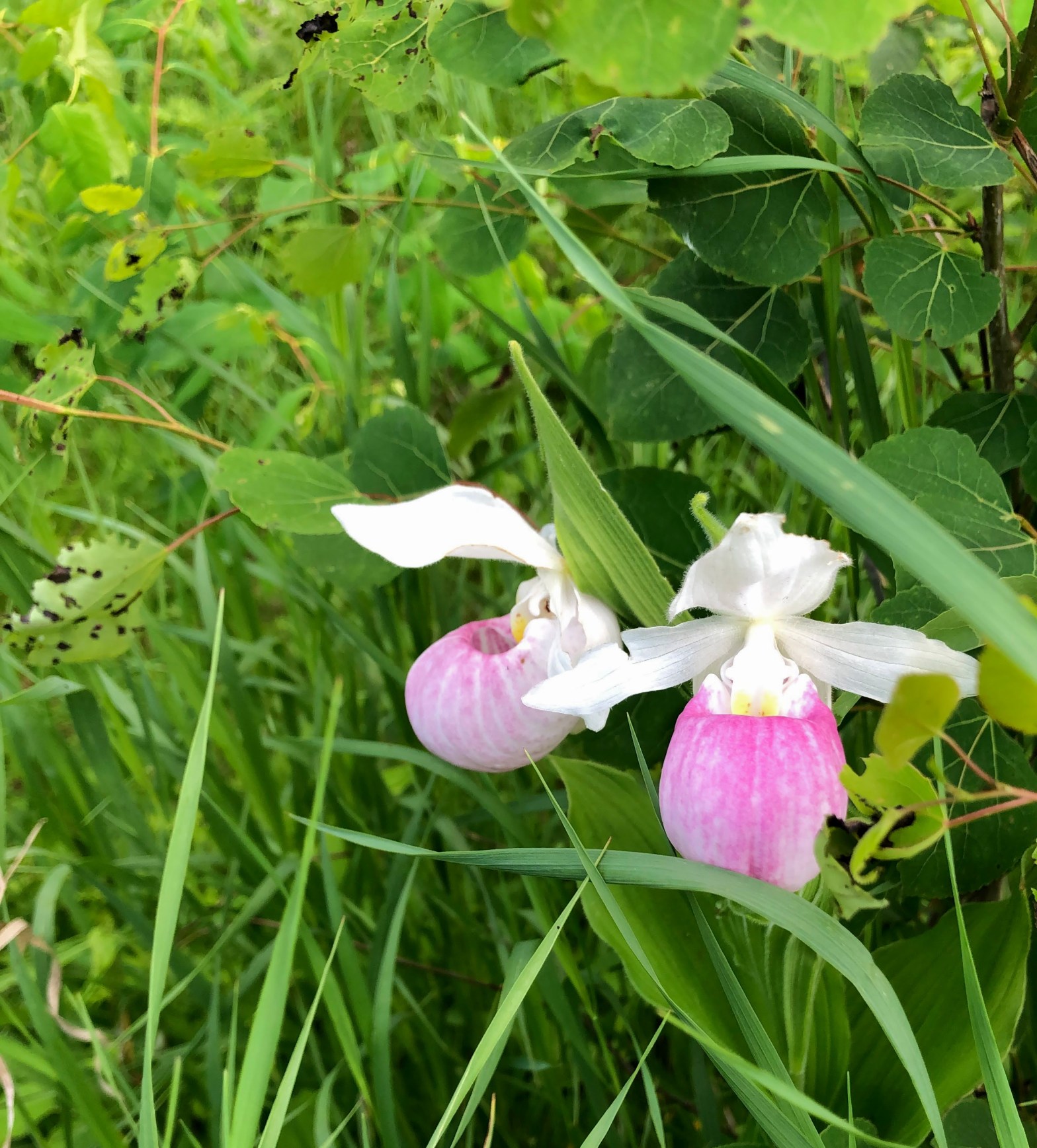
Showy Lady Slipper
Cypripedium reginae
Unfortunately, the Showy Lady Slipper is probably the rarest of the plants in this post. They grow in wet boggy areas and take many years before producing their first bloom. The Showy Lady Slipper is the state flower of Minnesota and is protected by state law.
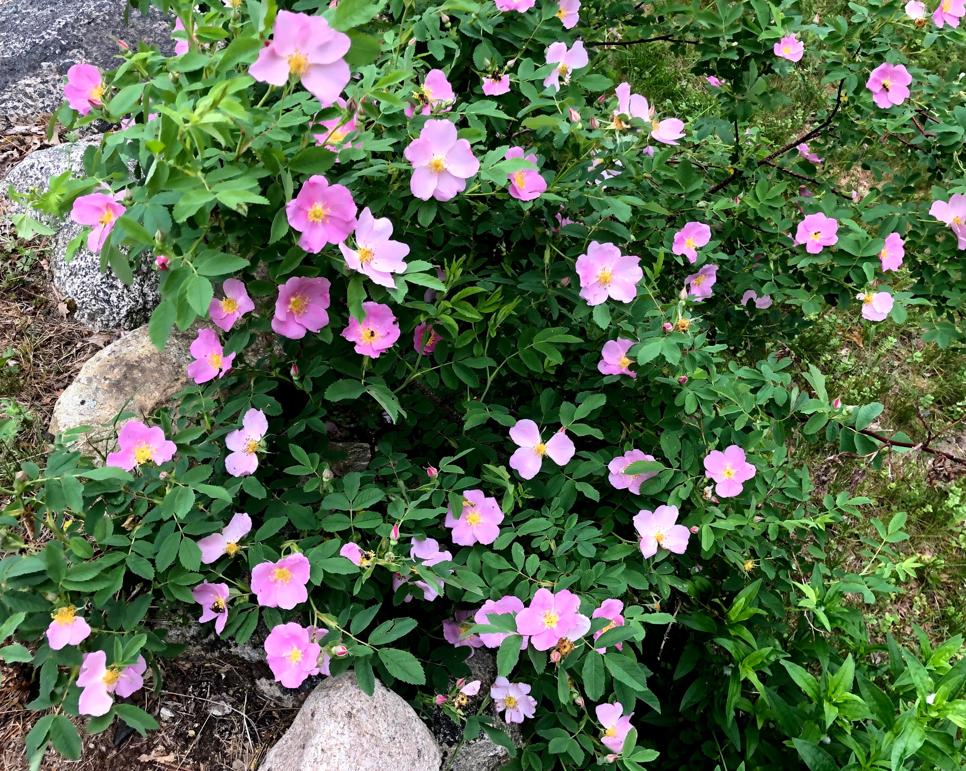
Smooth Wild Rose
Rosa blanda
Several species of wild roses are found in Minnesota. The Smooth Wild Rose is distinguished from others, like the Prairie Rose, by its smooth thorn-less stems.
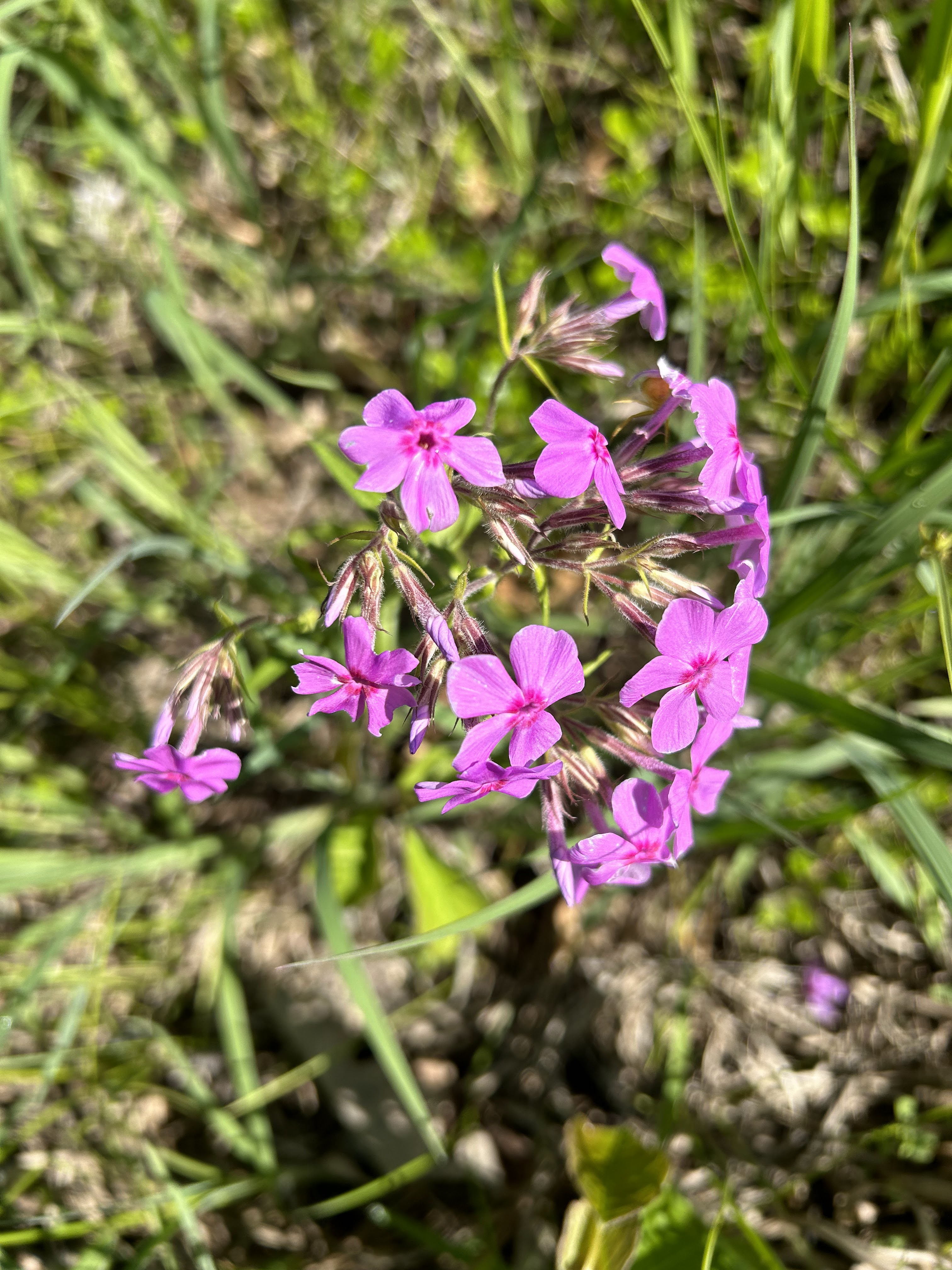
Downy Phlox
Phlox pilosa
Late June
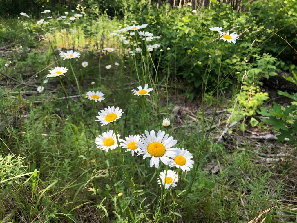
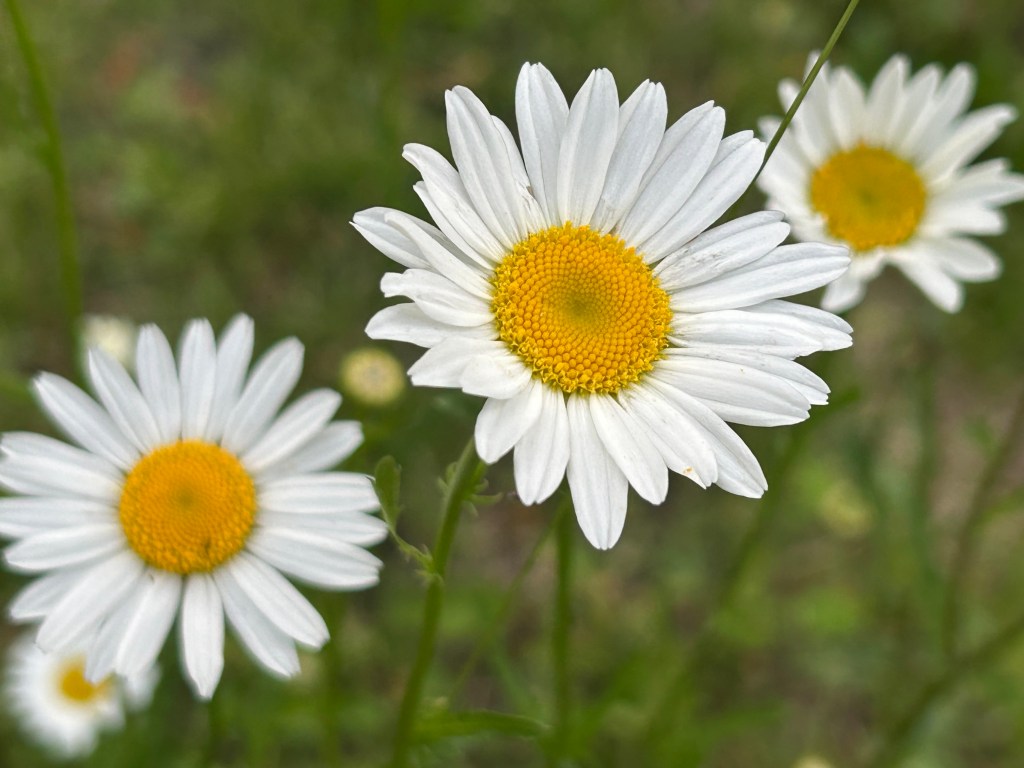
Oxeye Daisy
Leucanthemum vulgare
These daisies are very prevalent in our area; some pastures are taken over by them. Cows generally do not eat these daisies; if they do their milk has an unpleasant taste. While their flowers are attractive, ox-eye daisies are non-native and invasive.
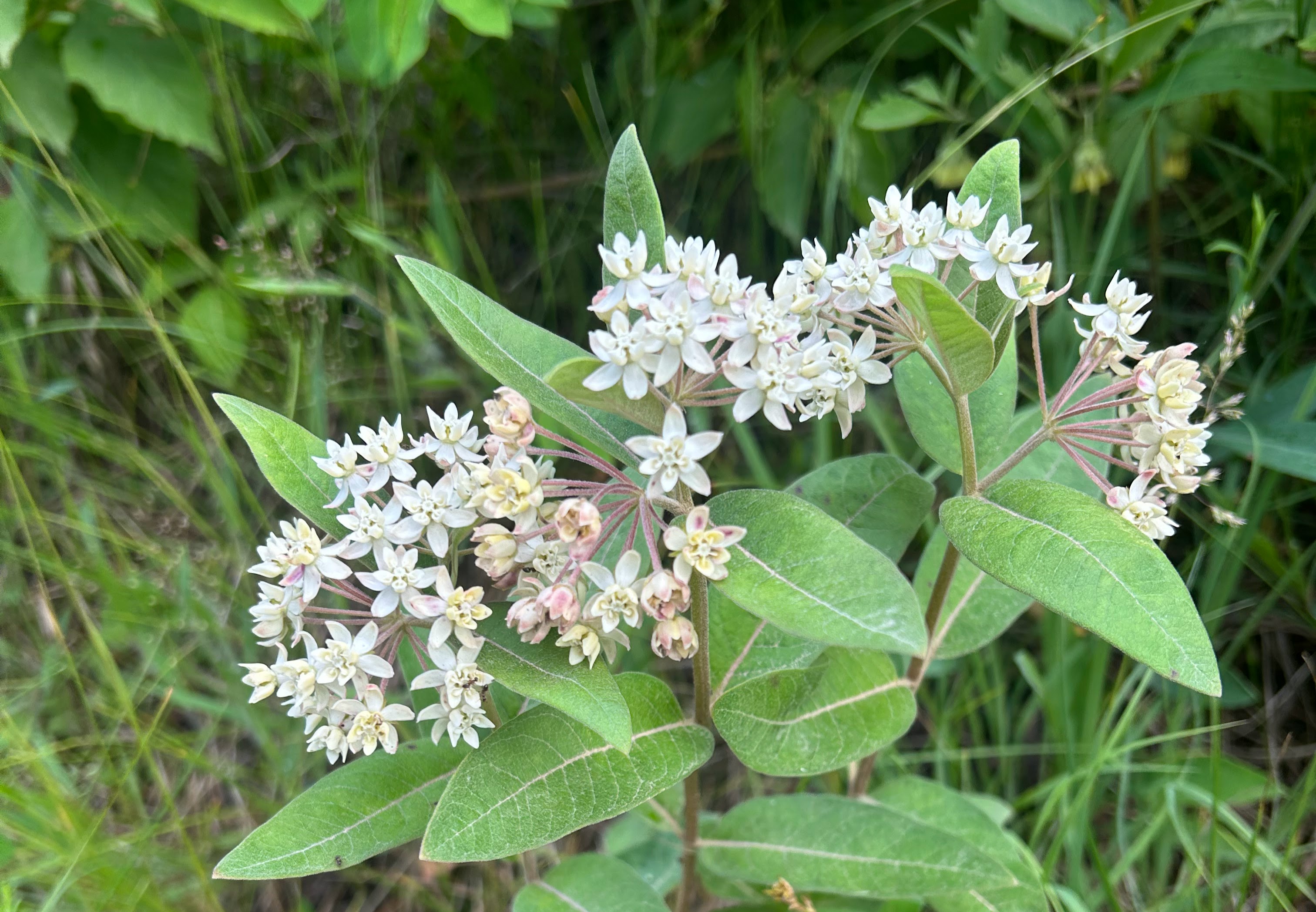
Oval-leaf Milkweed
Asclepias ovalifolia
I believe this plant is the Oval-Leaf variety of milkweed rather than the more prevalent Common Milkweed. The Oval-Leaf species is the northern-most milkweed and is relatively common in Minnesota.
Hoary Alyssum
Berteroa incana
Hoary alyssum flowers are arranged in clusters called raceme. While its raceme of white flowers is attractive up close, hoary alyssum is regarded as an invasive weed. One of its worst characteristics is that it is toxic to horses.
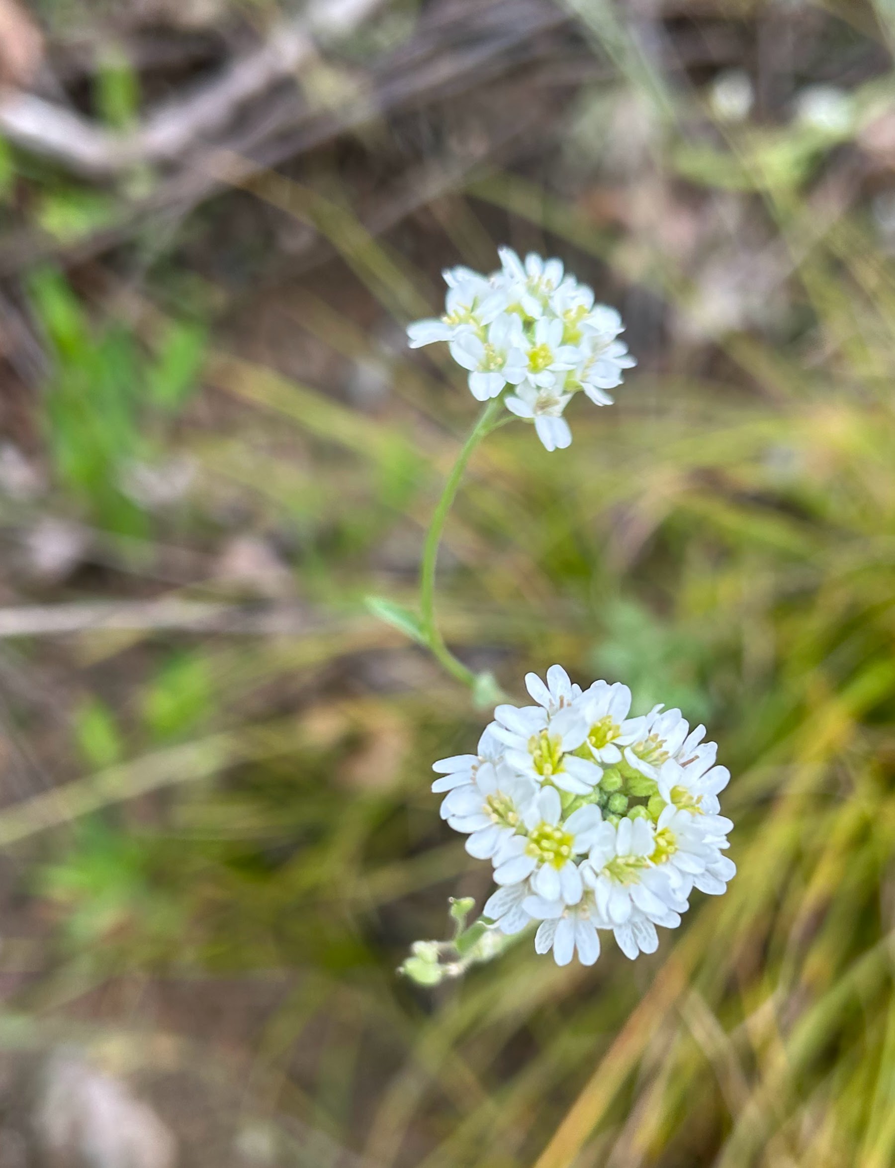
Northern Bedstraw
Galium boreale
The showy small white flowers of Northern Bedstraw bloom on panicles. Panicle is a botanical term for a structure with several branches each with one flower. This plant is edible as a wild salad green. Its most distinctive historic use has been as a stuffing for mattresses, which was desirable because of its delicate fragrance.
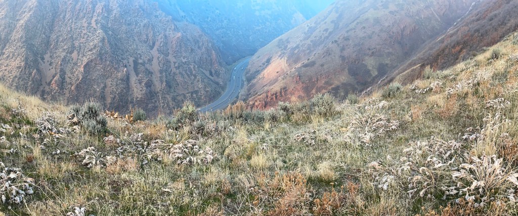
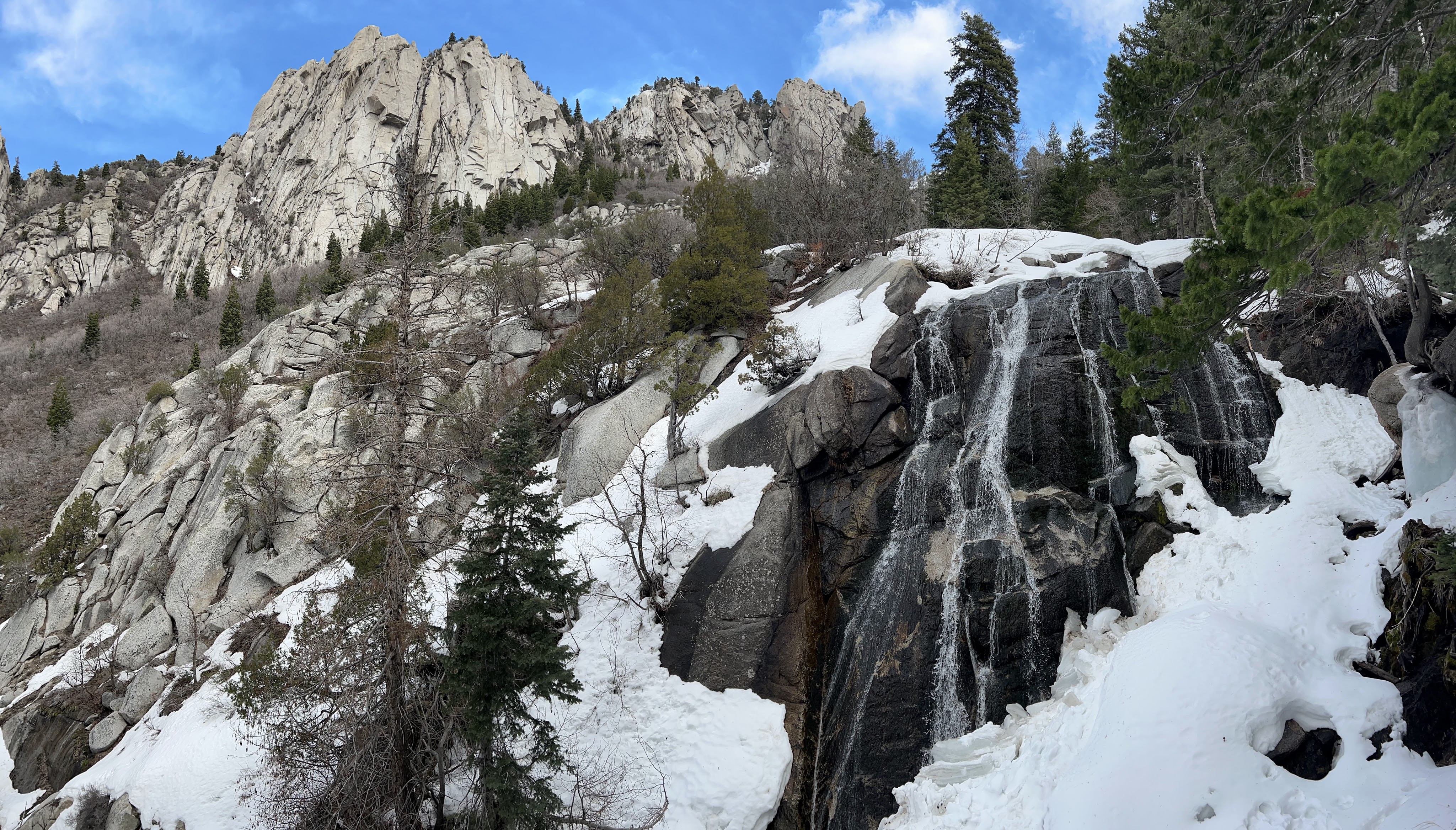
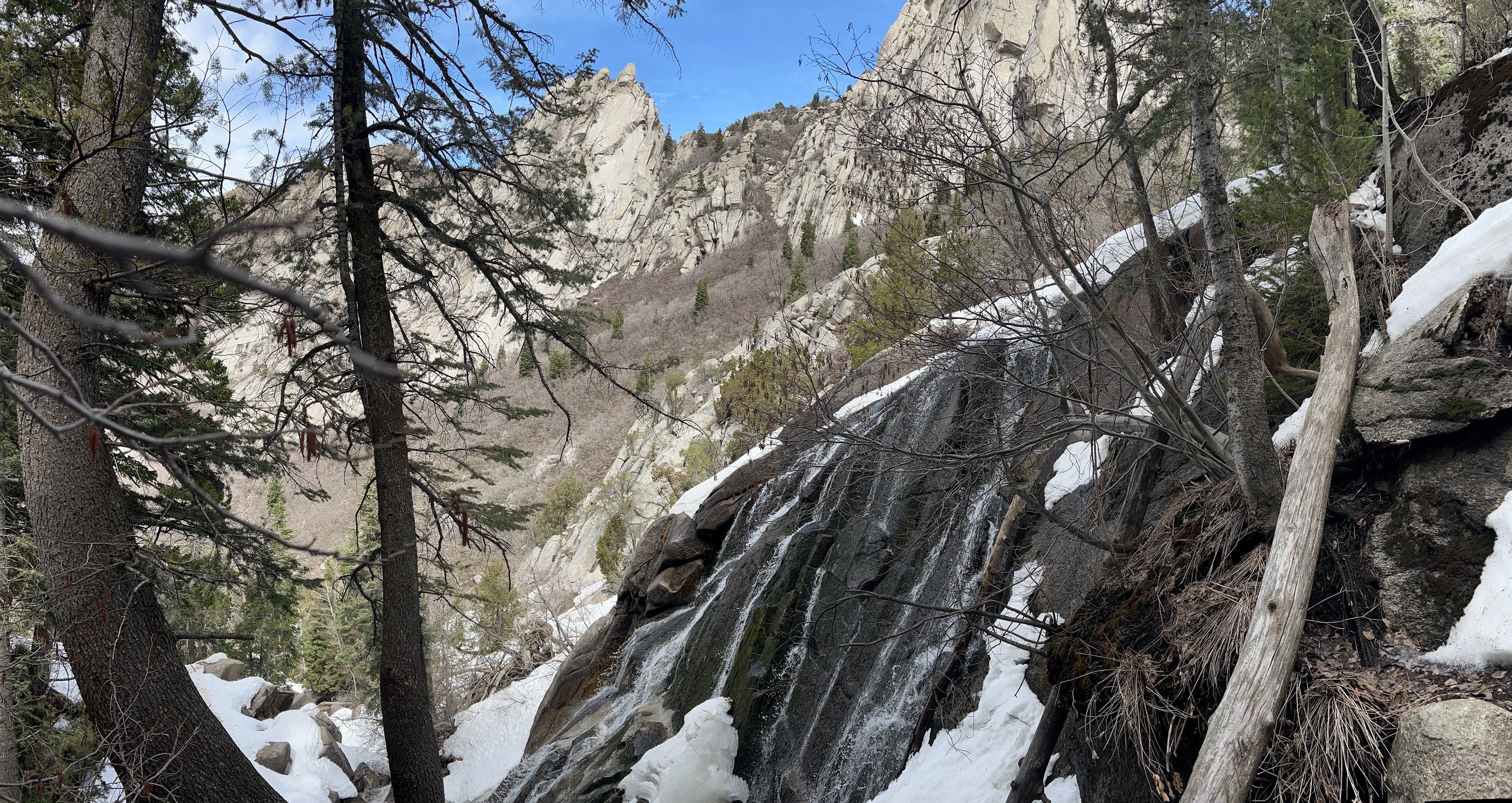
This post shares images taken on a hike through Bell Canyon which is SE of Salt Lake City Utah. Our destination, reached after 2.4 miles, was the lower waterfall in the canyon.
The map below shows the trail we took on March 27, 2025. There are also inserts showing the trail’s location relative to Salt Lake City and the elevation gain along the trail.
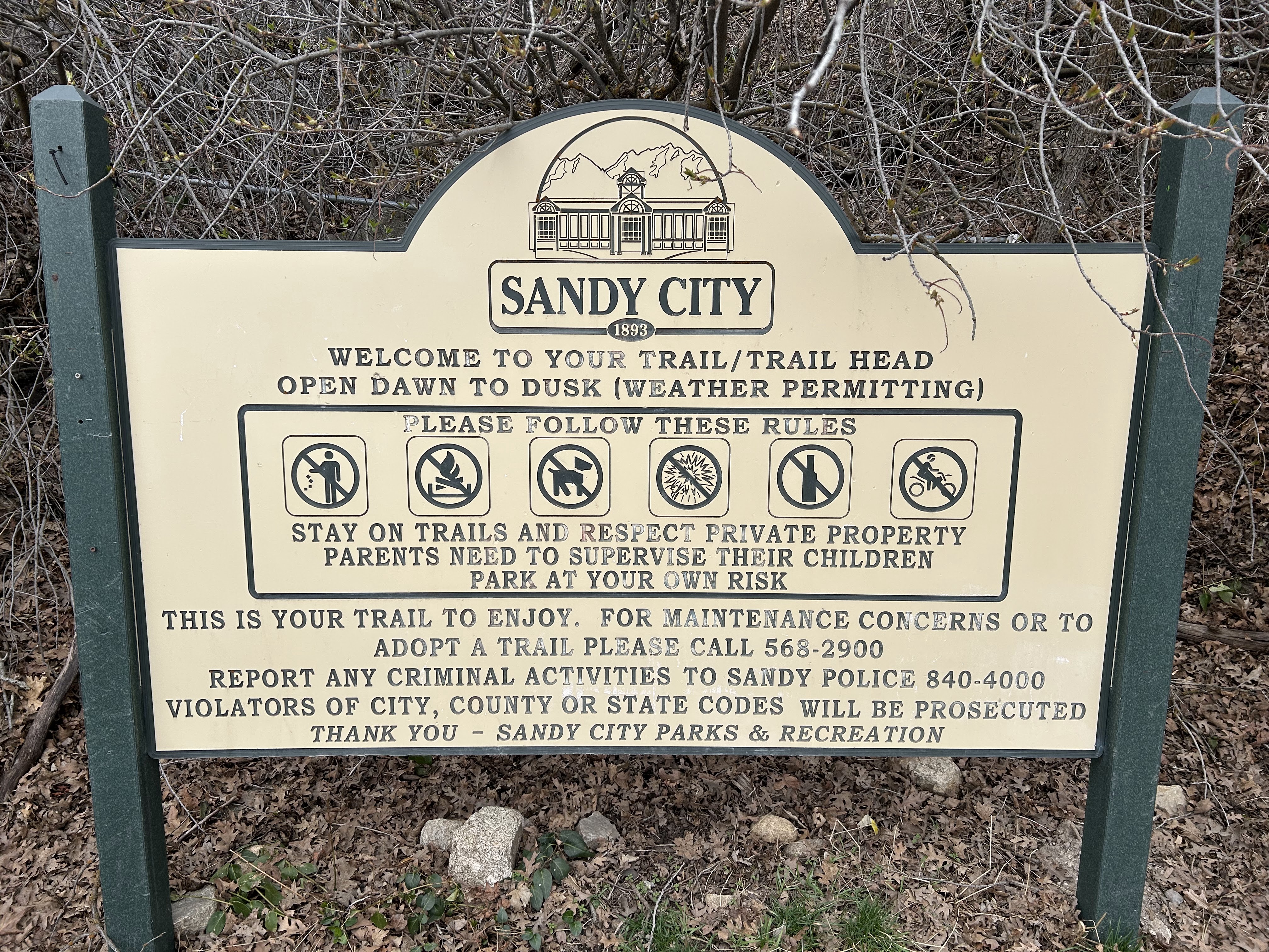
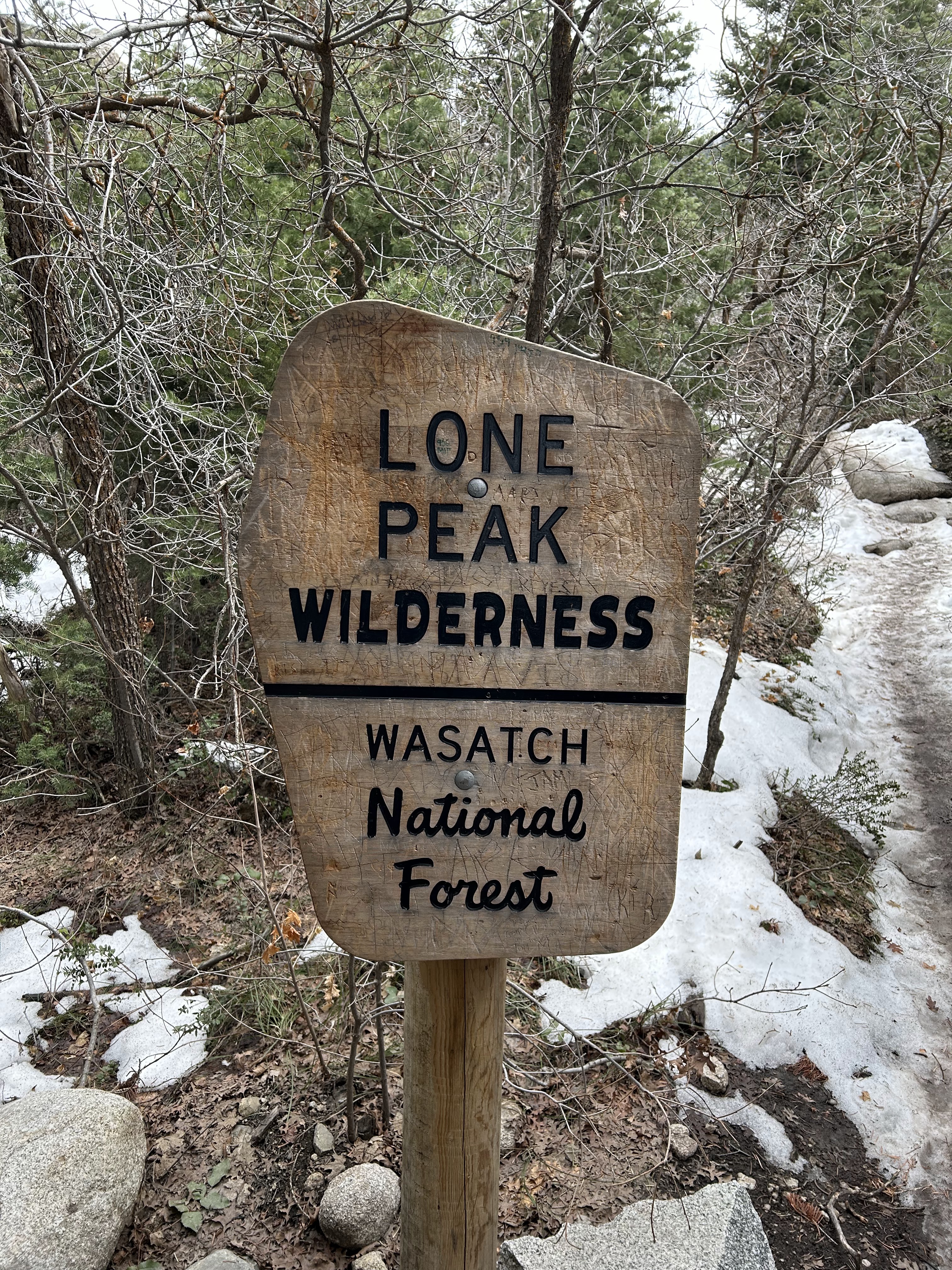
Sign at trail head
Lower Bell Canyon Reservoir (Designated as #1 on the map)
This photo shows the Lower Bell Canyon Reservoir and the Oquirrh Mountains in the distance to the westPanoramic view of the Lower Bell Canyon Reservoir
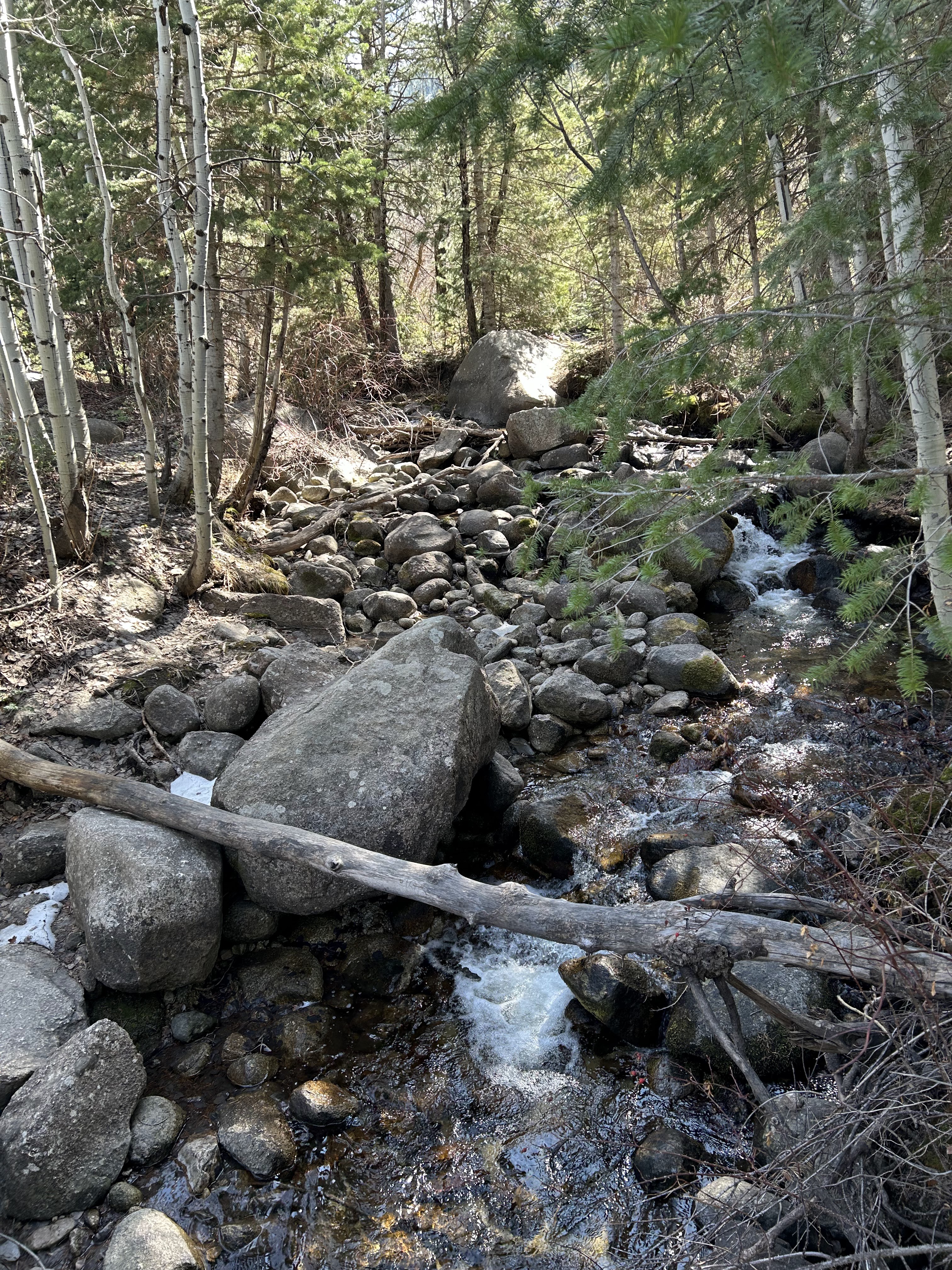
Along the trail
The beginning section of the trail is rocky and includes several switchbacks.The foothills of the Wasatch are strewn with boulders here.
Looking upstream from a footbridge that the trail crosses at #2 on the map.
The trail enters the Lone Peak Wilderness at #3 on the map. Beyond this point we were happy to have snow cleats because the trail was icy.
The Destination, Lower Falls (designated by #4 on the map)
The start of the 2024/25 ski season has not been ideal at Park City, Utah. The snow was slow in coming and is still less than we’d like to see.
Also, a strike by the ski patrol created chaos during the Christmas season. As a local skier I knew to avoid the resort and its incredible lift lines during this time. I still feel sorry for the many skiers whose Christmas vacations were ruined.
Despite all this, I have had several very fun days at Park City this season. The pictures below are a sampling of views from the season so far.
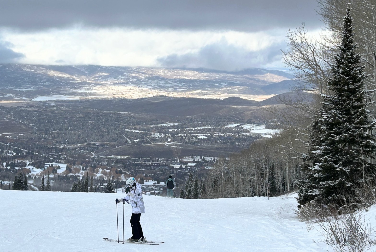
First ski day of the year, December 1, 2024
The number of runs open early in the season was limited. The picture shows the Kokopelli Run on the Canyons side of Park City.
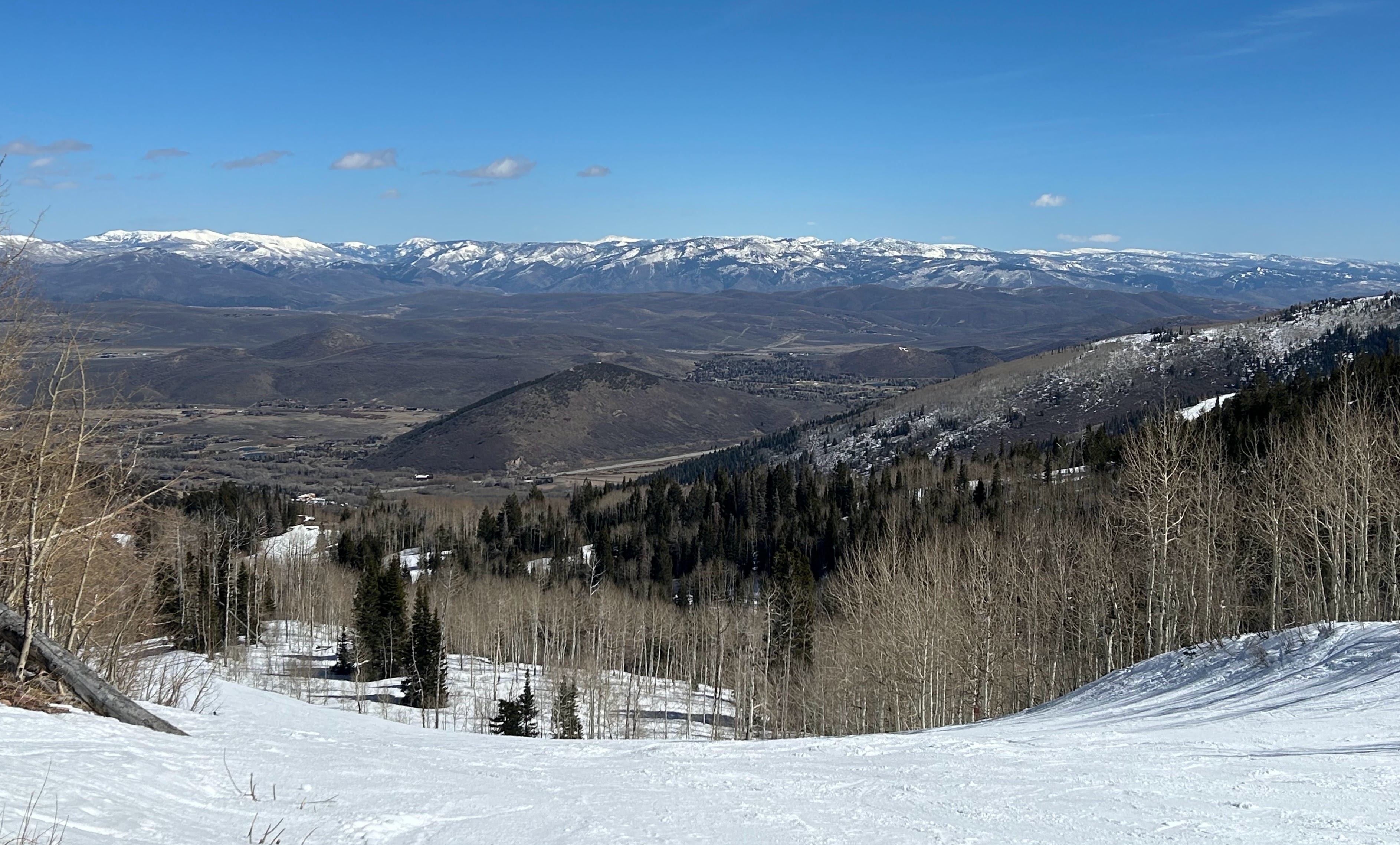
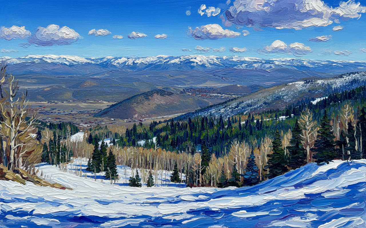
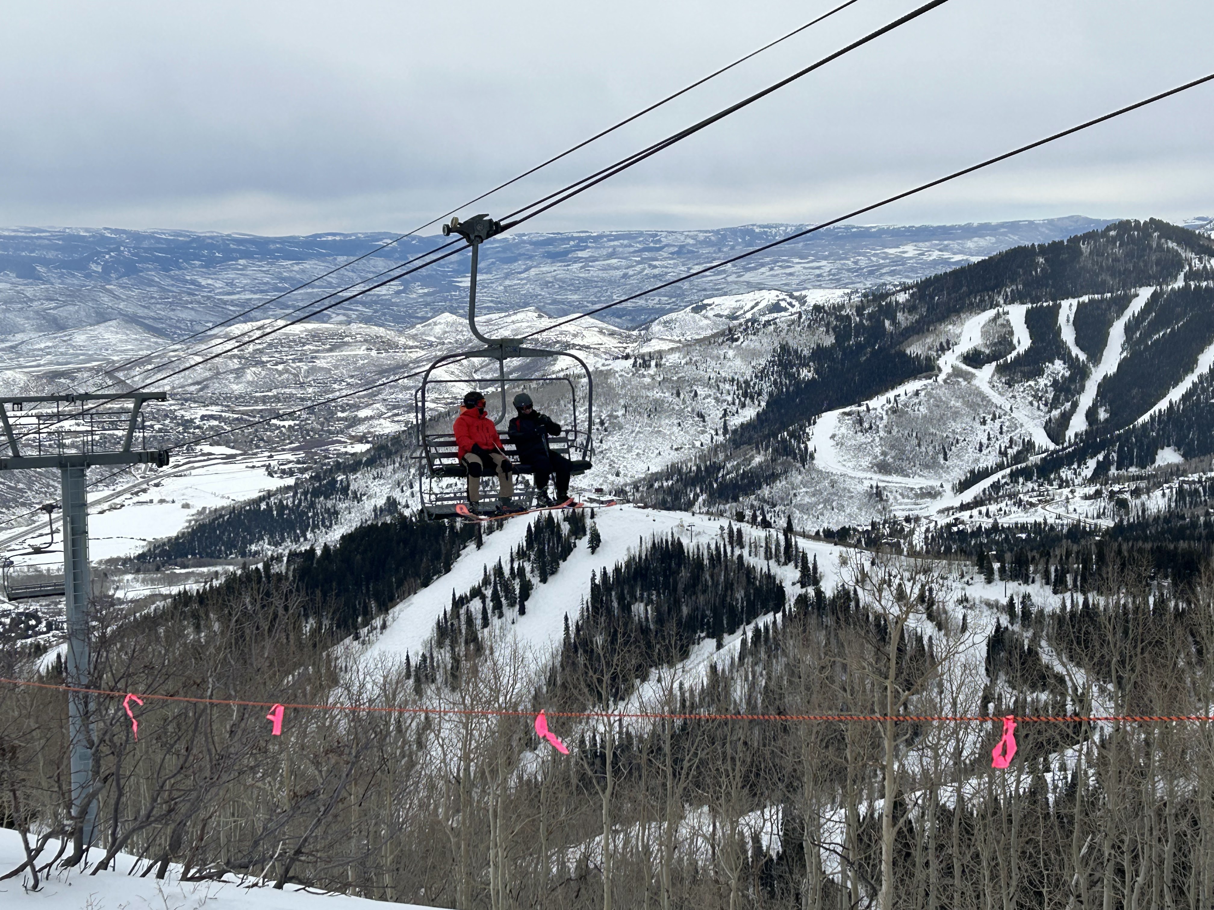
Top of the Bonanza Lift at Park CityLooking down at Park City
Pictures above are on the Park City side of the resort around the Bonanza Lift on December 6. The section of the mountain open for skiing was still limited.
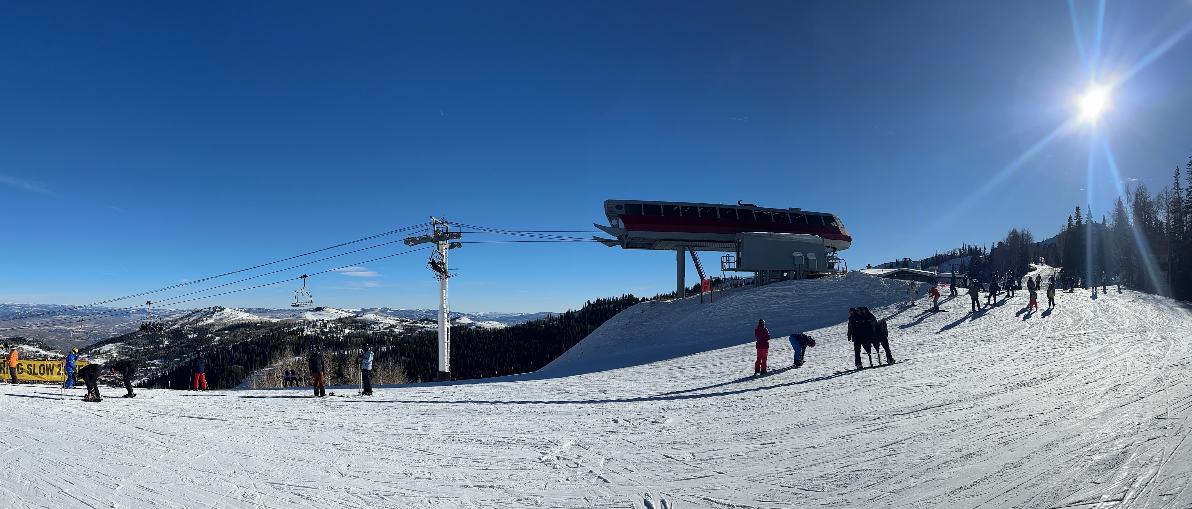
Top of Silver Lode lift at Park City, December 13
A week later, on December 13, not much more had opened up.
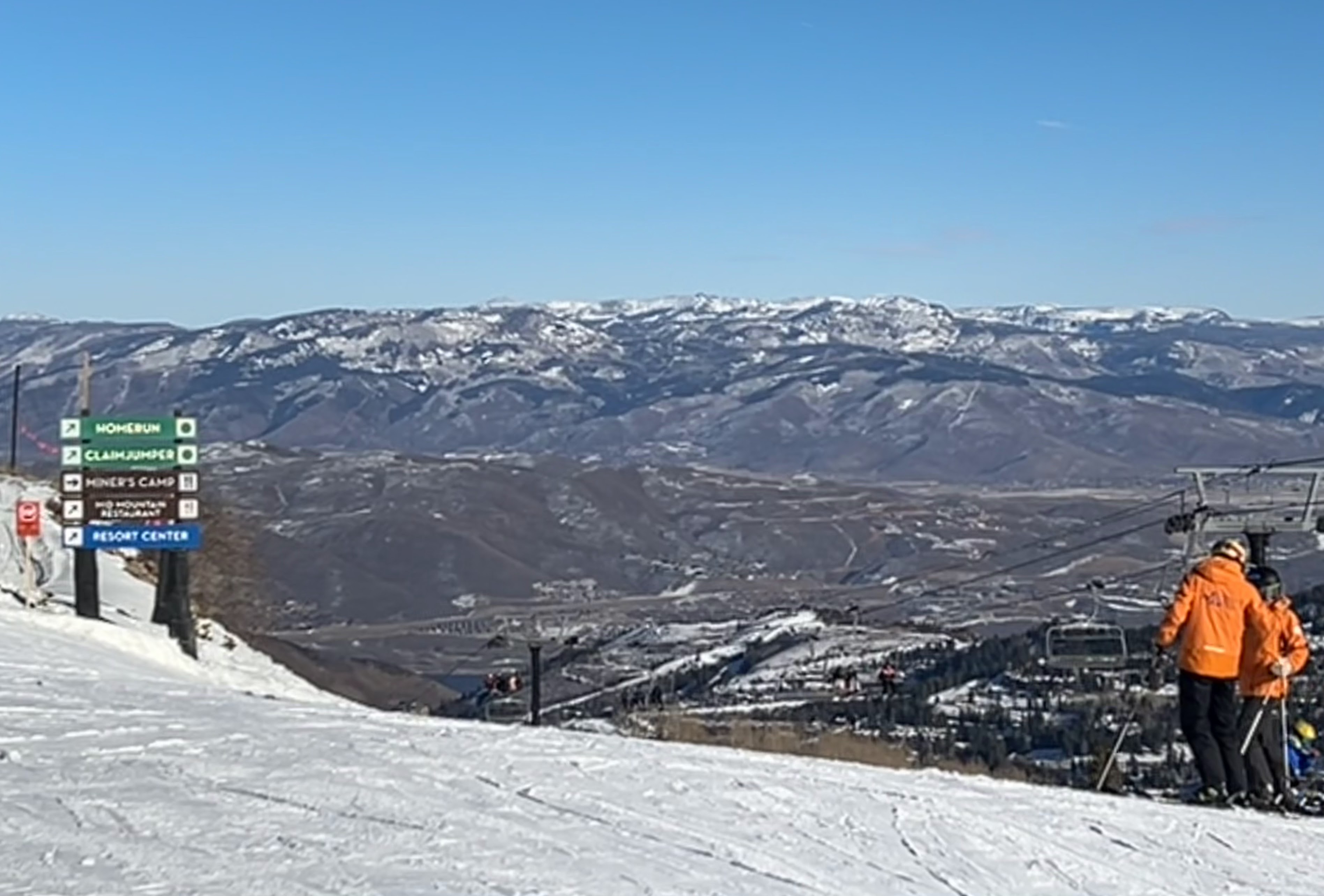
Canyons side of Park City, January 12, 2025
By January 12 things were looking up. The strike had been settled, and more area was opened for skiing.
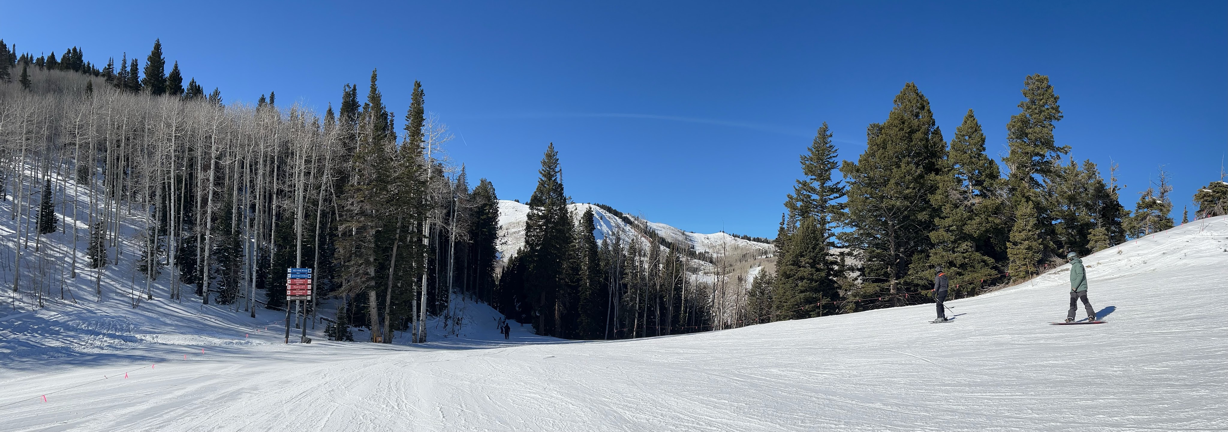
My favorite area on the Canyons side of Park City, the Condor Lift, January 24
By January 24 most of the mountain was open for skiing. The area serviced by the Condor lift on the northern side of Canyons was one of the last to open.