
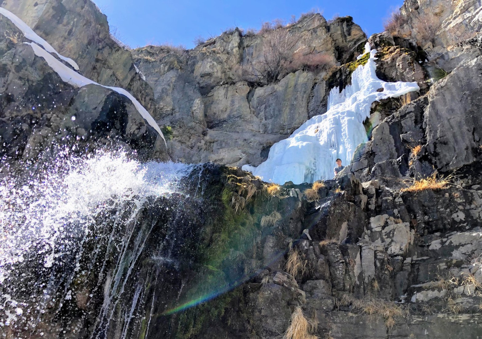
This post shares images taken on a hike through Bell Canyon which is SE of Salt Lake City Utah. Our destination, reached after 2.4 miles, was the lower waterfall in the canyon. The map below shows the trail we took on March 27, 2025. There are also inserts showing the trail’s location relative to Salt …
Tag Archives: Hiking
Antelope Island 2024
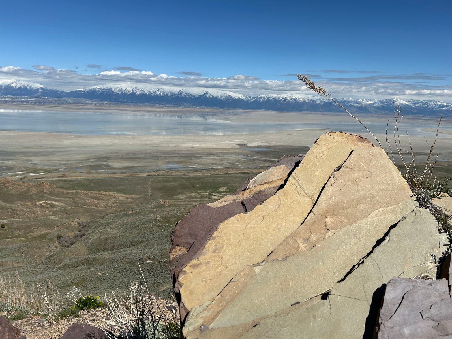
Antelope Island is a peninsula that juts out into the east side of the Great Salt Lake in Utah. The Utah State Park on Antelope Island is a short drive from Salt Lake City. Access to the park across a causeway is seen in the picture above. There are many hiking trails in the state …
Ski Slopes in Summer
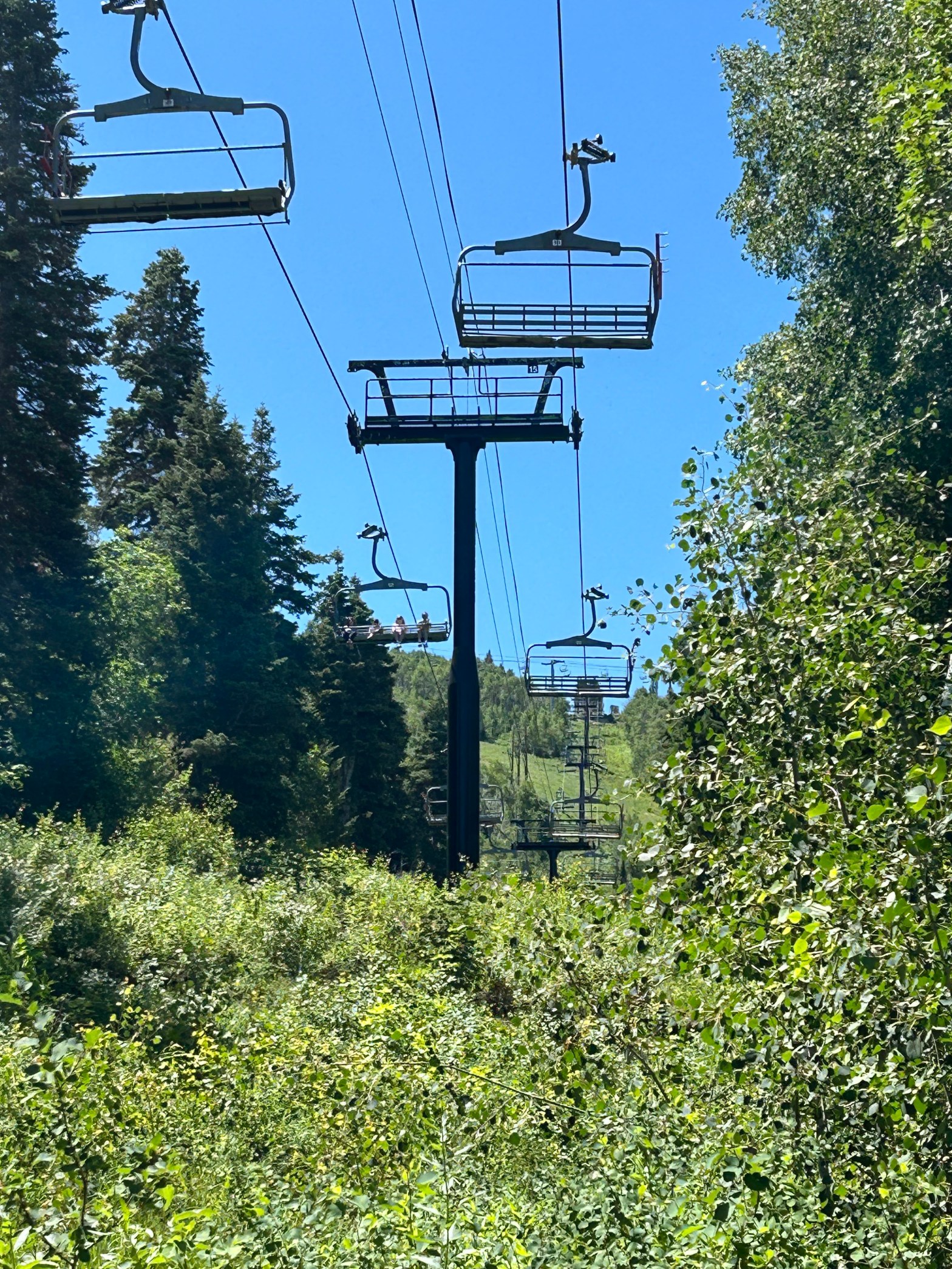
Being familiar with the Park City ski slopes in winter, it was an interesting experience to hike partway up the mountain in summer. I mostly followed a trail designated as Jenny’s Trail. A person hiking here has to be aware of the mountain bikers who are also enjoying the trails; parts of the trail are …
Hike to Stewart Falls, April 8, 2024
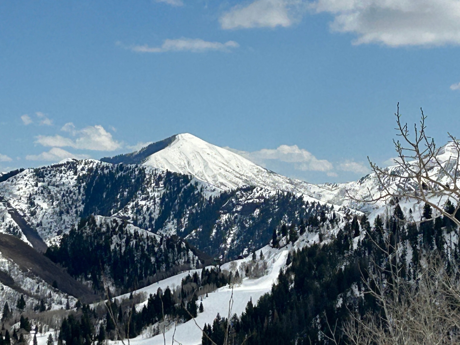
Stewart Falls is a dramatic, reasonably accessible waterfall near the Sundance ski area; it is east up the Provo canyon from the Salt Lake City metro area. Hiking to the waterfall from the trailhead near Aspen Grove was a 3.6-mile round trip. The change in elevation along the trail is about 780 feet, but it …
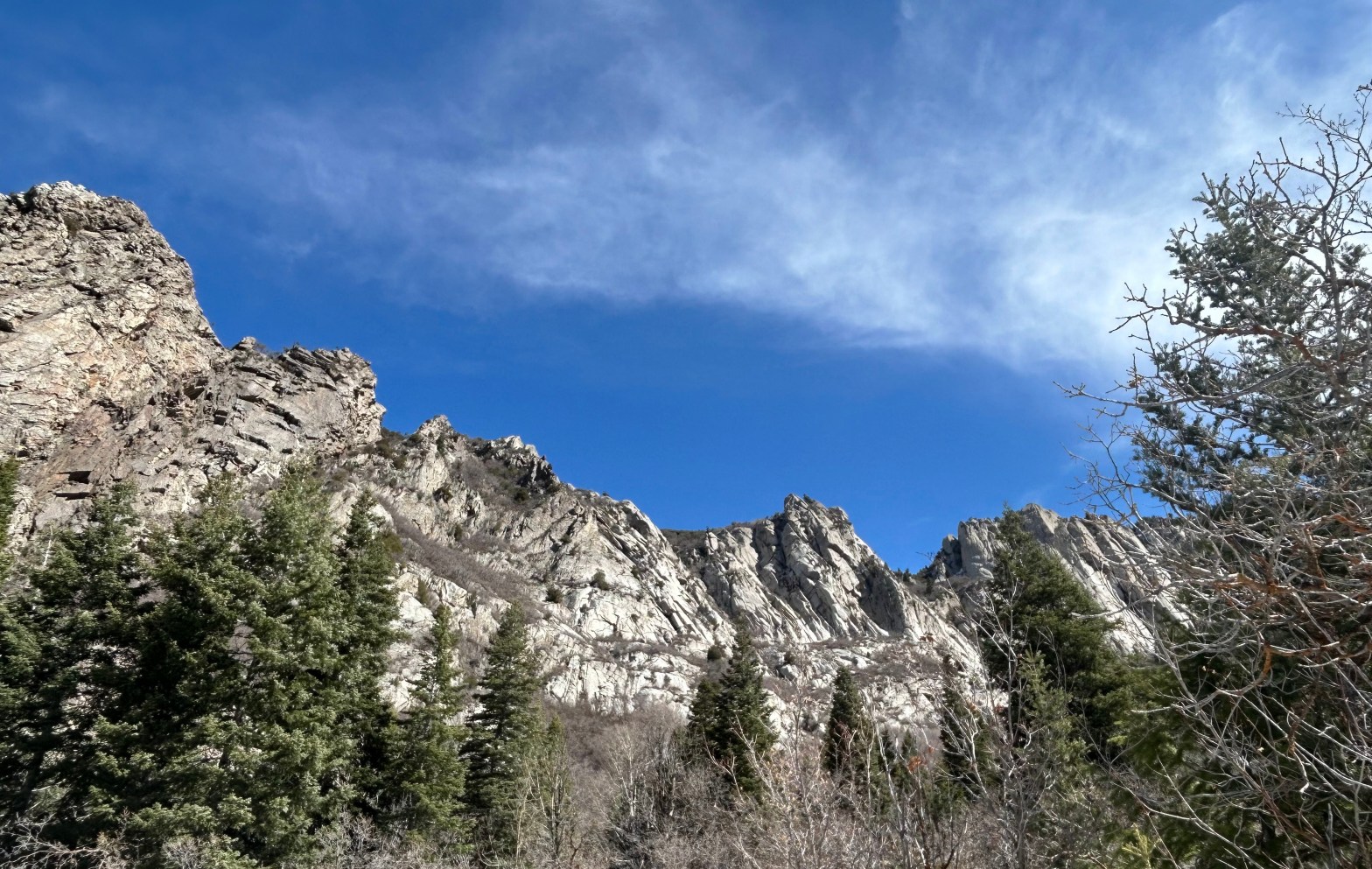
Neff’s Canyon Trail
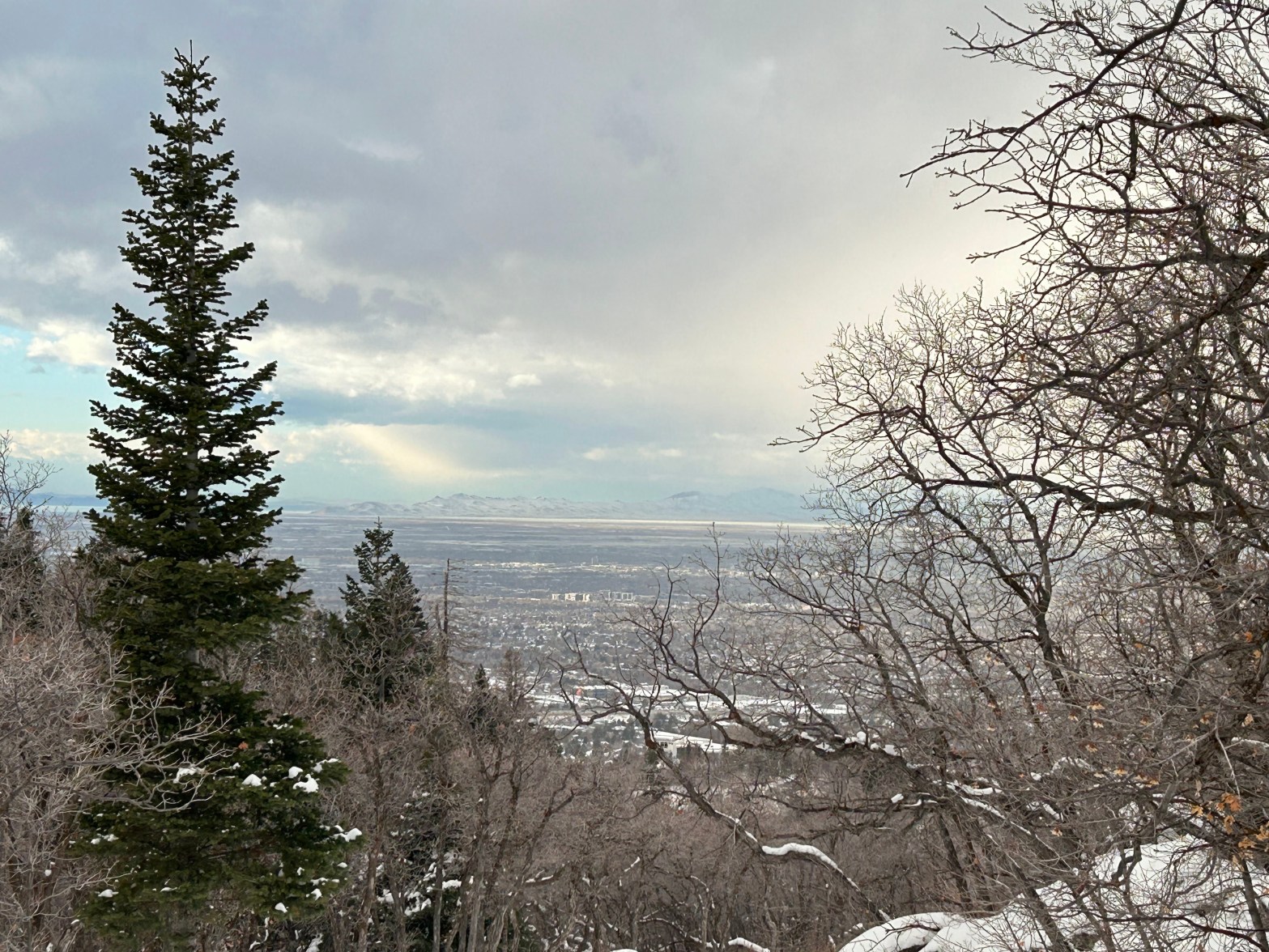
Mountainous hiking trails are remarkably close to Salt Lake City. One example is Neff’s Canyon trail; its trailhead is shown on the map below, right at the east edge of the Salt Lake City suburbs. The trail is steep, ascending 3562 feet over its 3.5-mile length. For my first visit, on January 9, I only ventured a …
Stewart Falls, near Provo Utah
Recently five of us (three people and two dogs) had the good fortune to hike to Stewart Falls on a gorgeous day in early April. The walk to the falls and back was just 3.5 miles, but made a bit more challenging by stretches of not-yet-melted snow. The following photos and videos attempt to capture …
